MyTopo
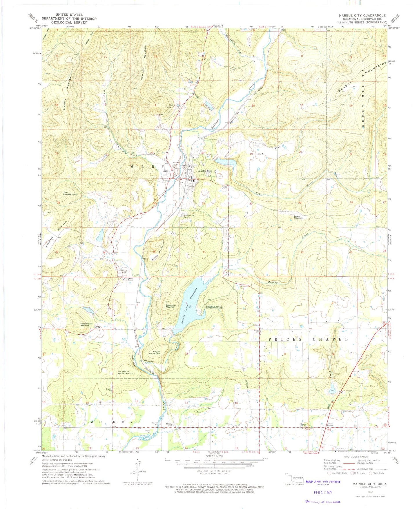
Classic USGS Marble City Oklahoma 7.5'x7.5' Topo Map
Couldn't load pickup availability
Historical USGS topographic quad map of Marble City in the state of Oklahoma. Map scale may vary for some years, but is generally around 1:24,000. Print size is approximately 24" x 27"
This quadrangle is in the following counties: Sequoyah.
The map contains contour lines, roads, rivers, towns, and lakes. Printed on high-quality waterproof paper with UV fade-resistant inks, and shipped rolled.
Contains the following named places: Andes Mountain, Barry Dotson Ranch Airport, Bird Flat, Blunt Church, Brushy Creek, Brushy Creek Reservoir, Dry Creek, Dwight Mission, Dwight Mission Cemetery, Dwight Mission Census Designated Place, Fields Chapel, Flute Springs, Flute Springs Census Designated Place, Grapevine Mountain, Hastings Mountain, Leathers Mountain, Little Round Mountain, Marble City, Marble City Cemetery, Marble City Community, Marble City Community Census Designated Place, Marble City Elementary School, Marble City Fire Association Station 1, Marble City Fire Association Station 2, Marble City Post Office, McCoy Cemetery, McEachin Hollow, Negro Mountain, Payne Hollow, Pettit Chapel, Prices Chapel, Quarry Mountain, Round Mountain, Sallisaw Creek Site 28 Dam, Sallisaw Creek Site 28 Reservoir, Sallisaw Creek Site 29 Dam, Sallisaw Creek Site 33 Dam, Sallisaw Creek Site 33 Reservoir, Sallisaw Creek Site 5 Dam, Sallisaw Creek Site 6 Dam, Sallisaw Creek Site 6 Reservoir, Sallisaw Creek Site 8 Dam, Sallisaw Creek Site 8 Reservoir, Sallisaw State Recreation Area, Schoolhouse Mountain, Ssllisaw Creek Site 5 Reservoir, Town of Marble City, Township of Marble, Trot Hollow, Ussery Mountain, ZIP Code: 74945