MyTopo
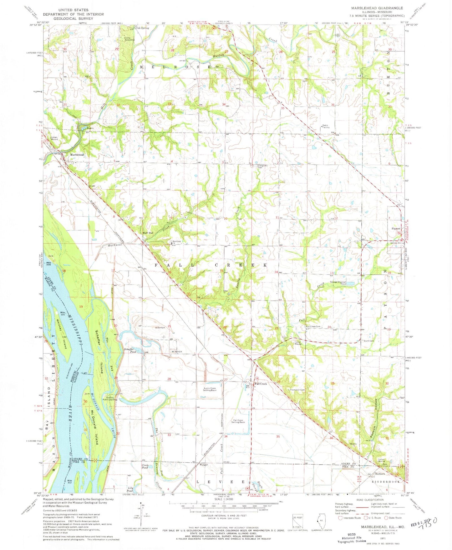
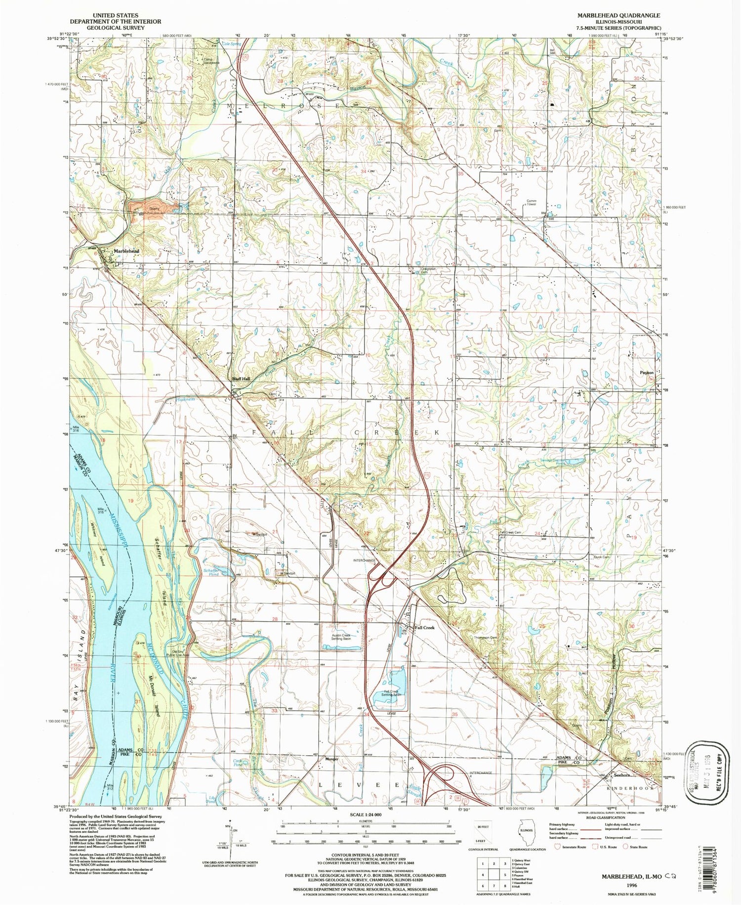
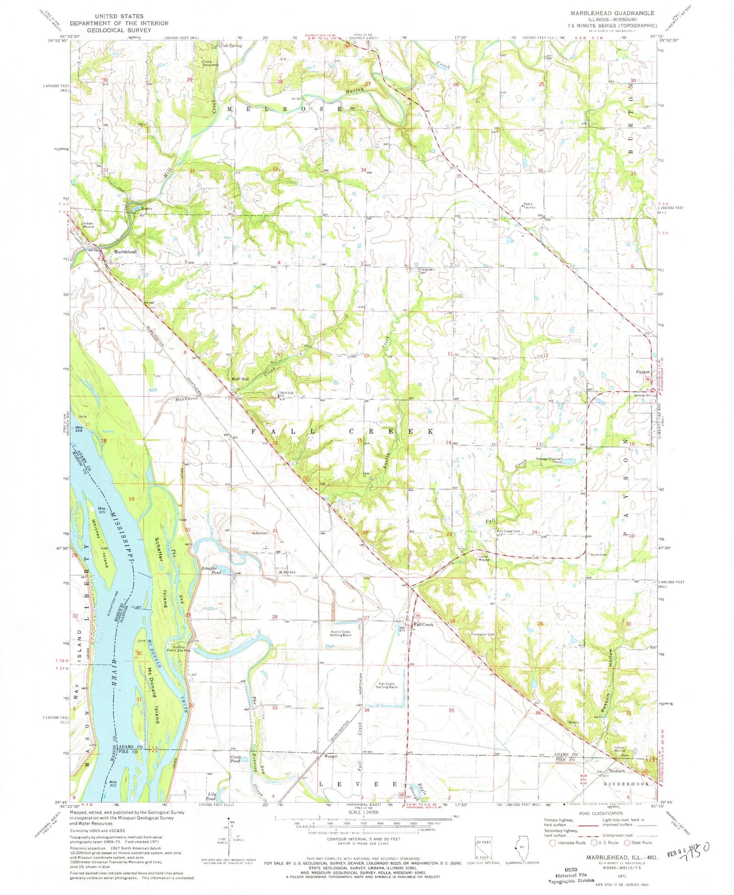
Classic USGS Marblehead Illinois 7.5'x7.5' Topo Map
Couldn't load pickup availability
Historical USGS topographic quad map of Marblehead in the states of Illinois, Missouri. Map scale may vary for some years, but is generally around 1:24,000. Print size is approximately 24" x 27"
This quadrangle is in the following counties: Adams, Marion, Pike.
The map contains contour lines, roads, rivers, towns, and lakes. Printed on high-quality waterproof paper with UV fade-resistant inks, and shipped rolled.
Contains the following named places: Austin Creek, Austin Creek Settling Basin, Bluff Hall, Bluff Hall Cemetery, Bluff Hall Church, Bluff Hall School, Burton Creek, Camp Sacajawea, Center School, Circle Pond, Cole Spring, Craigtown Cemetery, Craigtown School, Fall Creek, Fall Creek Census Designated Place, Fall Creek Chapel Cemetery, Fall Creek Methodist Protestant Cemetery, Fall Creek School, Fall Creek Settling Basin, Hibner School, Len Grove School, Marblehead, Marblehead Post Office, Marblehead Quarry, Mayer Pond, Mayer Pond Dam, McDonald Island, Munger, Newmaw Family Cemetery, Old Sny Public Use Area, Possum Hollow, Rogers Lake, Sand Slough School, Schaffer Island, Schaffer Pond, Seehorn, Seymour High School, The Sny, Thompson Cemetery, Township of Fall Creek, Washington School, Whitney Island, Whitney Post Light, ZIP Code: 62360