MyTopo
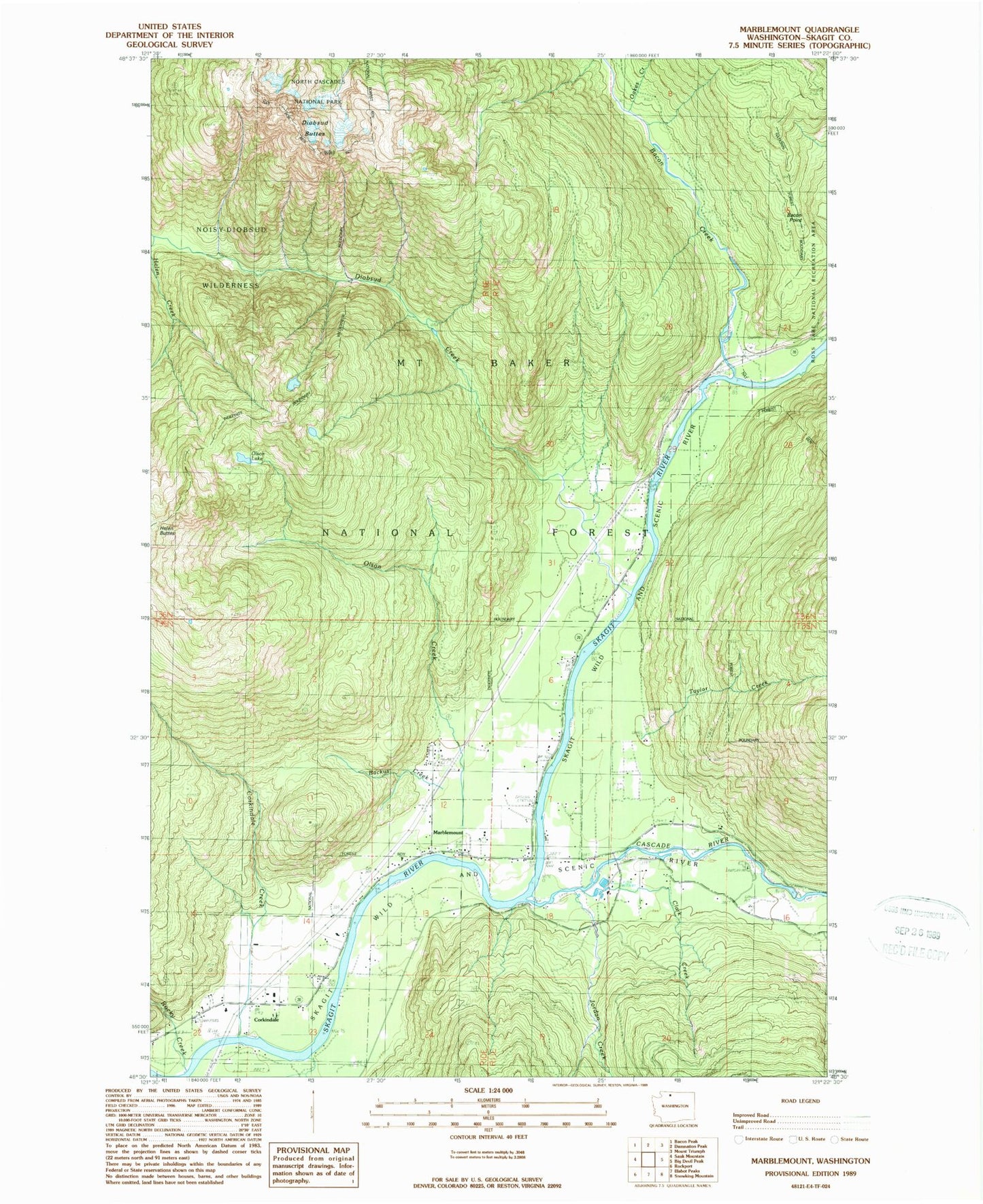
Classic USGS Marblemount Washington 7.5'x7.5' Topo Map
Couldn't load pickup availability
Historical USGS topographic quad map of Marblemount in the state of Washington. Map scale may vary for some years, but is generally around 1:24,000. Print size is approximately 24" x 27"
This quadrangle is in the following counties: Skagit.
The map contains contour lines, roads, rivers, towns, and lakes. Printed on high-quality waterproof paper with UV fade-resistant inks, and shipped rolled.
Contains the following named places: Backus Creek, Bacon Creek, Bacon Creek Campground, Bacon Creek Siding, Bacon Point, Bacon Point Lookout, Cascade Island Campground, Cascade Islands Campground, Cascade River, Clark Creek, Corkindale, Corkindale Creek, Diobsud Buttes, Diobsud Creek, Jordan Creek, Marblemount, Marblemount Census Designated Place, Marblemount Post Office, Marblemount Ranger District, Marblemount South Cascade Community Church, Oakes Creek, Olson Creek, Olson Lake, Portage, Rocky Creek, Skagit County Fire District 19 Marblemount Fire Department, Skagit Hatchery, Stewart Siding, Taylor Creek