MyTopo
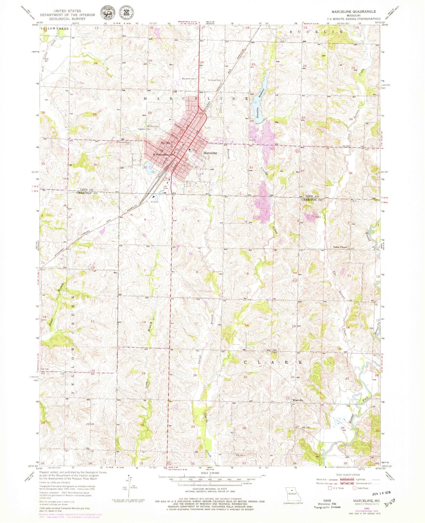
Classic USGS Marceline Missouri 7.5'x7.5' Topo Map
Couldn't load pickup availability
Historical USGS topographic quad map of Marceline in the state of Missouri. Map scale may vary for some years, but is generally around 1:24,000. Print size is approximately 24" x 27"
This quadrangle is in the following counties: Chariton, Linn.
The map contains contour lines, roads, rivers, towns, and lakes. Printed on high-quality waterproof paper with UV fade-resistant inks, and shipped rolled.
Contains the following named places: Asher Lake, Asher Lake Dam, Bell Cemetery, City of Marceline, Curry School, Doctor Charles Martin Dam, Doctor Charles Martin Lake, Eastman School, Elm Grove School, Elmwood Cemetery, Garys Lake, Hardin School, Kussmans Lake, Kussmans Lake Dam, Locust Branch, Marceline, Marceline City Reservoir Dam, Marceline Country Club Lake, Marceline Fire Department, Marceline Municipal Airport, Marceline New Reservoir Dam, Marceline Old Reservoir, Marceline Police Department, Marceline Post Office, Maupin School, Mount Olive Cemetery, New Marceline City Lake, Oldham School, Parish School, Park School, Peden Chapel, Roselawn Cemetery, Saint Bonaventure Cemetery, Saint Bonaventure School, Saint Francis Hospital Heliport, Santa Fe Country Club Dam, Smith Center School, Tarpening Lake East Dam, Tarpening Lake Northwest Dam, Tarpening Lake Southwest Dam, Township of Clark, Township of Marceline, Van Dorsen Creek, Westville, Westville School, White Lake, White Lake Dam, ZIP Code: 64658