MyTopo
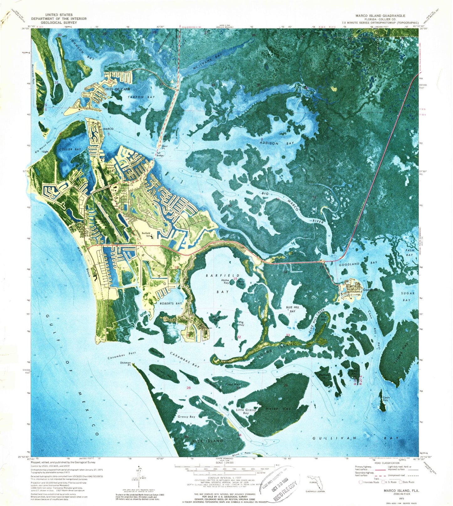
Classic USGS Marco Island Florida 7.5'x7.5' Topo Map
Couldn't load pickup availability
Historical USGS topographic quad map of Marco Island in the state of Florida. Typical map scale is 1:24,000, but may vary for certain years, if available. Print size: 24" x 27"
This quadrangle is in the following counties: Collier.
The map contains contour lines, roads, rivers, towns, and lakes. Printed on high-quality waterproof paper with UV fade-resistant inks, and shipped rolled.
Contains the following named places: Addison Bay, Dickmans Island, Alpha Key, Barfield Bay, Tommie Barfield Elementary School, Bear Point, Beta Key, Big Marco Pass, Big Marco River, Blue Hill, Blue Hill Bay, Blue Hill Creek, Caxambas Bay, Caxambas Pass, Collier Bay, Coon Key, Coon Key Pass, Currys Island, David Key, Dickmans Point, Fred Key, Goodland, Goodland Bay, Grassy Bay, Gullivan Bay, Helen Key, Henry Key, Horrs Island, Isles of Capri, Kice Island, Little Grassy Bay, Marco, Marco Beach, Marco Island, Margaret Key, McIlvane Bay, Neal Key, Lighter Bay, Pig Key, Ramsey Key, Roberts Bay, Saint Marks Church, Smokehouse Bay, Sugar Bay, Tarpon Bay, Tripod Key, Bear Point Cove, Hurricane Pass, Smokehouse Creek, Sunfish Flat, Northwest Gate, Marco Bay, Capri Pass, Clam Factory Shoal, North Point, The Muddies, Coconut Island, Charity Island, Bob Everett Point, Big Key, Angelwing Creek, Three Island Cove, Turtle Island, Turtle Creek, Upper Addison Bay, Factory Bay, East Marco Bay, Snook Hole Channel, South Marsh Creek, Stanton Creek, Stingaree Island, Pink Curlew Flats, Pass Key, Rookery Island, Johnson Snapper Hole, Highland Point, Little Tide Key, Hells Gate, Capris Pass Approach Light, Marco Island Christian School, Caxambas, Unknown Bay, Albert Island, Georgia Fruit Farm Creek, San Marco Catholic Church, Marco Lutheran Church, Whiskey Creek, Railroad Islet, Railroad Shoals, Sanctuary Sound, Sea Oat Island, Flotilla Passage, Johnson Island, One Island Bay, Cape Ramano - Ten Thousand Islands State Aquatic Preserve, Greater Naples Fire and Rescue Station 90, Marco Island Fire Rescue Department 50, Marco Island Fire Rescue Department Station 51, Collier County Sheriff's Office Marco Island Substation - Marine Patrol, Marco Island Police Department, Marco Island Police Department, Goodland Census Designated Place, City of Marco Island, Drop Anchor Mobile Home Park, Lemon Bay Golf Club, First Baptist Church of Marco Island, New Life Community Church, United Church of Marco Island, Wesley United Methodist Church, Ocala Golf Club, Cannon Channel, Georgia Fruit Farm, Marco Island Fire Rescue Department Station 50, Collier County Emergency Medical Services Station 90, Marco Island Post Office, Goodland Post Office, Marco Shores-Hammock Bay Census Designated Place