MyTopo
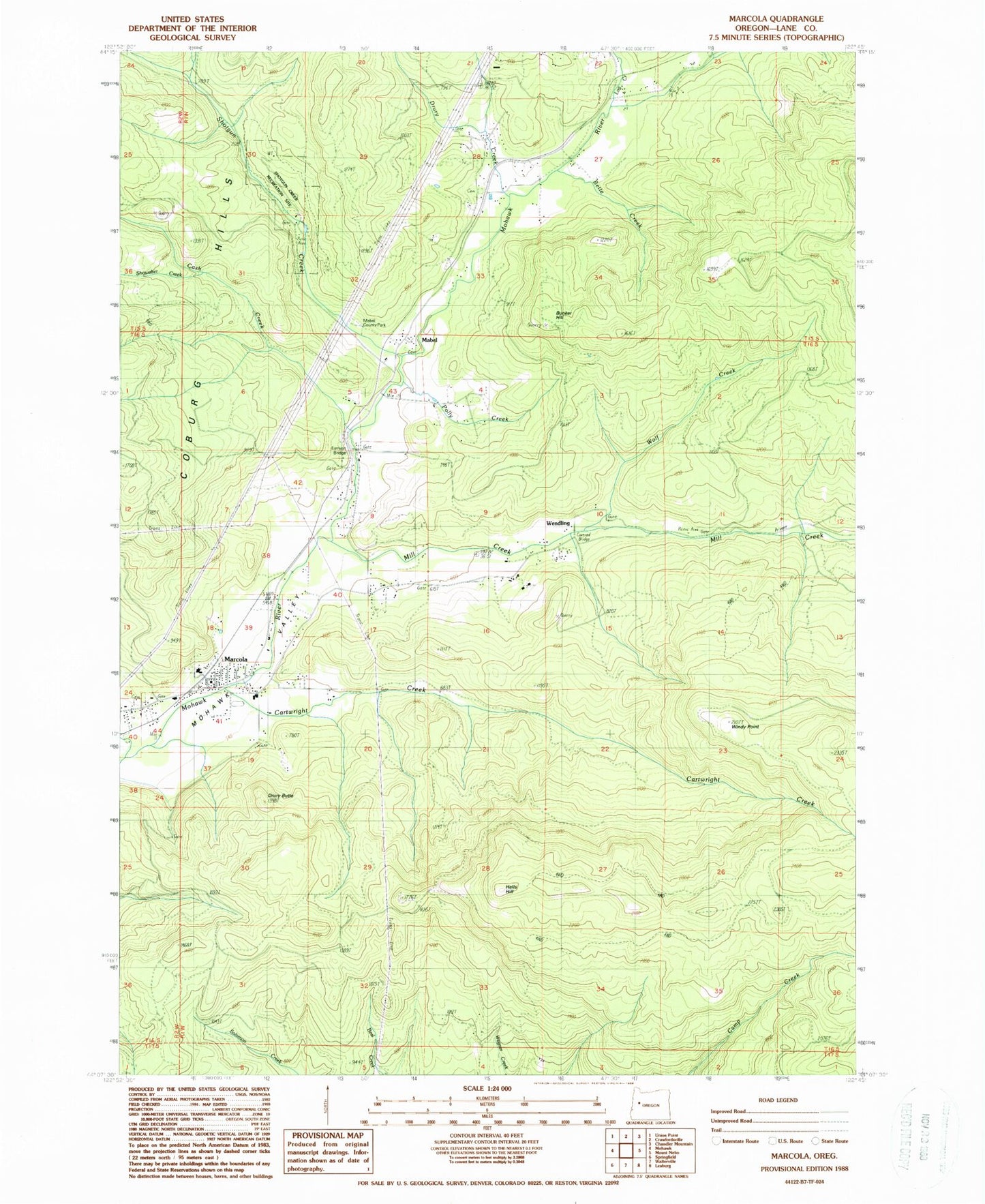
Classic USGS Marcola Oregon 7.5'x7.5' Topo Map
Couldn't load pickup availability
Historical USGS topographic quad map of Marcola in the state of Oregon. Map scale may vary for some years, but is generally around 1:24,000. Print size is approximately 24" x 27"
This quadrangle is in the following counties: Lane.
The map contains contour lines, roads, rivers, towns, and lakes. Printed on high-quality waterproof paper with UV fade-resistant inks, and shipped rolled.
Contains the following named places: Beaver Creek, Bedortha Reservoir, Bette Creek, Bunker Hill, Carolyn Creek, Cartwright Creek, Cash Creek, Crooked Creek, Dorothy Creek, Drury, Drury Butte, Drury Creek, Earnest Bridge, Ethel Creek, Hells Hill, Hyland, Log Creek, Mabel, Mabel Cemetery, Mabel Park, Mabel Post Office, Marcola, Marcola Cemetery, Marcola Census Designated Place, Marcola Christian Church, Marcola Division, Marcola Elementary School, Marcola Post Office, Mill Creek, Mohawk High School, Mohawk Valley Rural Fire District Station 1, Mohawk Valley Rural Fire District Station 2, Nettle, Parsons Creek, Polly Creek, Rock Creek, Seeley Creek, Shotgun Creek, Shotgun Recreational Site, Showalter Creek, Upper Mabel Cemetery, Wendling, Wendling Picnic Area, Wendling Post Office, Windy Point, Wolf Creek, ZIP Code: 97454