MyTopo
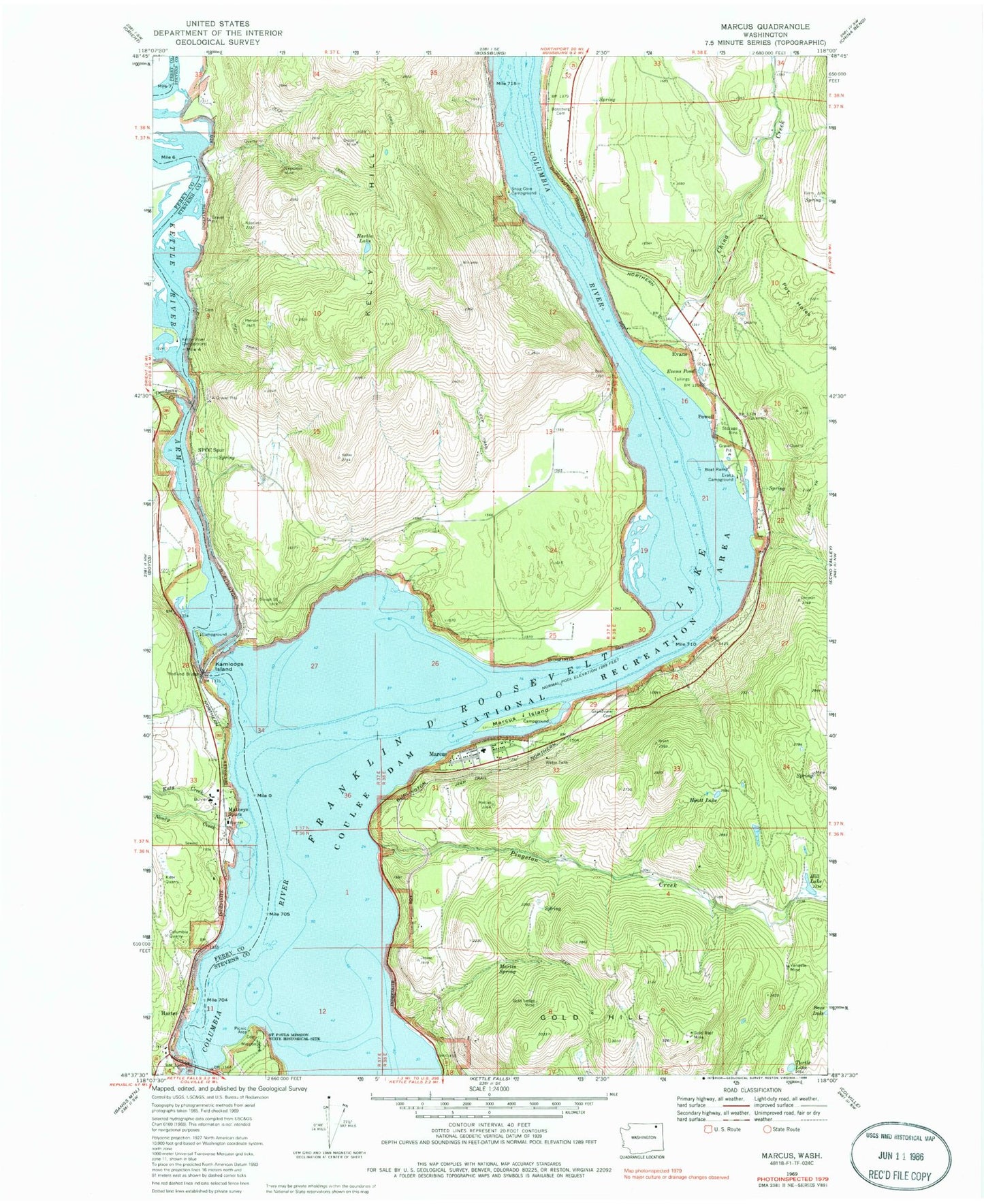
Classic USGS Marcus Washington 7.5'x7.5' Topo Map
Couldn't load pickup availability
Historical USGS topographic quad map of Marcus in the state of Washington. Map scale may vary for some years, but is generally around 1:24,000. Print size is approximately 24" x 27"
This quadrangle is in the following counties: Ferry, Stevens.
The map contains contour lines, roads, rivers, towns, and lakes. Printed on high-quality waterproof paper with UV fade-resistant inks, and shipped rolled.
Contains the following named places: Bass Lake, Bear, Blue Town, Bossburg Cemetery, China Creek, Columbia Quarry, Deadman Creek, Dipper Mine, East Marcus, Evans, Evans Campground, Evans Pond, Flat Creek Field, Godfrey, Gold Hill, Gold Ledge Mine, Gold Reef Mine, Grandview Cemetery, Harlin Lake, Harter, Hedlund Bridge, Hill Lake, Hyatt Lake, Joint Protection Ferry County Fire District 3 - Stevens County Fire District 8 Barneys, Kamloops Island, Kamloops Island Campground, Katy Creek, Kelly Hill, Kettle Falls, Kettle Falls Bridge, Kettle River, Kettle River Arm, Kettle River Campground, Kifer Quarry, Lakeside Mobile Home Park, Marcus, Marcus Flats, Marcus Island, Marcus Island Campground, Marcus Post Office, Martin Spring, Matneys Spurs, Nancy Creek, Napoleon, Napoleon Mine, Pingston Creek, Pot Holes, Powell, Presbyterian Church of Marcus, Saint Pauls Mission, Saint Pauls Mission State Historical Site, Seven Devils, Six Mile Bar, Snag Cove Campground, SPCC Spur, Stevens, Town of Marcus, Turtle Lake, Vanasse Mine, ZIP Code: 99151