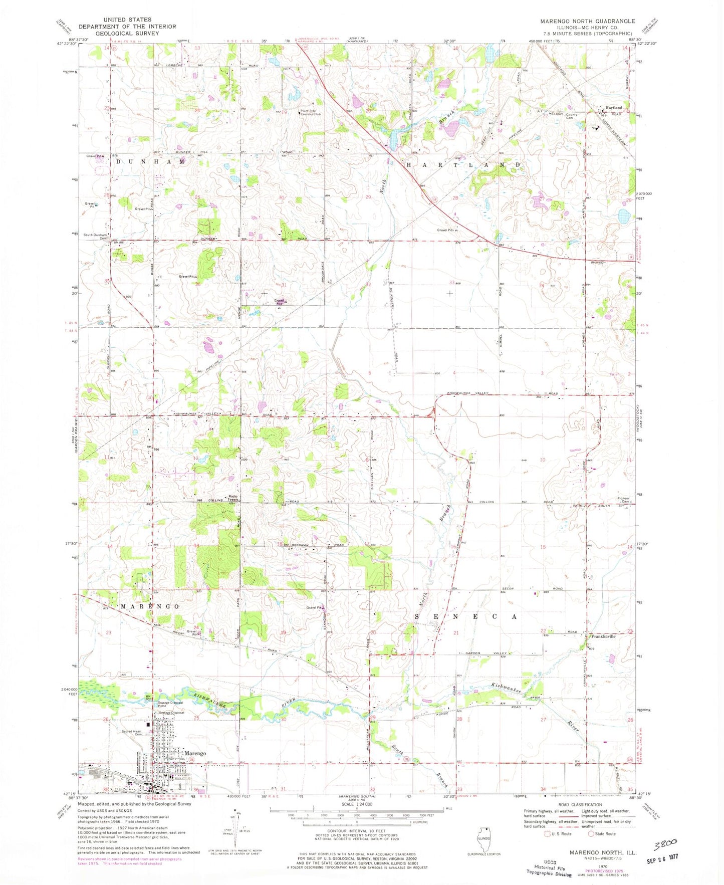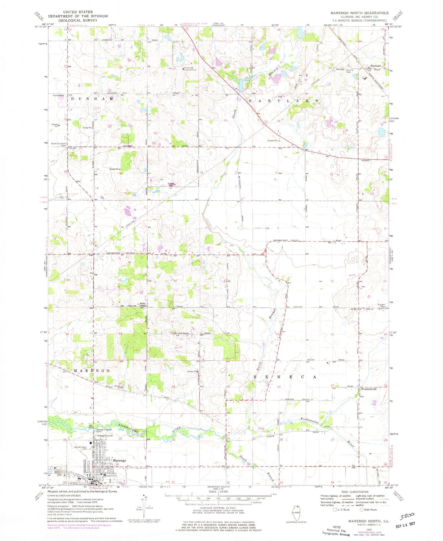
MyTopo
Classic USGS Marengo North Illinois 7.5'x7.5' Topo Map
Couldn't load pickup availability
Historical USGS topographic quad map of Marengo North in the state of Illinois. Map scale may vary for some years, but is generally around 1:24,000. Print size is approximately 24" x 27"
This quadrangle is in the following counties: McHenry.
The map contains contour lines, roads, rivers, towns, and lakes. Printed on high-quality waterproof paper with UV fade-resistant inks, and shipped rolled.
Contains the following named places: Aerogrange Airport, Bayrd School, Brookdale School, Burr Oak School, Central Sod Farms, Cherry Lane Farms, Deerpass Farm, Diggins School, Evergreen School, Franklinville, Franklinville Census Designated Place, Fuller School, Hartland, Hartland Census Designated Place, Hilbert Airport, Hughes School, Hunter Airport, Kanaly School, Kingdom Hall of Jehovahs Witnesses, Lang's Orchard, Marengo Fire Protection District Station 1, Marengo Police Department, Marengo Rescue Squad Station 2, McCann Berry Farm, North Branch Kishwaukee River, Ohana Farms, Olbrich Farm, Oneys Tree Farm, Pioneer Cemetery, Pleasant Acres Farm, Plum Tree Country Club, Prairie Sky Orchard, Pringle School, Sacred Heart Catholic Church, Sacred Heart Cemetery, South Branch Kishwaukee River, South Dunham Cemetery, South Dunham School, Township of Hartland, Township of Seneca, Vermont School, Windy Ridge Ranch, Woodstock Country Orchard, Zion Lutheran Church, Zion Lutheran School