MyTopo
Classic USGS Marengo South Illinois 7.5'x7.5' Topo Map
Couldn't load pickup availability
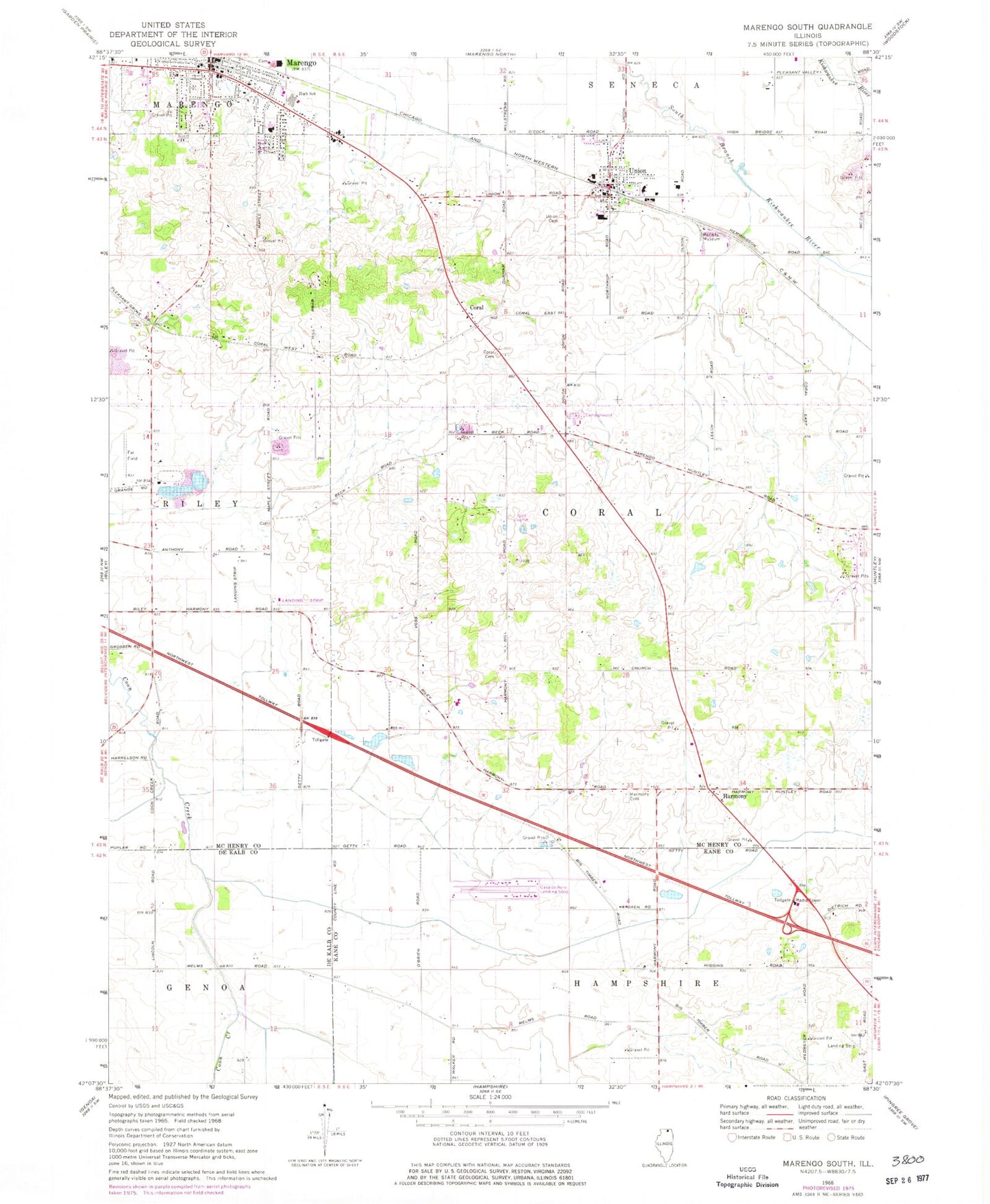
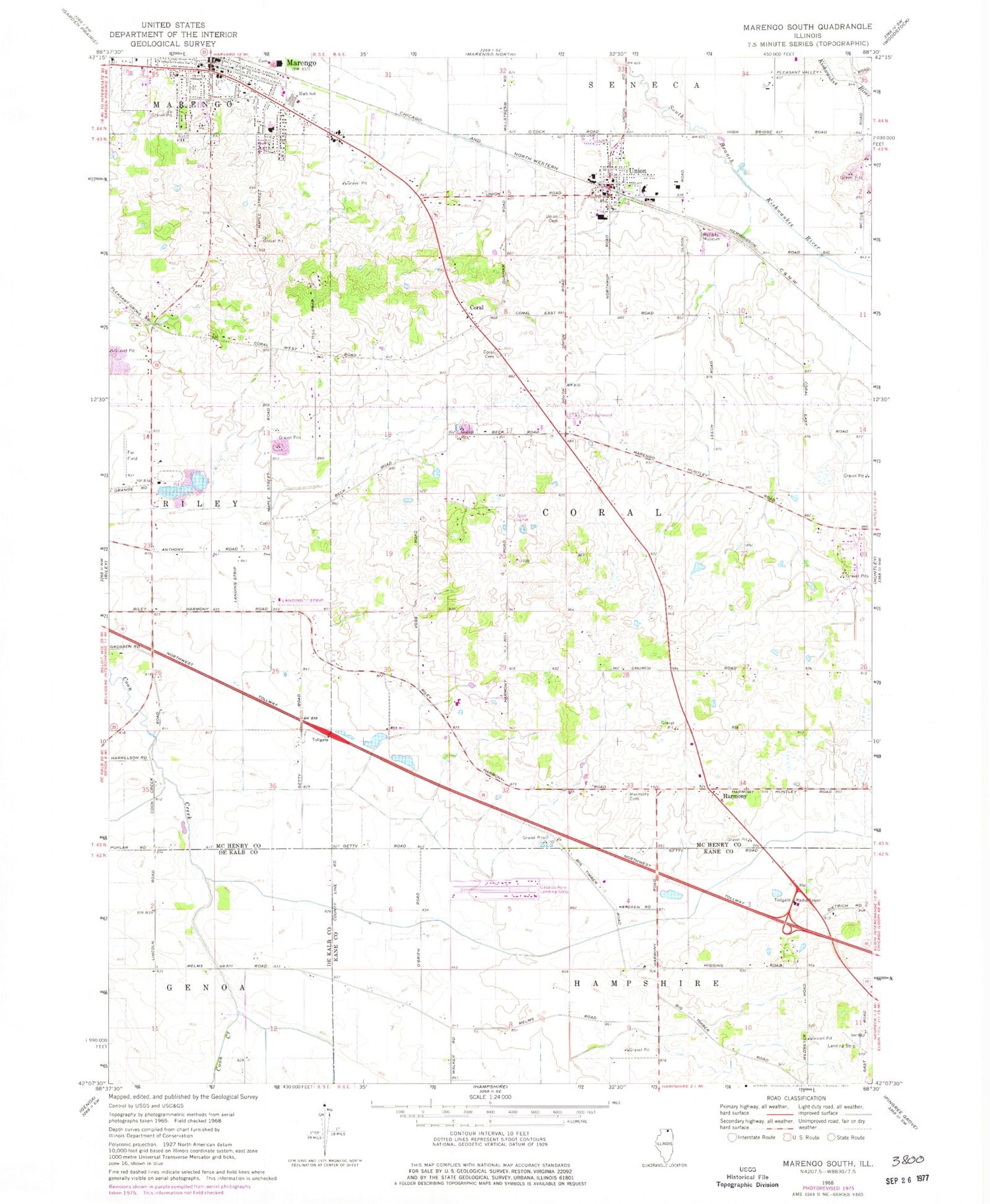
Historical USGS topographic quad map of Marengo South in the state of Illinois. Map scale may vary for some years, but is generally around 1:24,000. Print size is approximately 24" x 27"
This quadrangle is in the following counties: DeKalb, Kane, McHenry.
The map contains contour lines, roads, rivers, towns, and lakes. Printed on high-quality waterproof paper with UV fade-resistant inks, and shipped rolled.
Contains the following named places: Aldens Farms, Anthony School, Bean School, Browntown, Casa De Aero Park, Coniston Farms, Coral, Coral Cemetery, Coral Census Designated Place, Dr Joseph W Esser Airport, Edward Getzelman Airport, Emerick Airport, Far Field, Ferris Field, First Baptist Church, First Presbyterian Church, Fox Valley Nursery, Funny Farm Airport, Harmony, Harmony Cemetery, Harmony Census Designated Place, Heath School, Illinois Railway Museum, Locust Elementary School, MacGovern School, Marengo, Marengo City Hall, Marengo High School, Marengo Post Office, Marengo Public Library, Marengo United Methodist Church, Ney School, Oak Grove School, Reid School, Sewald School, Sky Soaring Airport, Township of Coral, Union, Union Cemetery, Union Fire Protection District, Union Post Office, Union Village Police Department, Village of Union, West Harmony School, ZIP Code: 60180