MyTopo
Classic USGS Maretburg Kentucky 7.5'x7.5' Topo Map
Couldn't load pickup availability
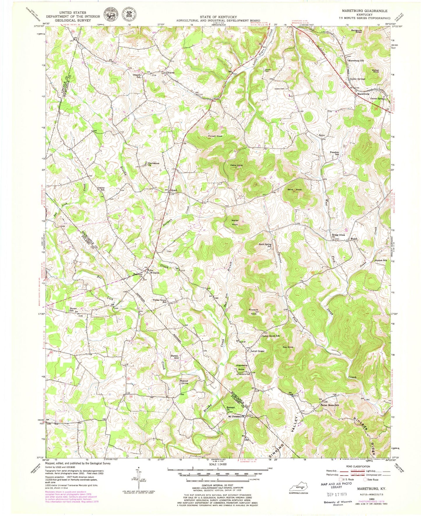
Historical USGS topographic quad map of Maretburg in the state of Kentucky. Map scale may vary for some years, but is generally around 1:24,000. Print size is approximately 24" x 27"
This quadrangle is in the following counties: Lincoln, Pulaski, Rockcastle.
The map contains contour lines, roads, rivers, towns, and lakes. Printed on high-quality waterproof paper with UV fade-resistant inks, and shipped rolled.
Contains the following named places: Backbone Ridge, Bee Lick Creek, Brown School, Browne Fork, Bull Pen Branch, Burnett Church, Burton School, Cable Knob, Cox Knob, Cummins Railroad Station, Denney Cemetery, Dorman Creek, Double Springs, Fairview Church, Freedom School, Friendship Cemetery, Friendship Knob, Guthrie Railroad Station, Jones Creek, Kincade Ridge, Level Green, Level Green School, Little Negro Creek, Maretburg, Maretburg School, Marler Knob, McCall Knob, Mount Pleasant Church, Mount Vernon Division, Norton School, Ottawa, Ottawa School, Owens School, Owens Spring, Patten Moore School, Pinnacle Knob, Poplar Grove Cemetery, Poplar Grove School, Providence Cemetery, Providence Church, Purcell Knob, Quail, Rock Spring Airport, Rock Spring School, Sand Knob, Sayers Cemetery, Skegg Creek Church, Spiro, Wabd, Walnut Grove, Warren Branch, Western Rockcastle Volunteer Fire Department, Willailla, WXJJ-FM (Mount Vernon), ZIP Code: 40409