
MyTopo
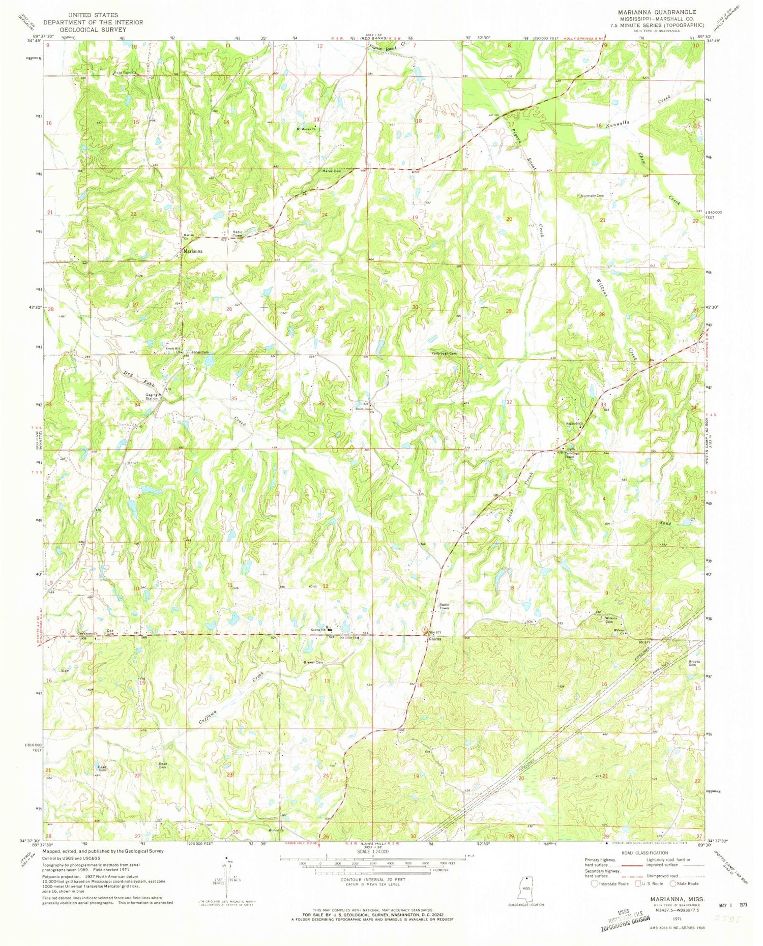
Classic USGS Marianna Mississippi 7.5'x7.5' Topo Map
Couldn't load pickup availability
Historical USGS topographic quad map of Marianna in the state of Mississippi. Map scale may vary for some years, but is generally around 1:24,000. Print size is approximately 24" x 27"
This quadrangle is in the following counties: Marshall.
The map contains contour lines, roads, rivers, towns, and lakes. Printed on high-quality waterproof paper with UV fade-resistant inks, and shipped rolled.
Contains the following named places: Brewer Cemetery, Brooks Cemetery, Chew Creek, Chulahoma Church, Chulahoma Missionary Baptist Church Cemetery, Cox Cemetery, Dean Cemetery, Galena, Galena School, J K Hurdle Lake Dam, Jones Cemetery, Jones Creek, Jones School, Marianna, Marvel Cemetery, Marvin Church, McCarley School, McIntyre Church, McIntyre School, Mount Gillie Cemetery, Mount Gillie Church, Mount Marie School, Mount Moriah Church, Mount Peel Missionary Baptist Church, Nunnally Cemetery, Nunnally Creek, Shiloh Hill School, Smith Grove Cemetery, Smith Grove Church, Street Hill Church, Supervisor District 4, Union Valley Church, Union Valley School, Wilkins Cemetery, Wilkins Chapel, Wilkins Church, Wilkins Creek, Wilkins School, Yarbrough Cemetery, Yarbrough Chapel Christian Methodist Episcopal Church, Yarbrough Church, Yarbrough School


