MyTopo
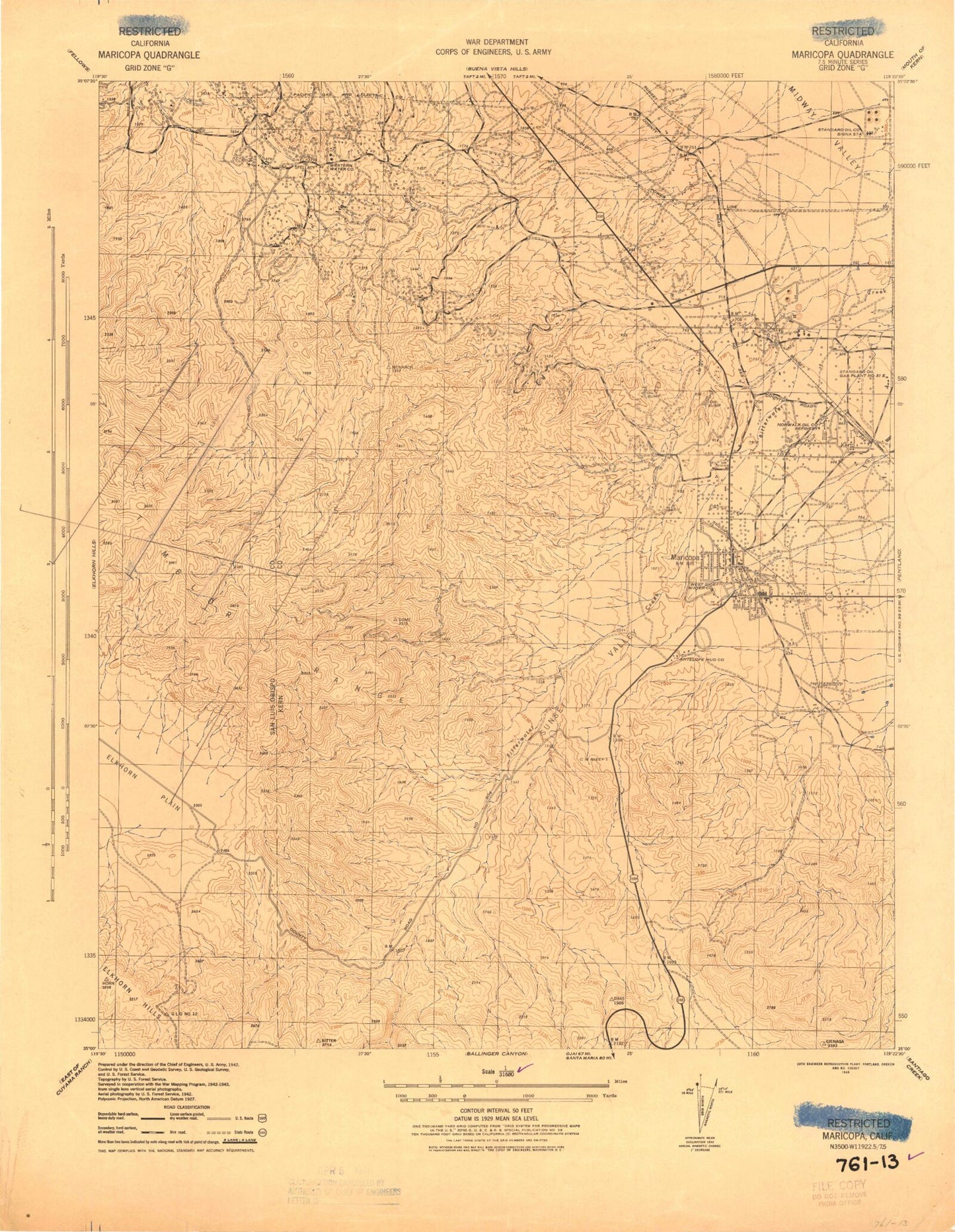
Classic USGS Maricopa California 7.5'x7.5' Topo Map
Couldn't load pickup availability
Historical USGS topographic quad map of Maricopa in the state of California. Map scale may vary for some years, but is generally around 1:24,000. Print size is approximately 24" x 27"
This quadrangle is in the following counties: Kern, San Luis Obispo.
The map contains contour lines, roads, rivers, towns, and lakes. Printed on high-quality waterproof paper with UV fade-resistant inks, and shipped rolled.
Contains the following named places: Beam Flat, Bitterwater Spring, Capitola Park, City of Maricopa, Correctional Institution Taft, Devils Gulch, Elkhorn Hills, Hazelton, Kern County Fire Department Station 22 Maricopa, KMYX-FM (Taft), Little Signal Hills, Maricopa, Maricopa Airport, Maricopa Branch Kern County Library, Maricopa City Hall, Maricopa Elementary School, Maricopa High School, Maricopa Post Office, Norwalk Oil Refinery, Spellacy, Standard Oil Signa Station, Sunset Oil Field, Sunset Valley, Twentyfive Hill