MyTopo
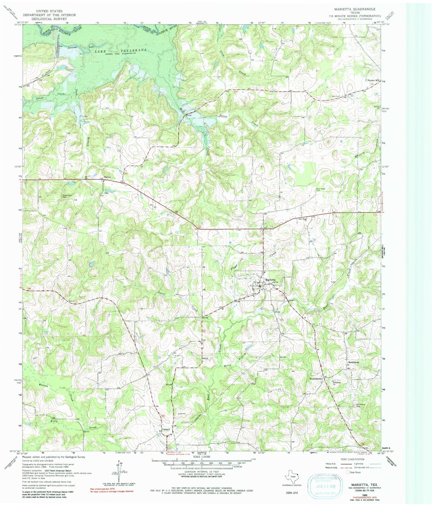
Classic USGS Marietta Texas 7.5'x7.5' Topo Map
Couldn't load pickup availability
Historical USGS topographic quad map of Marietta in the state of Texas. Map scale may vary for some years, but is generally around 1:24,000. Print size is approximately 24" x 27"
This quadrangle is in the following counties: Bowie, Cass.
The map contains contour lines, roads, rivers, towns, and lakes. Printed on high-quality waterproof paper with UV fade-resistant inks, and shipped rolled.
Contains the following named places: Bell Cemetery, Bethlehem, Bethlehem Cemetery, Bethlehem Church, Caney Creek, Cornett, Creekmore Cemetery, Dalton, Elliot Creek, Floyd Creek, Gethsemane Church, Holly Branch, Jennings Lake, Marietta, Marietta Fire Department, Marietta Post Office, New Hope Cemetery, New Hope Church, Nickleberry, Sweet Creek, Town of Marietta, Tuck Branch, Watson Creek, ZIP Code: 75568