MyTopo
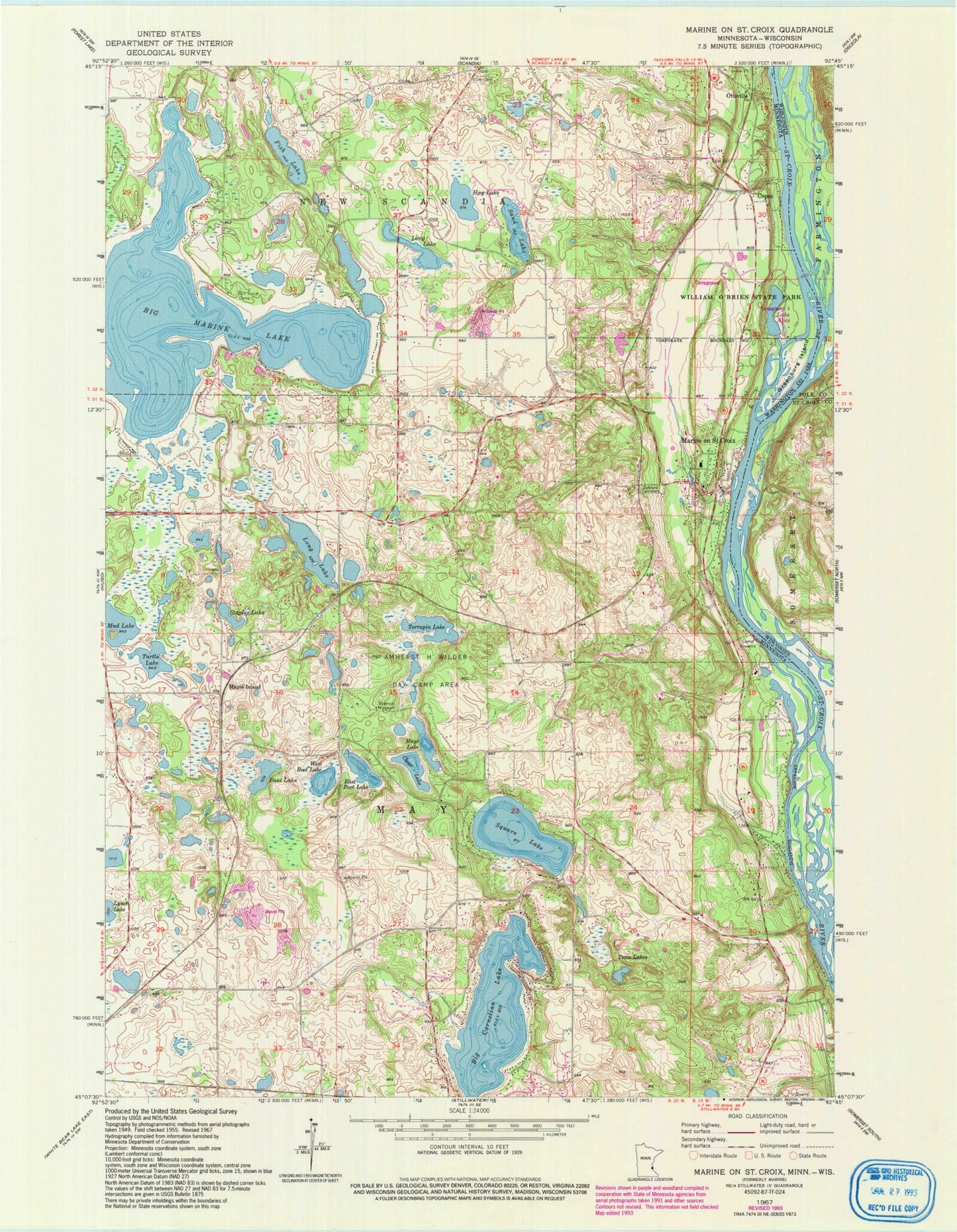
Classic USGS Marine on St. Croix Minnesota 7.5'x7.5' Topo Map
Couldn't load pickup availability
Historical USGS topographic quad map of Marine on St. Croix in the state of Minnesota. Map scale may vary for some years, but is generally around 1:24,000. Print size is approximately 24" x 27"
This quadrangle is in the following counties: Polk, St. Croix, Washington.
The map contains contour lines, roads, rivers, towns, and lakes. Printed on high-quality waterproof paper with UV fade-resistant inks, and shipped rolled.
Contains the following named places: Amherst H Wilder Day Camp Area, Bass Lake, Big Carnelian Lake, Big Marine Lake, Camp Kiwanis, City of Marine on Saint Croix, Clear Lake, Copas, East Boot Lake, Elim Cemetery, Fish Lake, Greenburg Island, Hay Lake, Keller Airport, Lake Alice, Long Lake, Maple Island, Maple Island Post Office, Marine Elementary School, Marine on Saint Croix, Marine on Saint Croix Post Office, Marine on Saint Croix Volunteer Fire Department, Mays Lake, Mud Lake, Oakland Cemetery, Otisville, Otisville Post Office, Sand Lake, Square Lake, Staples Lake, Terrapin Lake, Township of May, Turtle Lake, Twin Lakes, West Boot Lake, William O'Brien State Park, ZIP Code: 55047