MyTopo
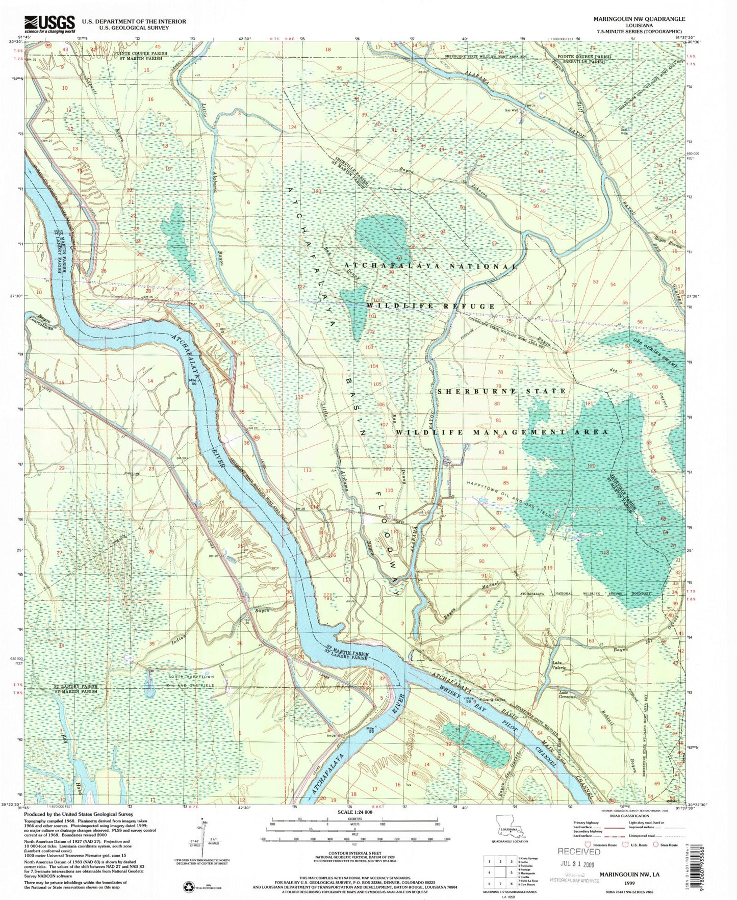
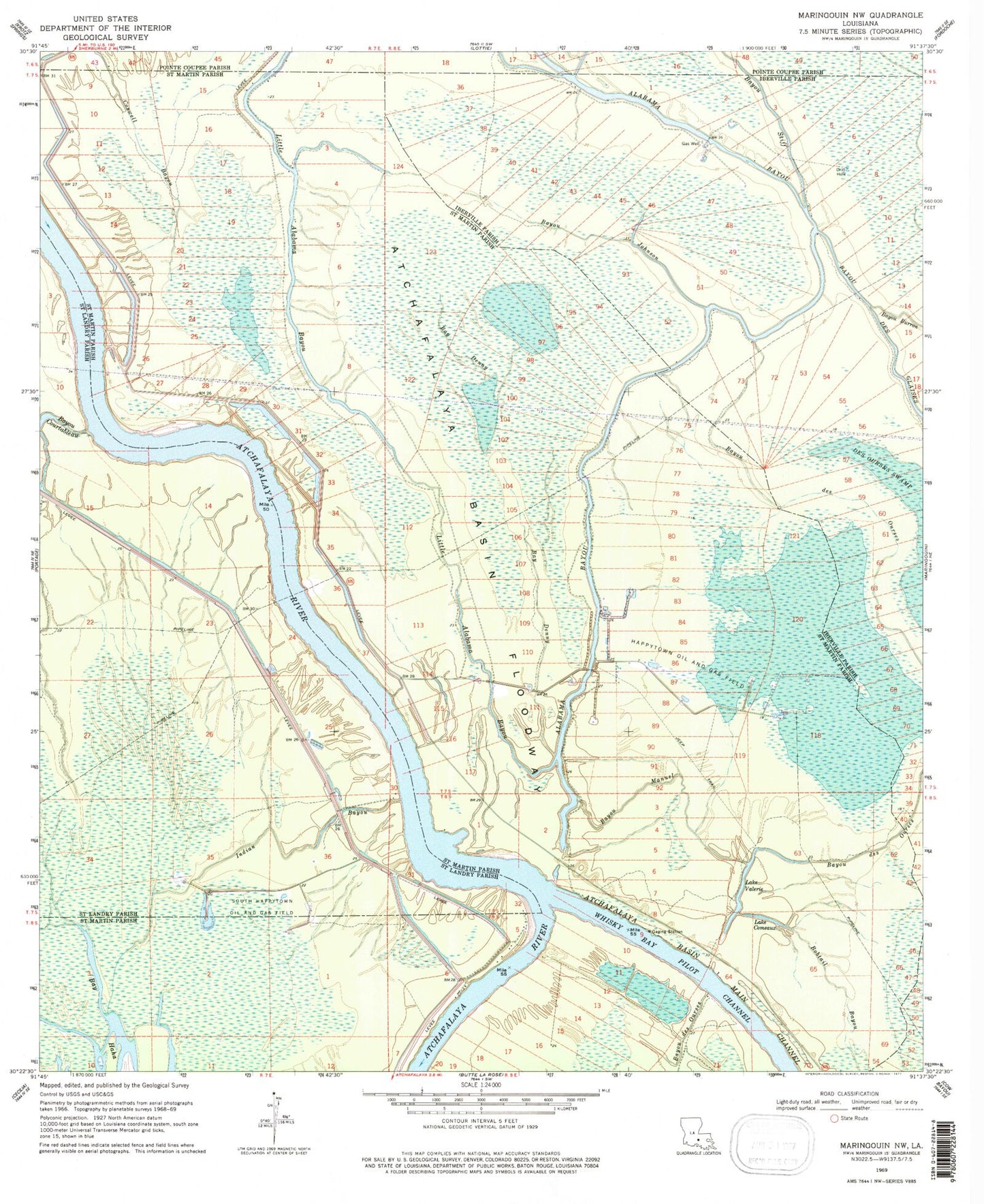
Classic USGS Maringouin NW Louisiana 7.5'x7.5' Topo Map
Couldn't load pickup availability
Historical USGS topographic quad map of Maringouin NW in the state of Louisiana. Typical map scale is 1:24,000, but may vary for certain years, if available. Print size: 24" x 27"
This quadrangle is in the following counties: Iberville, Pointe Coupee, St. Landry, St. Martin.
The map contains contour lines, roads, rivers, towns, and lakes. Printed on high-quality waterproof paper with UV fade-resistant inks, and shipped rolled.
Contains the following named places: Sherburne Wildlife Management Area, Bayou Johnson, Bayou Stiff, Alabama Bayou Gas Field, Bay Denny, Bayou des Ourses, Bayou Courtableau, Bayou Manuel, Bobtail Bayou, Lake Comeaux, Coswell Bayou, Happytown Oil and Gas Field, Indian Bayou, South Happytown Oil and Gas Field, Lake Valerie, Lake Valerie Oil Field, Parish Governing Authority District 8, Atchafalaya National Wildlife Refuge