
MyTopo
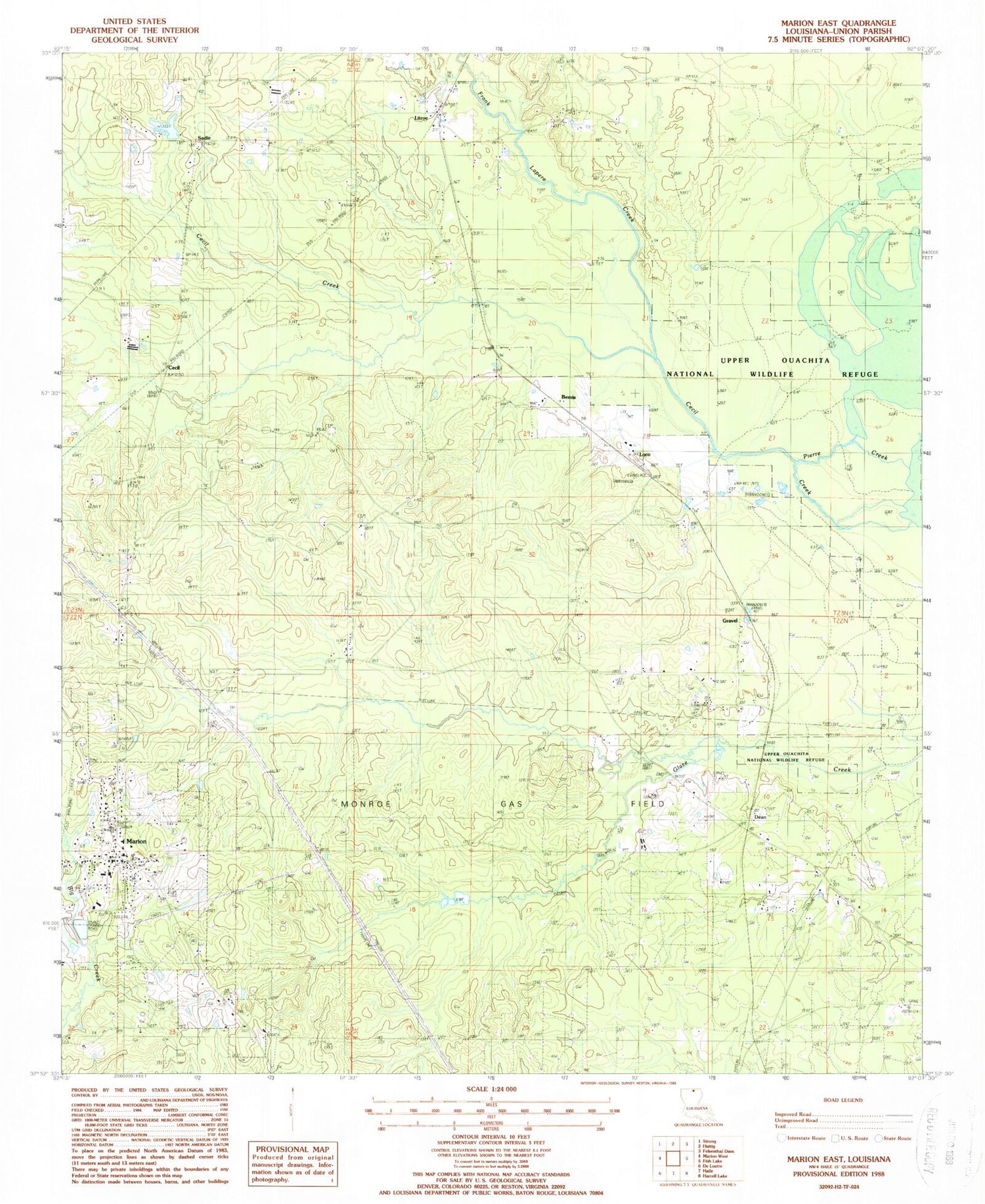
Classic USGS Marion East Louisiana 7.5'x7.5' Topo Map
Couldn't load pickup availability
Historical USGS topographic quad map of Marion East in the state of Louisiana. Map scale may vary for some years, but is generally around 1:24,000. Print size is approximately 24" x 27"
This quadrangle is in the following counties: Union.
The map contains contour lines, roads, rivers, towns, and lakes. Printed on high-quality waterproof paper with UV fade-resistant inks, and shipped rolled.
Contains the following named places: Bemis, Cecil, Dean, Dean Baptist Church Cemetery, Frank Lapere Creek, Gravel, Linville High School, Litroe, Loco, Marion, Marion Church, Marion Gas Field, Marion High School, Marion Police Department, Marion Post Office, Marion Volunteer Fire Department, Parish Governing Authority District 2, Reppond - Pace Cemetery, Reppond Cemetery, Sadie, Saint Paul Cemetery Number 2, Saint Pauls Church, Town of Marion, Ward Two, ZIP Code: 71260


