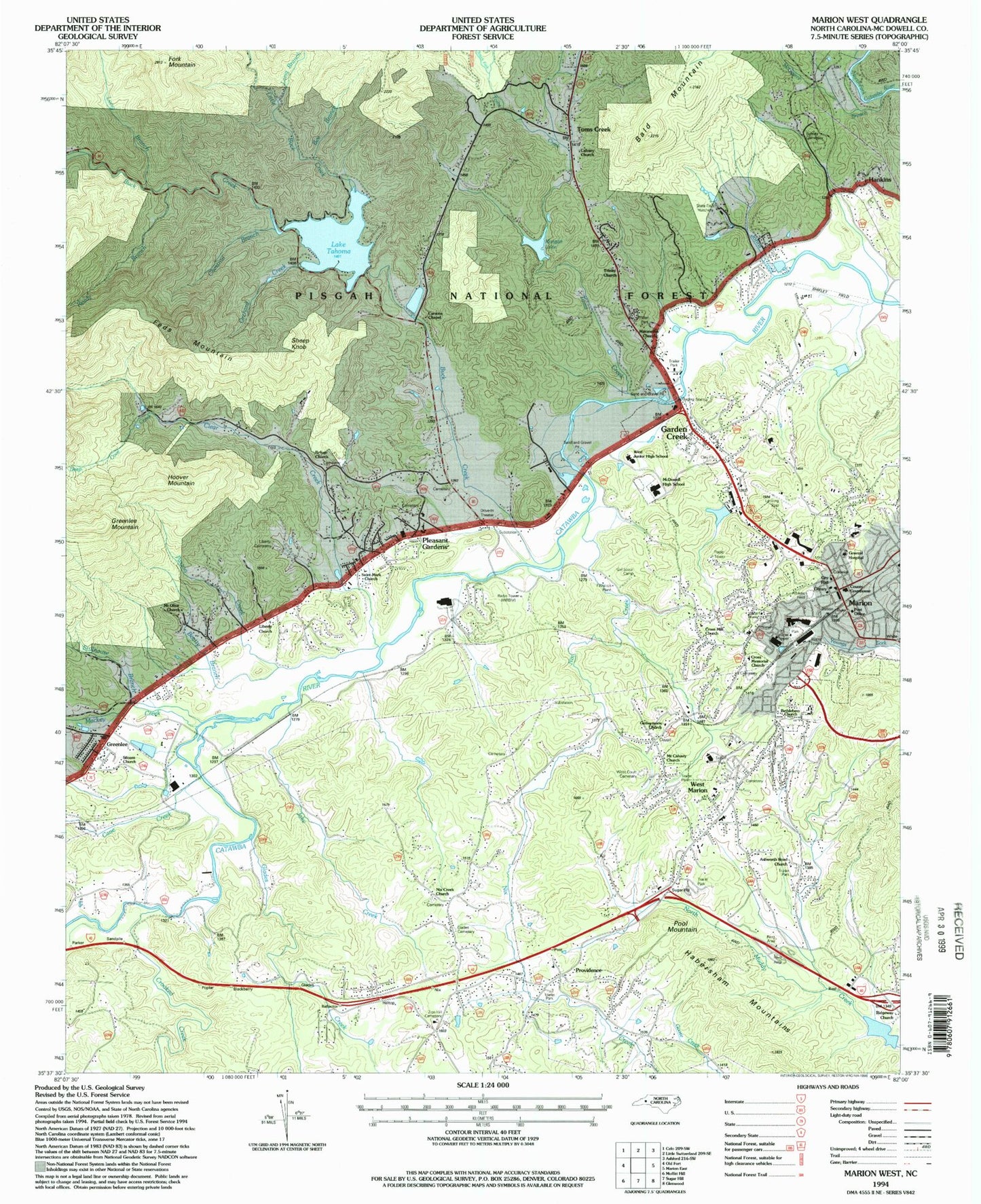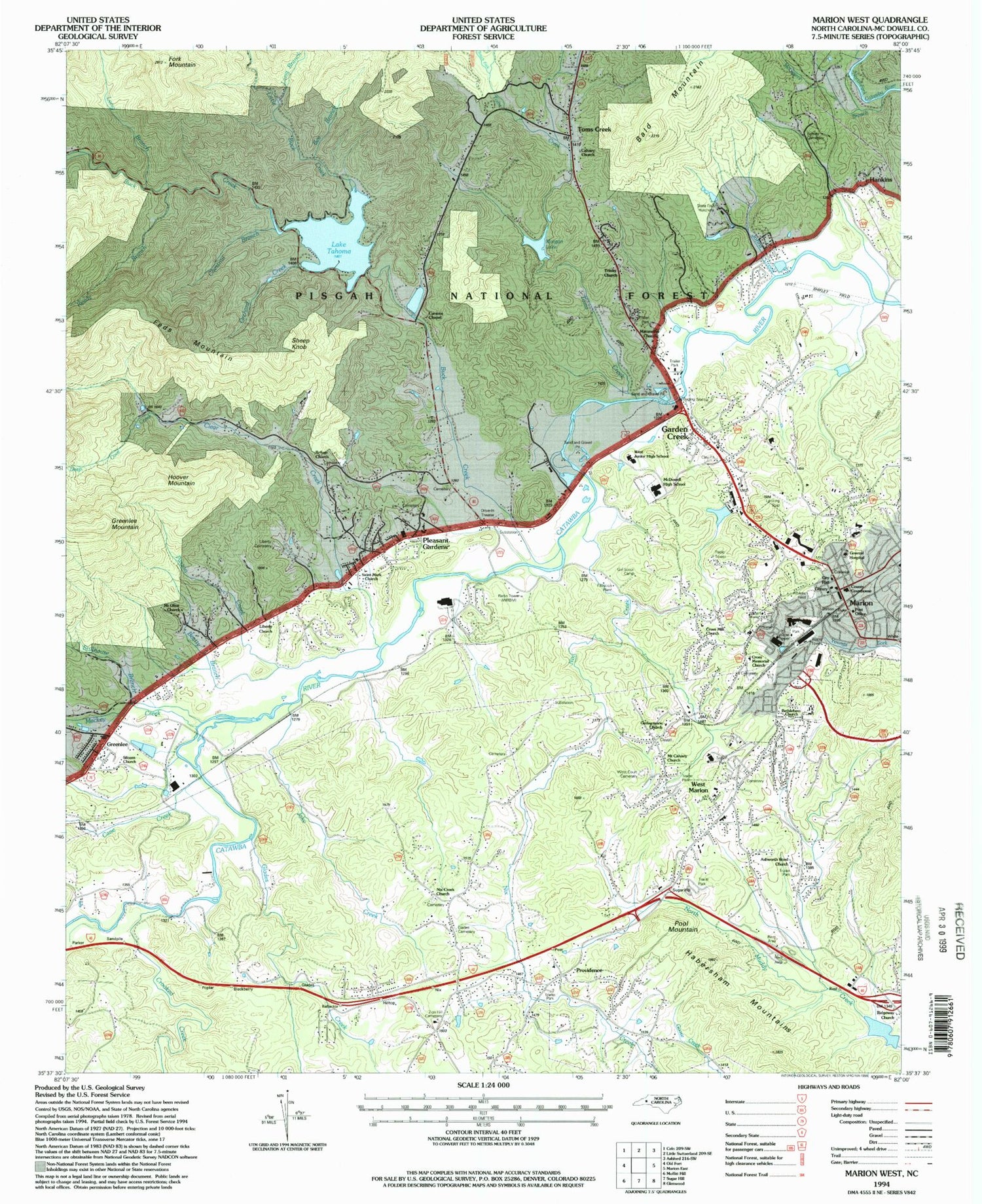
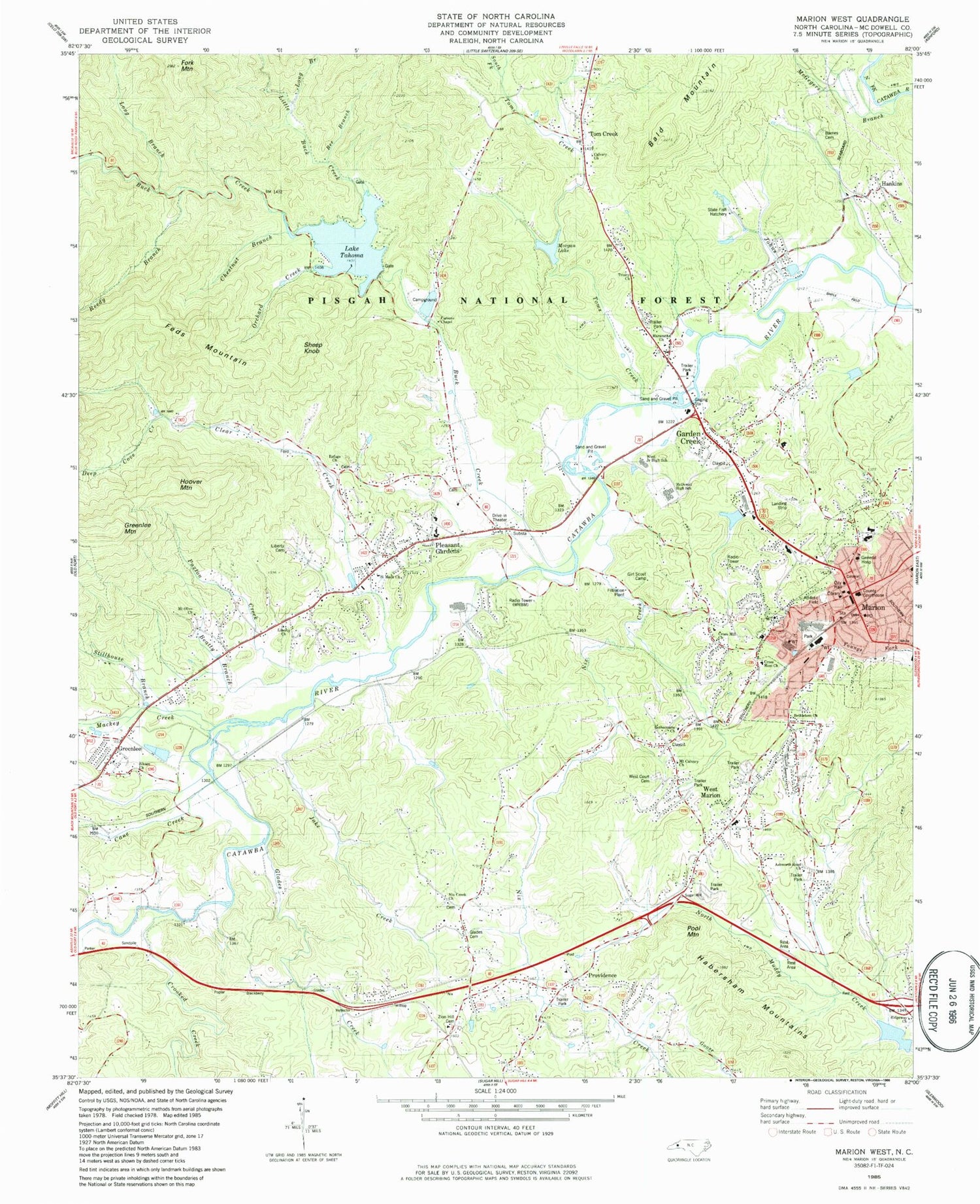
MyTopo
Classic USGS Marion West North Carolina 7.5'x7.5' Topo Map
Couldn't load pickup availability
Historical USGS topographic quad map of Marion West in the state of North Carolina. Map scale may vary for some years, but is generally around 1:24,000. Print size is approximately 24" x 27"
This quadrangle is in the following counties: McDowell.
The map contains contour lines, roads, rivers, towns, and lakes. Printed on high-quality waterproof paper with UV fade-resistant inks, and shipped rolled.
Contains the following named places: Ashworth Road Church, Bald Mountain, Barnes Cemetery, Beatty Branch, Bee Branch, Bethlehem Church, Buck Creek, Calvary Church, Cane Creek, Carson Chapel, Chestnut Branch, City of Marion, Clear Creek, Clear Creek Church, Crooked Creek, Cross Memorial Church, Cross Mill Church, Deep Cove Creek, East Mcdowell Junior High School, Eastfield Elementary School, Feds Mountain, Fork Mountain, Garden Creek, Gethsemane Church, Glades Cemetery, Glades Creek, Grandfather Ranger District Office, Greenlee, Greenlee Church, Greenlee Mountain, Habersham Mountains, Hankins, Hoover Mountain, Jake Creek, Johns Creek, Lady Marian Plaza, Lake Tahoma, Lake Tahoma Dam, Liberty Cemetery, Liberty Church, Liberty Hill Church, Little Buck Creek, Long Branch, Mackey Creek, Maranatha Church, Marion, Marion City Hall, Marion Elementary School, Marion Fire Department, Marion Police Department, Marion Post Office, McDowell County, McDowell County Courthouse, McDowell County Emergency Medical Services Station 1, McDowell County Rescue Squad and Ambulance Station 97, McDowell County Sheriff's Office, McDowell High School, McDowell Hospital, McGegers Branch, Morgan Dam, Morgan Lake, Mount Calvary Church, Mount Olive Church, Nicks Creek Church, Nix Creek, North Carolina State Fish Hatchery, Orchard Creek, Paxton Creek, Pleasant Gardens, Pleasant Gardens Volunteer Fire Department, Pool Mountain, Providence, Reedy Branch, Refuge Church, Ridgeway Church, Rose Chapel, Saint Mark Church, Sheep Knob, Shiflet Field, Siloam Church, South Fork Toms Creek, Stillhouse Branch, Toms Creek, Township of Marion, Trinity Church, WBRM-AM (Marion), West Court Cemetery, West Junior High School, West Marion, West Marion Census Designated Place, West Marion Elementary School, Zion Hill Cemetery, ZIP Code: 28752