MyTopo
Classic USGS Marion Maryland 7.5'x7.5' Topo Map
Couldn't load pickup availability
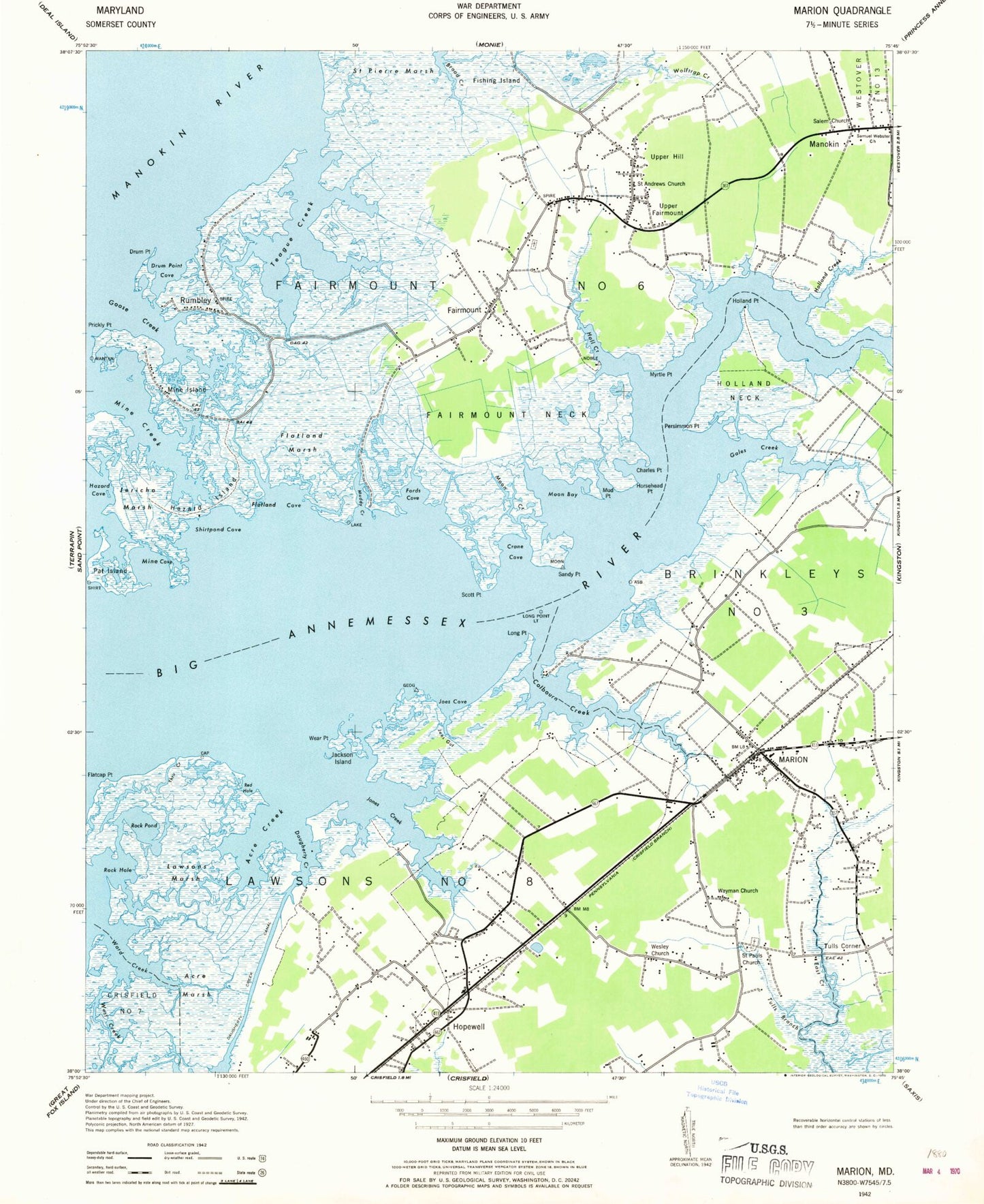
Historical USGS topographic quad map of Marion in the state of Maryland. Map scale may vary for some years, but is generally around 1:24,000. Print size is approximately 24" x 27"
This quadrangle is in the following counties: Somerset.
The map contains contour lines, roads, rivers, towns, and lakes. Printed on high-quality waterproof paper with UV fade-resistant inks, and shipped rolled.
Contains the following named places: A Hill Camping Area, A Hill Cemetery, Academy Grove Historic District, Acre Creek, Acre Marsh, Annemessix Towne, Big Annemessex River, Charles Point, Christ Cemetery, Christ Church, Colbourn Creek, Crane Cove, Crisfield-Somerset County Airport, Daugherty Creek, Daugherty Creek Canal, District 6 Fairmount, District 8 Lawsons, Drum Point, Drum Point Cove, Fairmount, Fairmount Academy, Fairmount Cemetery, Fairmount Census Designated Place, Fairmount Neck, Fairmount State Wildlife Management Area, Fairmount Volunteer Fire Department Station 9, Flatcap Basin, Flatcap Point, Flatland Cove, Flatland Marsh, Fords Cove, Fords Wharf, Frenchtown, Frenchtown-Rumbly Census Designated Place, Gales Creek, Goose Creek, Goose Creek Marina, Hall Creek, Handy Memorial Church, Hazard Cove, Hazard Island, Hearts Ease, Highway Church, Holland Creek, Holland Neck, Holland Point, Hopewell, Horsehead Point, Ipsenancy Creek, Jackson Island, Janes Island, Janes Island State Park, Jericho Marsh, Joes Cove, Joes Gut, Jones Creek, Landford Cemetery, Landonville, Lawsons Marsh, Long Point, Long Point Light, Manokin, Manokin Post Office, Marion, Marion Baptist Church, Marion Elementary School, Marion High School, Marion Sarah Peyton Elementary School, Marion Station Post Office, Marion Volunteer Fire Department Station 3, Mine Cove, Mine Creek, Mine Island, Moon Bay, Moon Creek, Mount Peer Church, Mud Point, Muddy Creek, Myrtle Point, Pat Island, Persimmon Point, Prickly Point, Quindocqua Cemetery, Red Hole, Rock Hole, Rock Pond, Rumbley, Rumbley Post Office, Saint Andrews Church, Saint Pauls Cemetery, Saint Pauls Church, Saint Peters Church, Saint Peters Episcopal Cemetery, Saint Pierre Marsh, Saint Stephens Church, Saint Stephens Episcopal Cemetery, Salem Cemetery, Salem Church, Sandy Point, Scott Point, Shirtpond Cove, Somerset County, Somerset Hospital, Sunny Ridge Memorial Park, Teague Creek, Thru Creek, Trinity Church, Trinity Episcopal Cemetery, Tulls Branch, Tulls Corner, Union Cemetery, Union Church, Upper Fairmount, Upper Fairmount Cemetery, Upper Fairmount Post Office, Upper Hill, Ward, Wayman Church, Wear Point, Wesley Church, ZIP Code: 21867