MyTopo
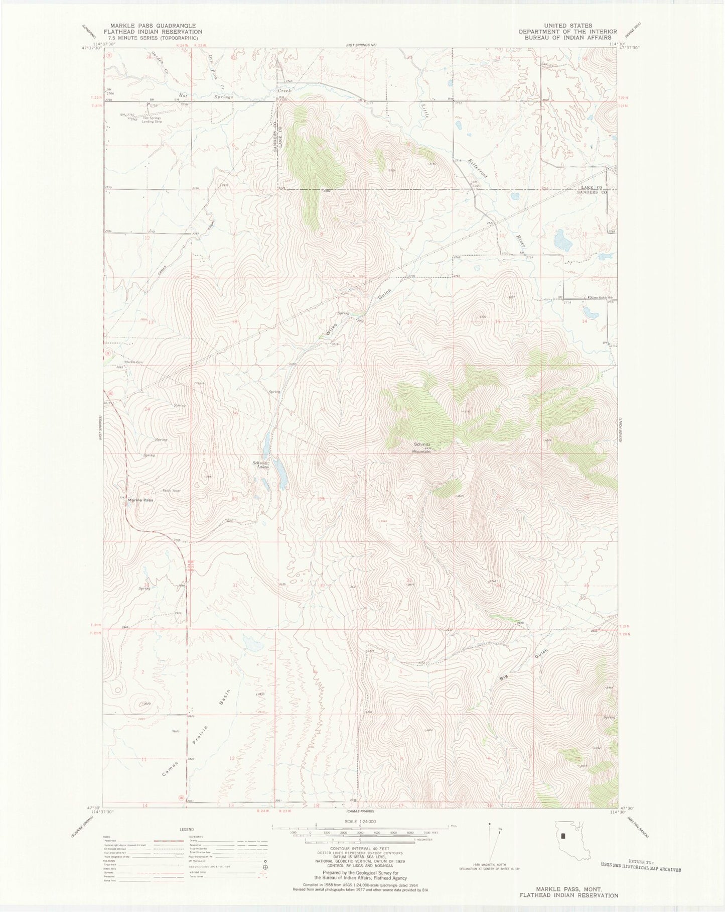
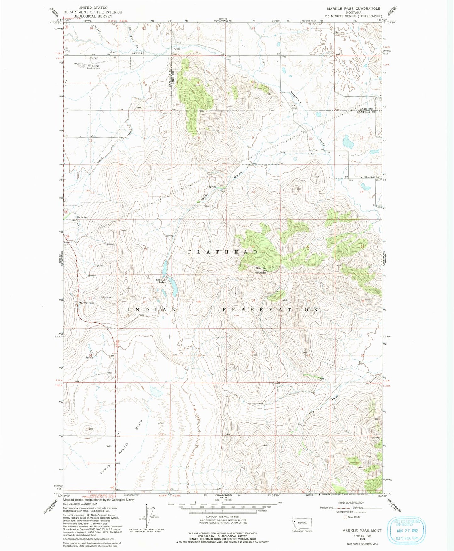
Classic USGS Markle Pass Montana 7.5'x7.5' Topo Map
Couldn't load pickup availability
Historical USGS topographic quad map of Markle Pass in the state of Montana. Map scale may vary for some years, but is generally around 1:24,000. Print size is approximately 24" x 27"
This quadrangle is in the following counties: Lake, Sanders.
The map contains contour lines, roads, rivers, towns, and lakes. Printed on high-quality waterproof paper with UV fade-resistant inks, and shipped rolled.
Contains the following named places: 20N24W01CCB_01 Well, 20N24W01DCCD01 Well, 20N24W02CCD_01 Well, 20N24W11AADC01 Well, 20N24W12CCA_01 Well, 21N23W02DBB_01 Well, 21N23W03DBAC01 Well, 21N23W03DBB_01 Well, 21N23W04AAD_01 Well, 21N23W04DAAC01 Well, 21N23W10BDD_01 Well, 21N23W11CACC01 Well, 21N23W11CBD_01 Well, 21N23W14ACB_01 Well, 21N23W14ACD_01 Well, 21N24W01ABB_01 Well, 21N24W01CAD_01 Well, 21N24W10AADD01 Well, 21N24W12ADD_01 Well, 21N24W12CCC_01 Well, 21N24W12CCC_02 Well, 21N24W24BAC_01 Well, 22N23W33DAD_01 Well, 22N23W33DDA_01 Well, 22N23W33DDC_01 Well, Christensen Dam, Cottonwood Creek, Cross Dam, Dry Fork Creek, Garden Creek, Hot Springs Airport, Hot Springs Creek, Hot Springs District, Markle Cemetery, Markle Pass, Oliver Gulch School, Schmitz Lakes, Schmitz Mountain, Warm Springs Creek, Wilks Gulch