MyTopo
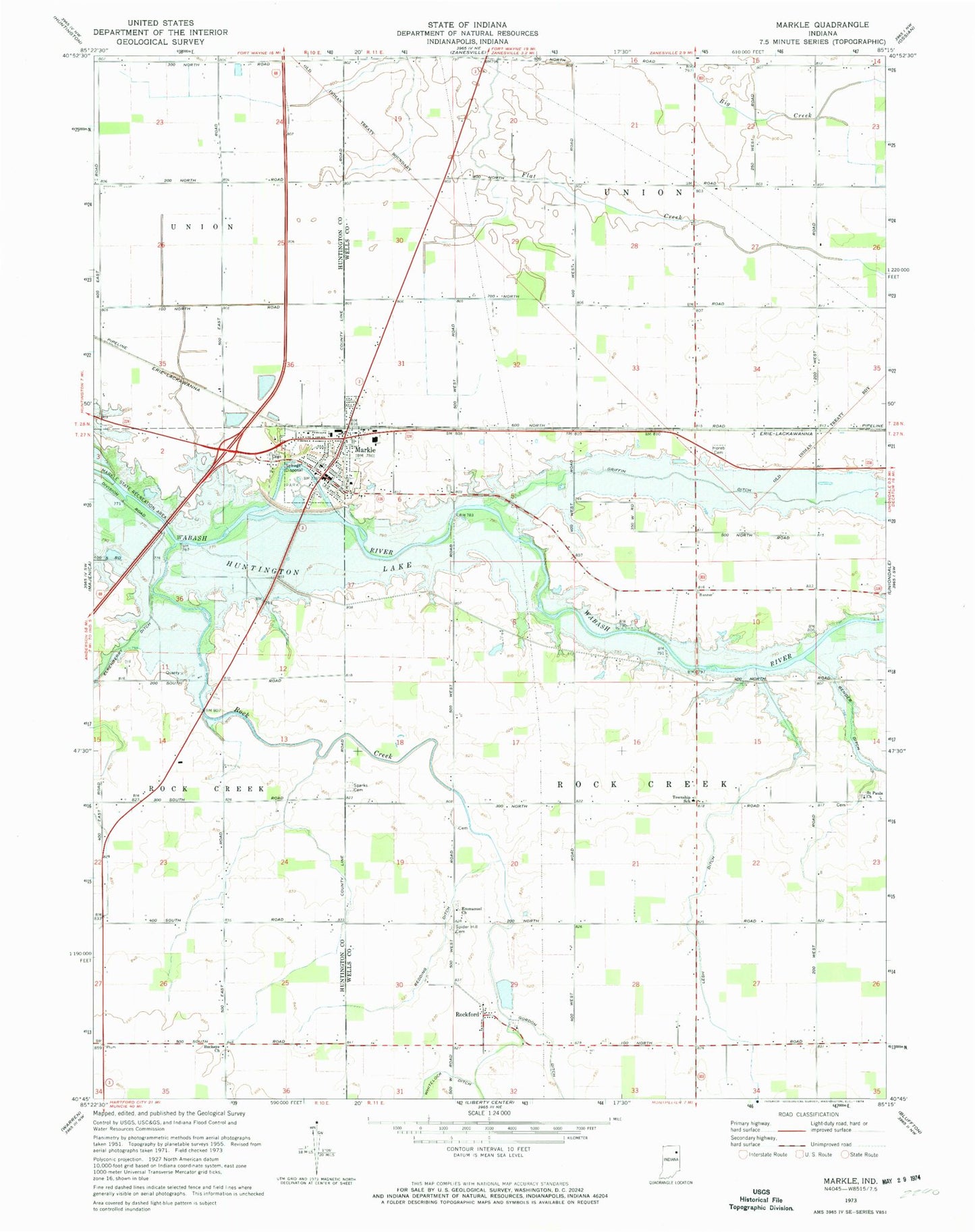
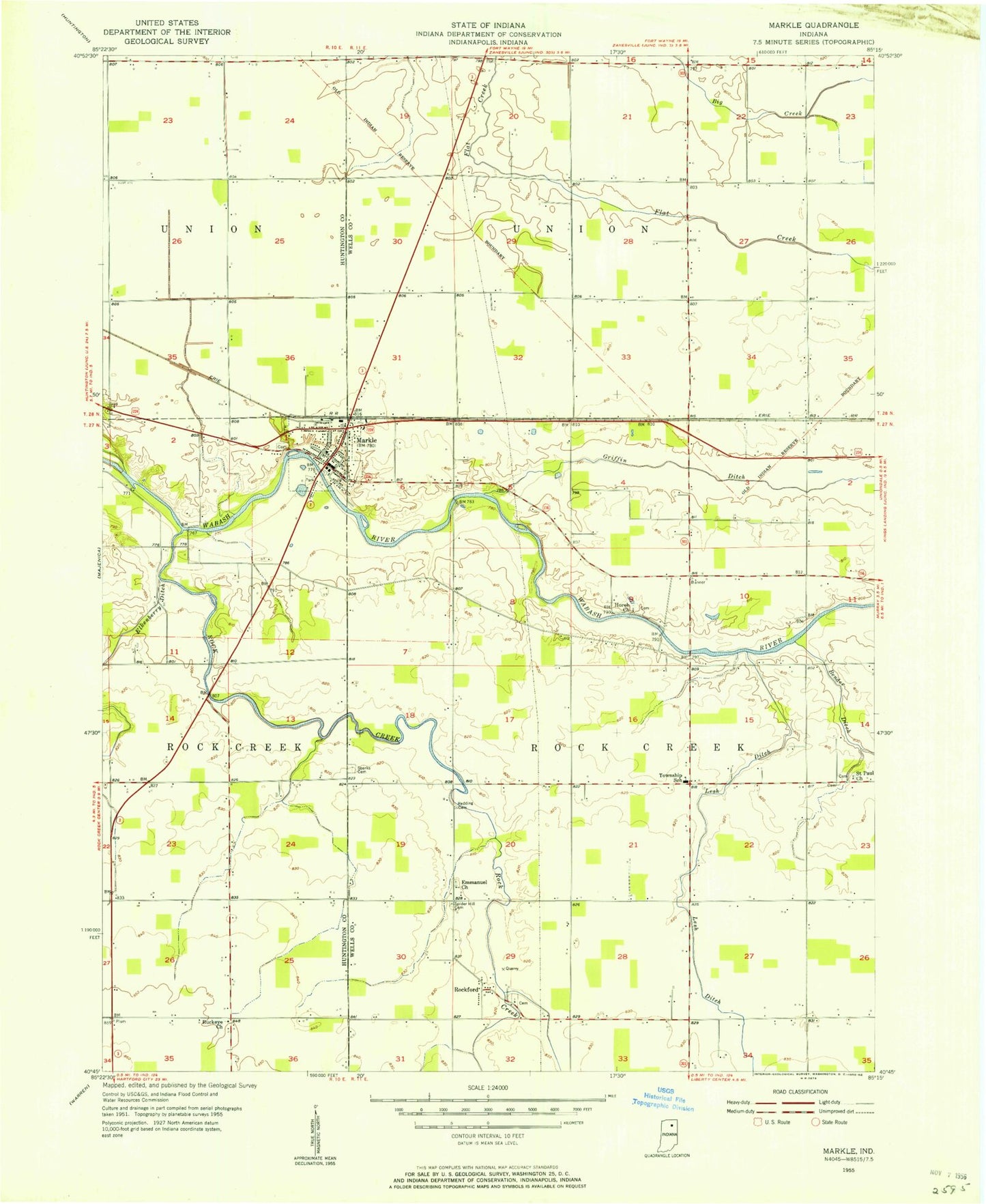
Classic USGS Markle Indiana 7.5'x7.5' Topo Map
Couldn't load pickup availability
Historical USGS topographic quad map of Markle in the state of Indiana. Map scale may vary for some years, but is generally around 1:24,000. Print size is approximately 24" x 27"
This quadrangle is in the following counties: Huntington, Wells.
The map contains contour lines, roads, rivers, towns, and lakes. Printed on high-quality waterproof paper with UV fade-resistant inks, and shipped rolled.
Contains the following named places: Buckeye Church, Emmanuel Church, Gordon Ditch, Griffin Ditch, Horeb Cemetery, Johnson Airport, Lesh Ditch, Markle, Markle Police Department, Markle Post Office, Markle Volunteer Fire and Rescue, Redding Ditch, Rock Creek, Rockford, Saint Pauls Church, Sparks Cemetery, Spider Hill Cemetery, Town of Markle, Township of Rockcreek, Township of Union, Wells County Emergency Medical Services - Markle Station, Worster Farms, ZIP Code: 46770