MyTopo
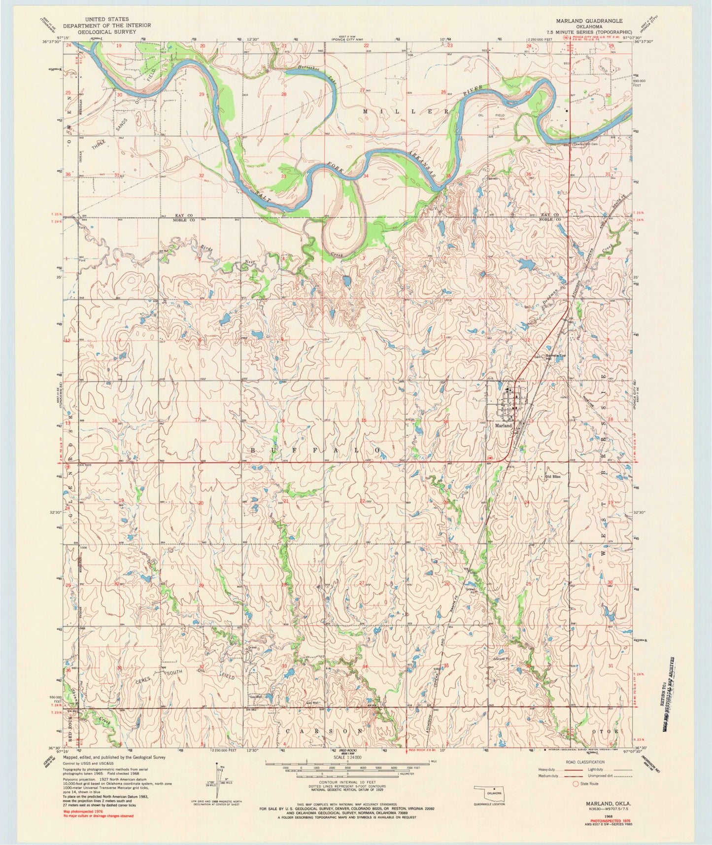
Classic USGS Marland Oklahoma 7.5'x7.5' Topo Map
Couldn't load pickup availability
Historical USGS topographic quad map of Marland in the state of Oklahoma. Map scale may vary for some years, but is generally around 1:24,000. Print size is approximately 24" x 27"
This quadrangle is in the following counties: Kay, Noble.
The map contains contour lines, roads, rivers, towns, and lakes. Printed on high-quality waterproof paper with UV fade-resistant inks, and shipped rolled.
Contains the following named places: Birds Nest Creek, Ceres South Oil Field, Chikaskia River, Cowboy Hill Cemetery, Horseshoe Lake, Longbranch Site 2 Dam, Longbranch Site 2 Reservoir, Marland, Marland Post Office, Marland Volunteer Fire Department, Oknoname 103011 Dam, Oknoname 103011 Reservoir, Oknoname 103012 Dam, Oknoname 103012 Reservoir, Old Bliss, Spindle Top Hill, Three Sands Oil Field, Town of Marland, Township of Buffalo