MyTopo
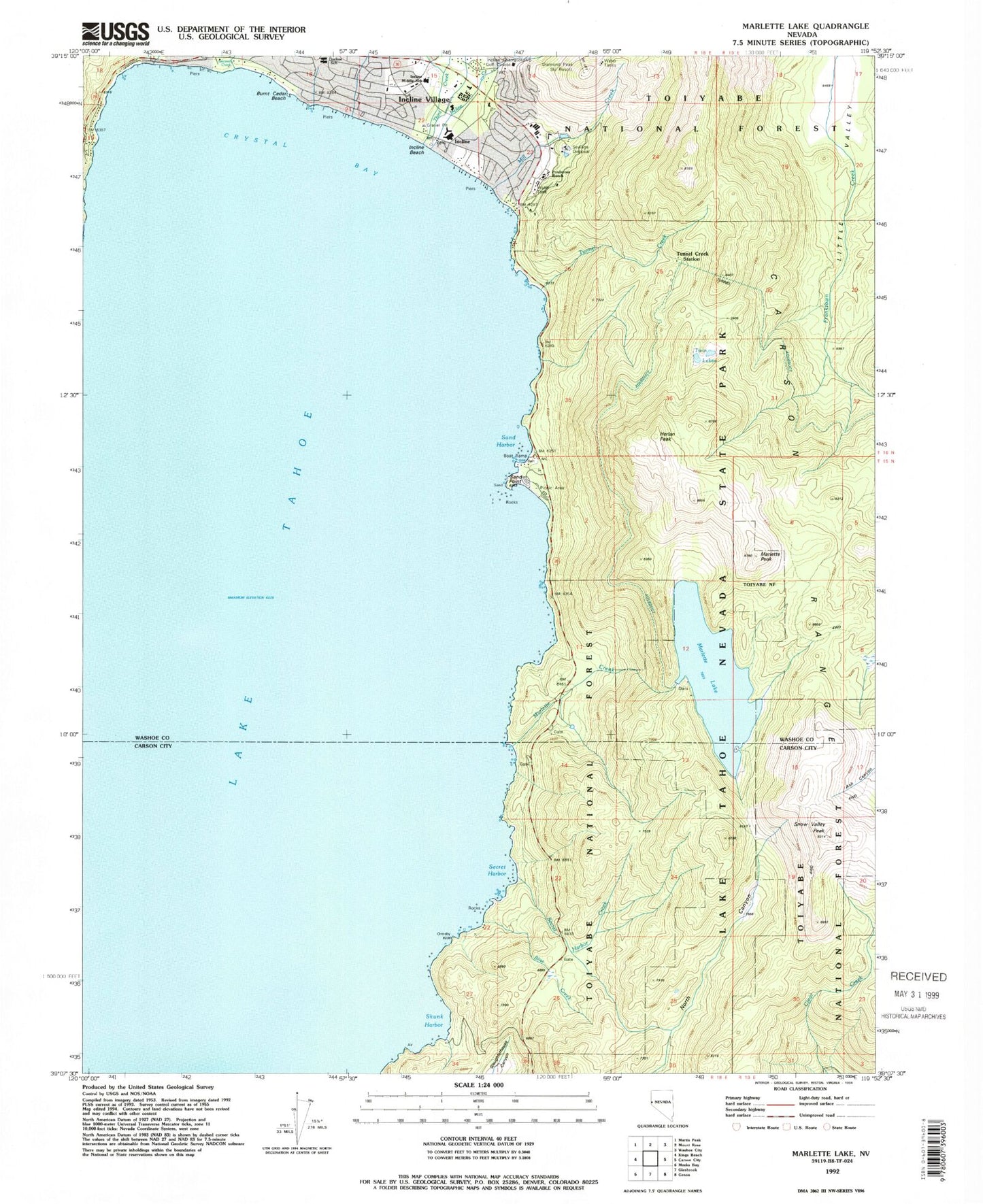
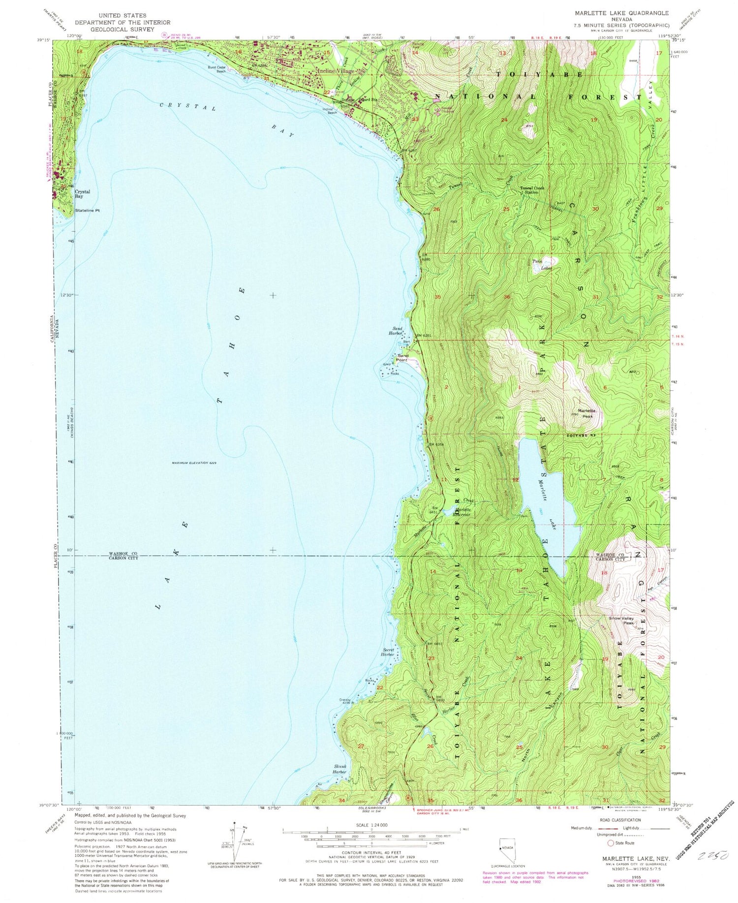
Classic USGS Marlette Lake Nevada 7.5'x7.5' Topo Map
Couldn't load pickup availability
Historical USGS topographic quad map of Marlette Lake in the state of Nevada. Typical map scale is 1:24,000, but may vary for certain years, if available. Print size: 24" x 27"
This quadrangle is in the following counties: Carson City (city), Washoe.
The map contains contour lines, roads, rivers, towns, and lakes. Printed on high-quality waterproof paper with UV fade-resistant inks, and shipped rolled.
Contains the following named places: Burnt Cedar Beach, Summit Valley, Village Shopping Center, Incline Middle School, Incline Elementary School, Hidden Beach, Highway 28 Management Area, Backcountry Management Area, Memorial Point, Little Valley Mine, Bliss Creek, Crystal Bay, First Creek, Incline Beach, Incline Creek, Incline Guard Station, Marlette Creek, Marlette Lake, Marlette Peak, Marlette Reservoir, Mill Creek, Sand Harbor, Sand Harbor Beach State Recreation Area, Sand Point, Second Creek, Secret Harbor, Secret Harbor Creek, Skunk Harbor, Snow Valley Peak, Third Creek, Tunnel Creek, Tunnel Creek Station, Twin Lakes, Herlan Peak, Burnt Cedar Beach, Lake Tahoe State Park, Marlette Lake Dam, Mill Creek Dam Number Two, Mill Creek Reservoir Number Two, Incline Village Post Office, Incline Post Office (historical), Incline Village Division, Incline Elementary K-2nd School, Lake Tahoe School, Incline Village-Crystal Bay Census Designated Place (historical), North Lake Tahoe Fire Protection District Station 11, Mark Twain Cultural Center