MyTopo
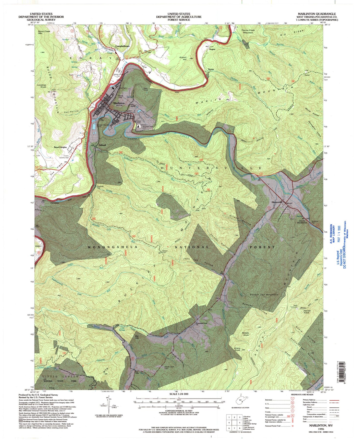
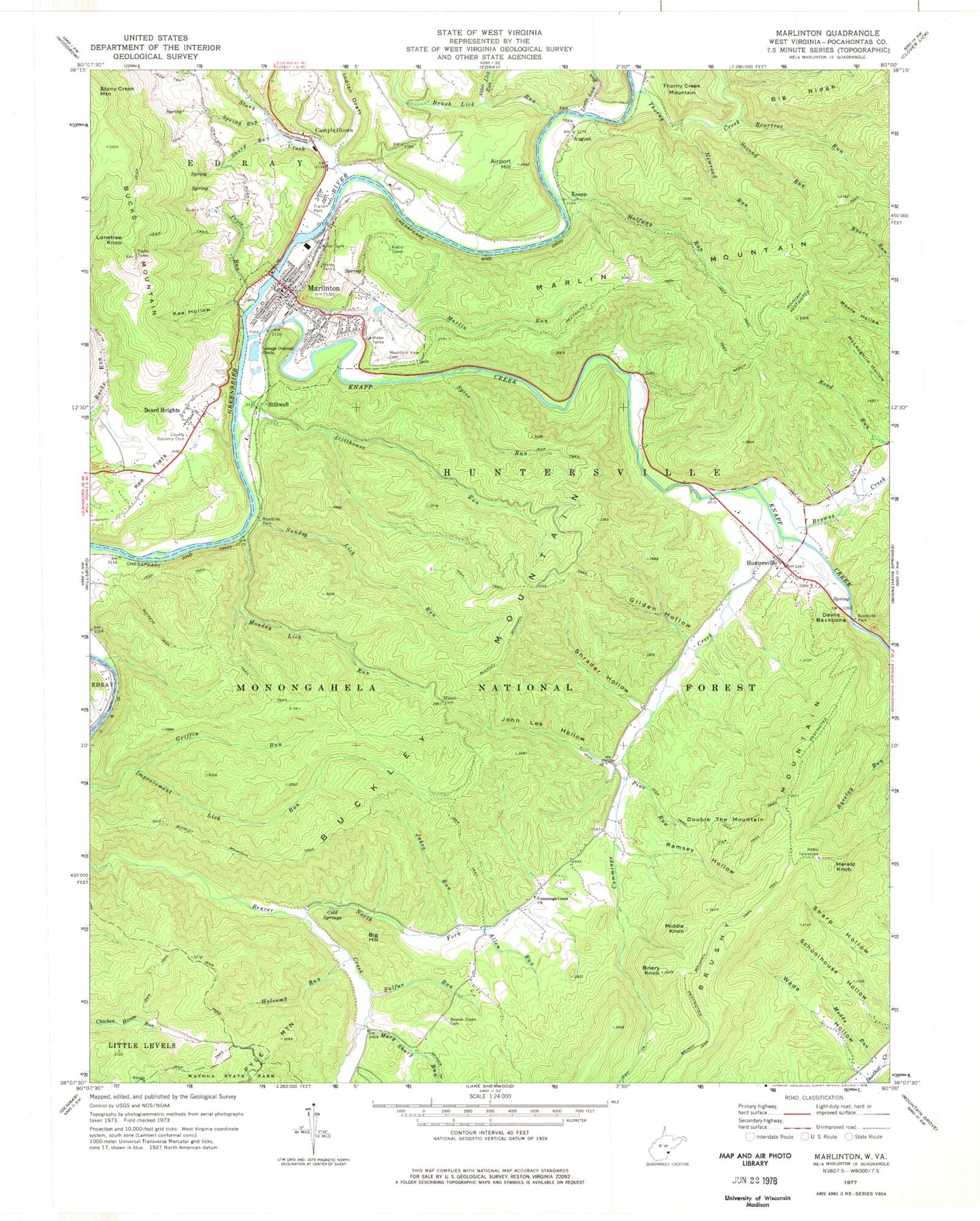
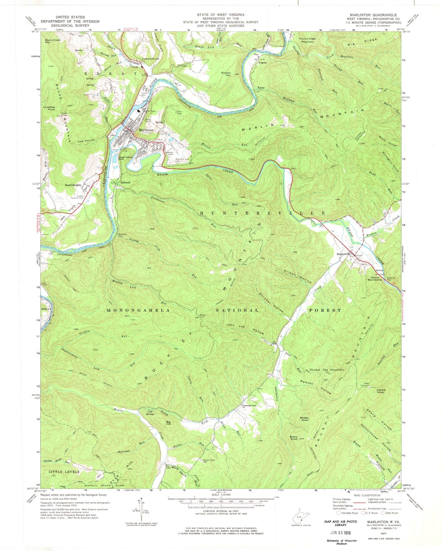
Classic USGS Marlinton West Virginia 7.5'x7.5' Topo Map
Couldn't load pickup availability
Historical USGS topographic quad map of Marlinton in the state of West Virginia. Typical map scale is 1:24,000, but may vary for certain years, if available. Print size: 24" x 27"
This quadrangle is in the following counties: Pocahontas.
The map contains contour lines, roads, rivers, towns, and lakes. Printed on high-quality waterproof paper with UV fade-resistant inks, and shipped rolled.
Contains the following named places: Indian Draft, Airport Hill, Alder Lick Run, Allen Run, August, Beartree Run, Beaver Creek Cemetery, Big Ridge, Bridger Mountain, Briery Knob, Browns Creek, Brush Lick Run, Buckeye Trail, Buckley Mountain Trail, Cold Springs, Cummings Creek, Cummings Creek Church, Devils Backbone, Gilden Hollow, Griffin Run, Halfway Run, Holcomb Run, Huntersville, Jakes Run, John Lee Hollow, Kee Flats, Kee Hollow, Knapp, Knapp Creek, Lewis Lick Run, Marlin Mountain Trail, Marlin Run, Marlinton, Mary Sharp Run, Messir Cemetery, Monday Lick Run, Mountain View Cemetery, Muddy Run, Newroad Run, North Fork Beaver Creek, Pine Run, Price Run, Ramsey Hollow, Second Run, Sharp Run, Shrader Hollow, Spice Run, Spring Run, Stillhouse Run, Stillwell, Stony Creek, Sulfur Run, Sunday Lick Run, Thorny Creek, Wade Hollow, Marlinton District Ranger Station, Beard Heights, Big Hill, Brushy Mountain, Buckley Mountain, Bucks Mountain, Campbelltown, Double the Mountain, Herald Knob, Lonetree Knob, Marlin Mountain, Middle Knob, Adam Moore Chalybeate Spring, Cold Spring, Curry Neil Spring, Fred Moore Spring, Sharp Spring, Marlin Run Structure One Dam, Buck Run School (historical), Cummins Creek School (historical), First Baptist Church, Fort Greenbrier (historical), Green Hill School (historical), Huntersville Presbyterian Church, Huntersville United Methodist Church, Jericho Flat, Marlinton Elementary School, Marlinton Post Office, Marlinton Presbyterian Church, Marlinton United Methodist Church, Pocahontas County Courthouse, Pocahontas County Jail, Pocahontas Memorial Hospital, Saint Johns Episcopal Church, Marlinton Middle School, Town of Marlinton, Marlinton Volunteer Fire Department, West Virginia Division of Forestry Pocahontas County Field Office, Marlinton Rescue Squad, Huntersville Census Designated Place, Pocahontas Country Club Golf Course, Marlinton City Bridge, Trooper Doug W. Bland Memorial Bridge, McClintic Public Library, West Virginia State Police Troop 3 - Marlinton Detachment, Pocahontas County Sheriff's Office, Marlinton Police Department