MyTopo
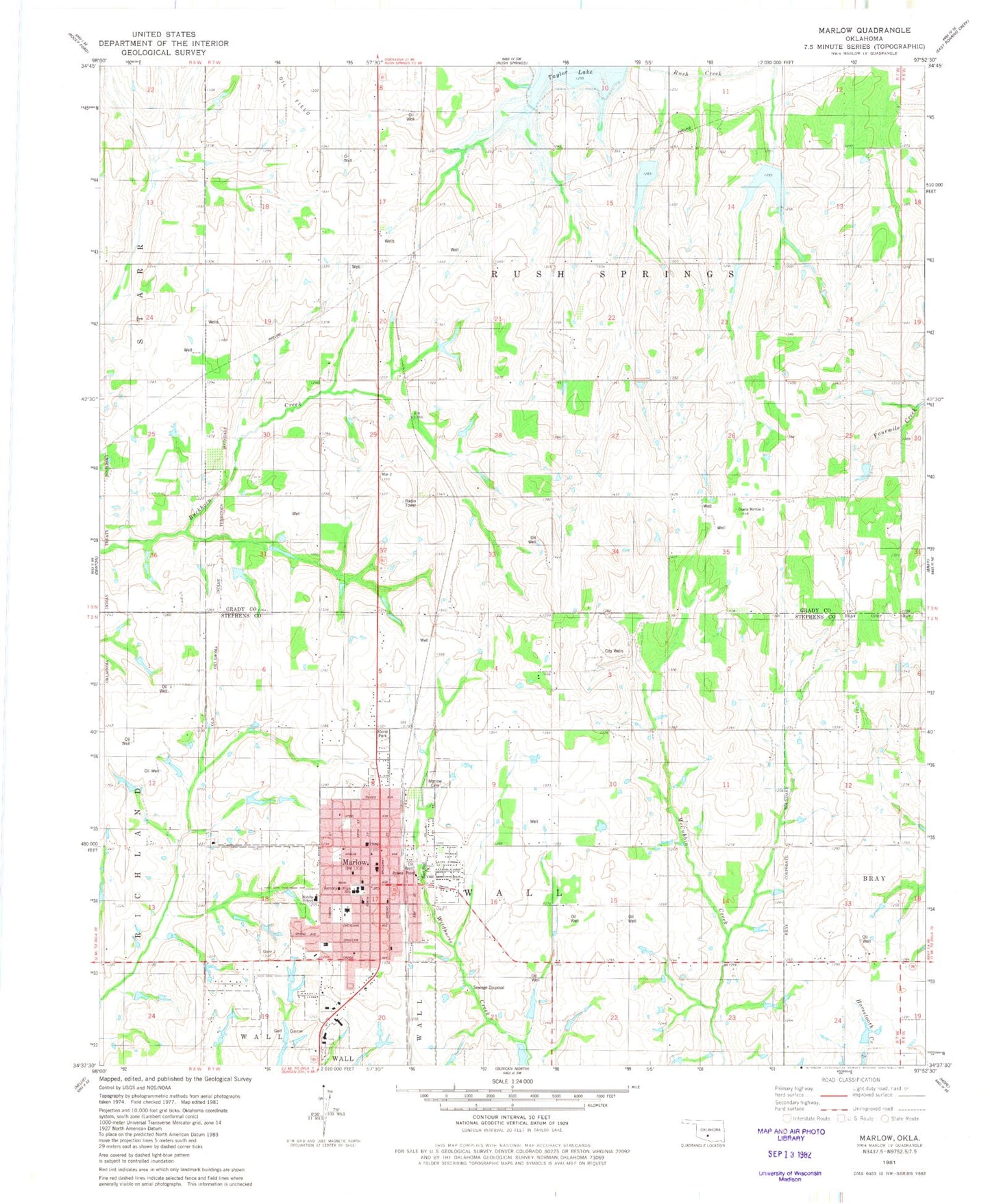
Classic USGS Marlow Oklahoma 7.5'x7.5' Topo Map
Couldn't load pickup availability
Historical USGS topographic quad map of Marlow in the state of Oklahoma. Map scale may vary for some years, but is generally around 1:24,000. Print size is approximately 24" x 27"
This quadrangle is in the following counties: Grady, Stephens.
The map contains contour lines, roads, rivers, towns, and lakes. Printed on high-quality waterproof paper with UV fade-resistant inks, and shipped rolled.
Contains the following named places: American Medical Response Marlow, Christian Church, City of Marlow, Double H Ranch Airport, East Side Baptist Church, First Assembly of God Church, First Baptist Church of Marlow, Lemons Airstrip, Marlow, Marlow Cemetery, Marlow City Police Department, Marlow Elementary School, Marlow Fire Department, Marlow High School, Marlow Middle School, Marlow Post Office, Oknoname 137043 Dam, Oknoname 137043 Reservoir, Red Bud Park, Rush Creek Site 1 Dam, Rush Creek Site 1 Reservoir, Rush Creek Site 101 Dam, Rush Creek Site 101 Reservoir, Rush Creek Site 103 Dam, Rush Creek Site 103 Reservoir, Rush Creek Site 105 Dam, Rush Creek Site 105 Reservoir, Rush Creek Site 2 Dam, Rush Creek Site 2 Reservoir, Rush Creek Site 4 Dam, Rush Creek Site 4 Reservoir, Stone Park, Stover School, Trail School, ZIP Code: 73055