MyTopo
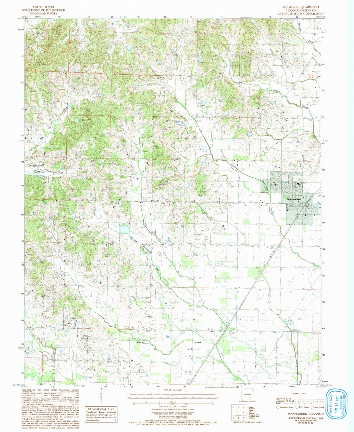
Classic USGS Marmaduke Arkansas 7.5'x7.5' Topo Map
Couldn't load pickup availability
Historical USGS topographic quad map of Marmaduke in the state of Arkansas. Map scale may vary for some years, but is generally around 1:24,000. Print size is approximately 24" x 27"
This quadrangle is in the following counties: Greene.
The map contains contour lines, roads, rivers, towns, and lakes. Printed on high-quality waterproof paper with UV fade-resistant inks, and shipped rolled.
Contains the following named places: City of Marmaduke, Coopers School, Cudd Cemetery, Culver Creek, Dickeys Lake, Dickeys Lake Dam, Friendship School, Hartsoe Cemetery, Harvey's Chapel Cemetery, Harveys Chapel United Methodist Church, Hickory Grove School, Hurricane United Methodist Church, Marmaduke, Marmaduke Elementary School, Marmaduke High School, Marmaduke Police Department, Marmaduke Post Office, New Friendship Baptist Church, New Friendship Cemetery, New Home Missionary Baptist Church, Newberry School, Northeast Greene County Fire Dist - Fire Station, Nutts Chapel Baptist Church, Old Friendship Church, Old Liberty Cemetery, Old Liberty Church, Paris, Providence Baptist Church, Providence Cemetery, Ramer School, Ramers Chapel United Methodist Church, Toddsville School, Toelken Cemetery, Township of Friendship, Township of Hopewell, Township of Hurricane, Union Church, Union Grove Church, Upper Lake School, Woods School, Wright Cemetery, ZIP Codes: 72436, 72443