MyTopo
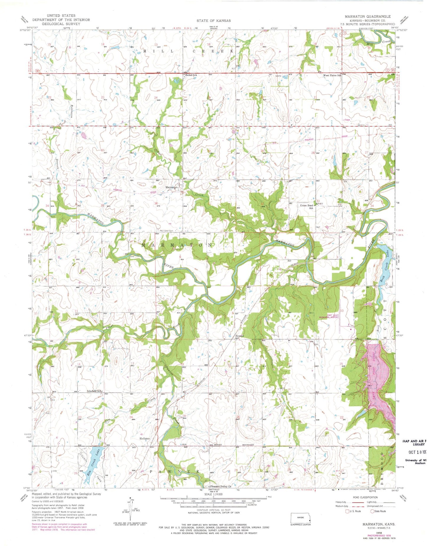
Classic USGS Marmaton Kansas 7.5'x7.5' Topo Map
Couldn't load pickup availability
Historical USGS topographic quad map of Marmaton in the state of Kansas. Map scale may vary for some years, but is generally around 1:24,000. Print size is approximately 24" x 27"
This quadrangle is in the following counties: Bourbon.
The map contains contour lines, roads, rivers, towns, and lakes. Printed on high-quality waterproof paper with UV fade-resistant inks, and shipped rolled.
Contains the following named places: Bethal Community Church, Bethel School, Bourbon County, Bourbon County Dam, Cedar Creek, Chambers Branch, Elm Creek, Elm Creek Lake, Elm Creek Lake County Park, Fort Scott Municipal Airport, Fort Scott Municipal Dam, Gilfillan, Harmony School, Hollister, Hollister Wildlife Area, Jubilee School, Lake Fort Scott, Marmaton, Marmaton Cemetery, Ozark School, Paint Creek, Pawnee Creek, Pleasant Valley Cemetery, Pleasant Valley Church, Robinson Branch, Rock Creek, Rock Creek Lake, Rock Creek Lake Dam, Ronald, Schofield School, Township of Marmaton, Union Bend School, West Plains School, ZIP Code: 66701