MyTopo
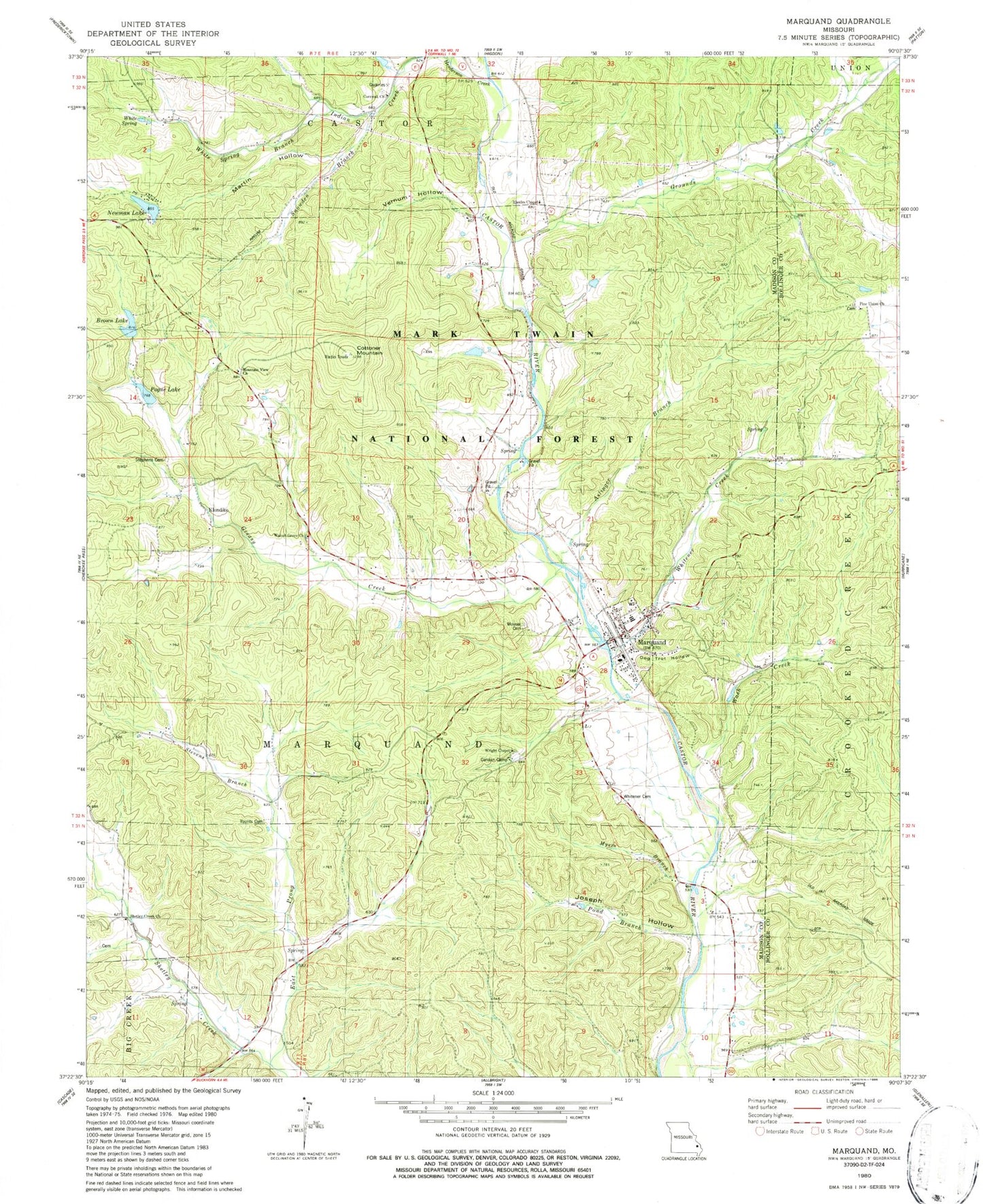
Classic USGS Marquand Missouri 7.5'x7.5' Topo Map
Couldn't load pickup availability
Historical USGS topographic quad map of Marquand in the state of Missouri. Map scale may vary for some years, but is generally around 1:24,000. Print size is approximately 24" x 27"
This quadrangle is in the following counties: Bollinger, Madison.
The map contains contour lines, roads, rivers, towns, and lakes. Printed on high-quality waterproof paper with UV fade-resistant inks, and shipped rolled.
Contains the following named places: Aslinger Branch, Big Four School, Brown Lake, Canaan Camp, City of Marquand, Cornwall Church, Cottoner Mountain, Cozean Mine, Dog Trot Hollow, East Prong Shetley Creek, Greasy Creek, Greasy Creek School, Grounds Creek, Henderson Creek, Indian Creek, Joseph Hollow, Klendike, Leaky Lake, Marquand, Marquand Post Office, Marquand Volunteer Fire Department, Martin Hollow, Mountain View Church, Mouser Cemetery, Mouser School, Myers Branch, Neville Dam, Newman Lake, Newman Lake Dam, Pine Union Church, Pine Union School, Pogue Lake, Pogue Lake Dam, Pond Branch, Rhodes Chapel, Shetley Creek Church, Shetley Creek School, Smittys Catfish Pond Dam, Snowden Branch, Snowdenville School, Starkey Mine, Stephens Cemetery, Stevens Branch, Tiptop School, Township of Marquand, Vernum Hollow, Walnut Grove Church, Wash Creek, White Spring, White Spring Branch, Whitener Cemetery, Whitener Creek, Whiteners Creek, Wright Chapel, Younts Cemetery, ZIP Code: 63655