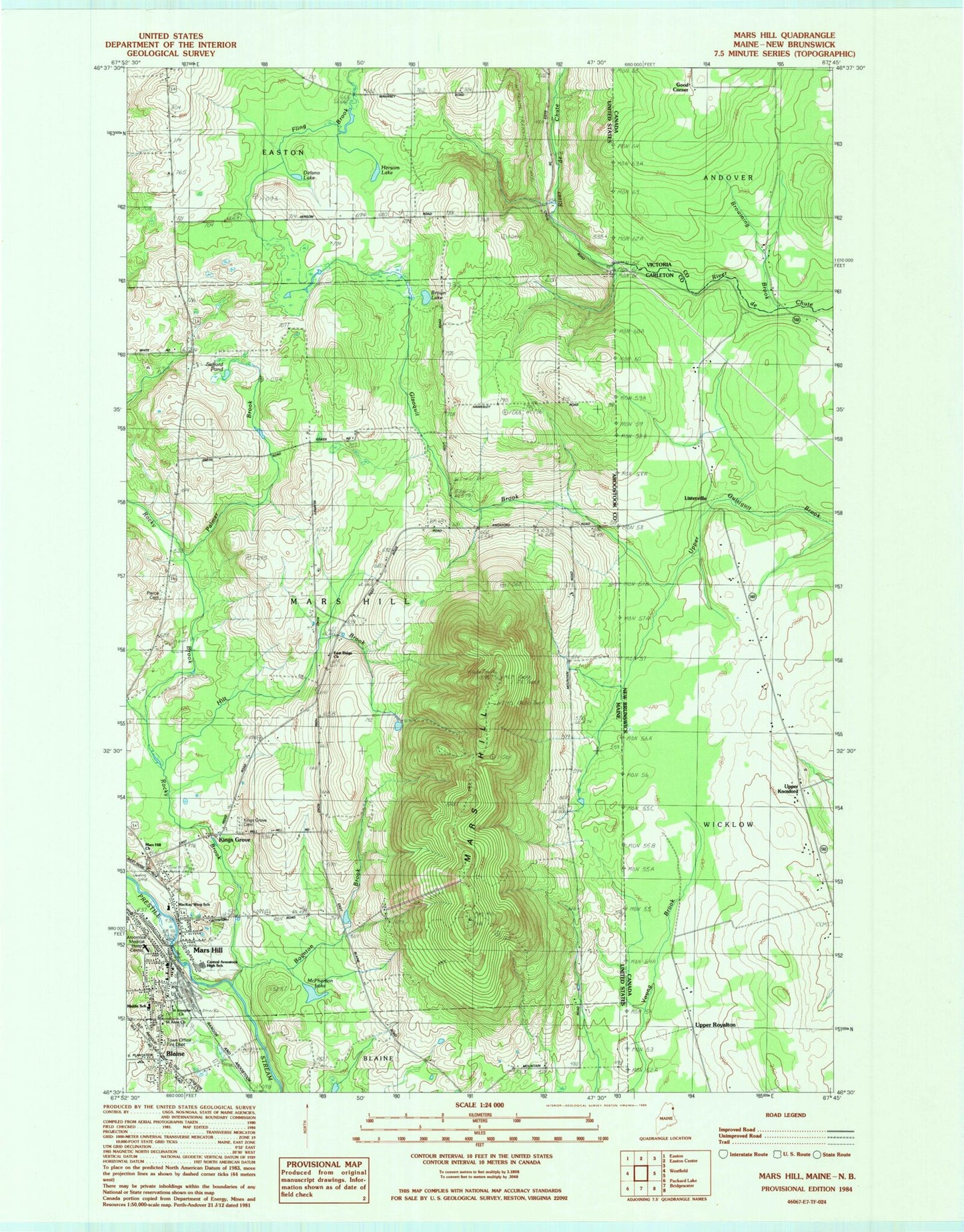
MyTopo
Classic USGS Mars Hill Maine 7.5'x7.5' Topo Map
Couldn't load pickup availability
Historical USGS topographic quad map of Mars Hill in the state of Maine. Map scale may vary for some years, but is generally around 1:24,000. Print size is approximately 24" x 27"
This quadrangle is in the following counties: Aroostook.
The map contains contour lines, roads, rivers, towns, and lakes. Printed on high-quality waterproof paper with UV fade-resistant inks, and shipped rolled.
Contains the following named places: Aroostook Medical Hospital Center, Blaine, Blaine Free Baptist Church, Blaine Post Office, Boynton Brook, Brown Lake, Central Aroostook Junior / Senior High School, Delano Lake, East Ridge Church, Fort Street Elementary School, Hersom Lake, Hilt Brook, Kings Grove, Kings Grove Cemetery, Mars Hill, Mars Hill Airport, Mars Hill Census Designated Place, Mars Hill Church, Mars Hill Dam, Mars Hill Fire Department, Mars Hill Pond, Mars Hill Post Office, Mars Hill-Blaine Census Designated Place, McPherson Lake, Palmer Brook, Pierce Cemetery, Riviere des Chutes Church, Rocky Brook, Safford Pond, Saint Anns Church, Saint Josephs Church, Town of Mars Hill, Walter T A Hansen Memorial Library, WBPW-FM (Presque Isle), WMEM-FM (Presque Isle), WMEM-TV (Presque Isle), WOZI-FM (Presque Isle), ZIP Code: 04758