MyTopo
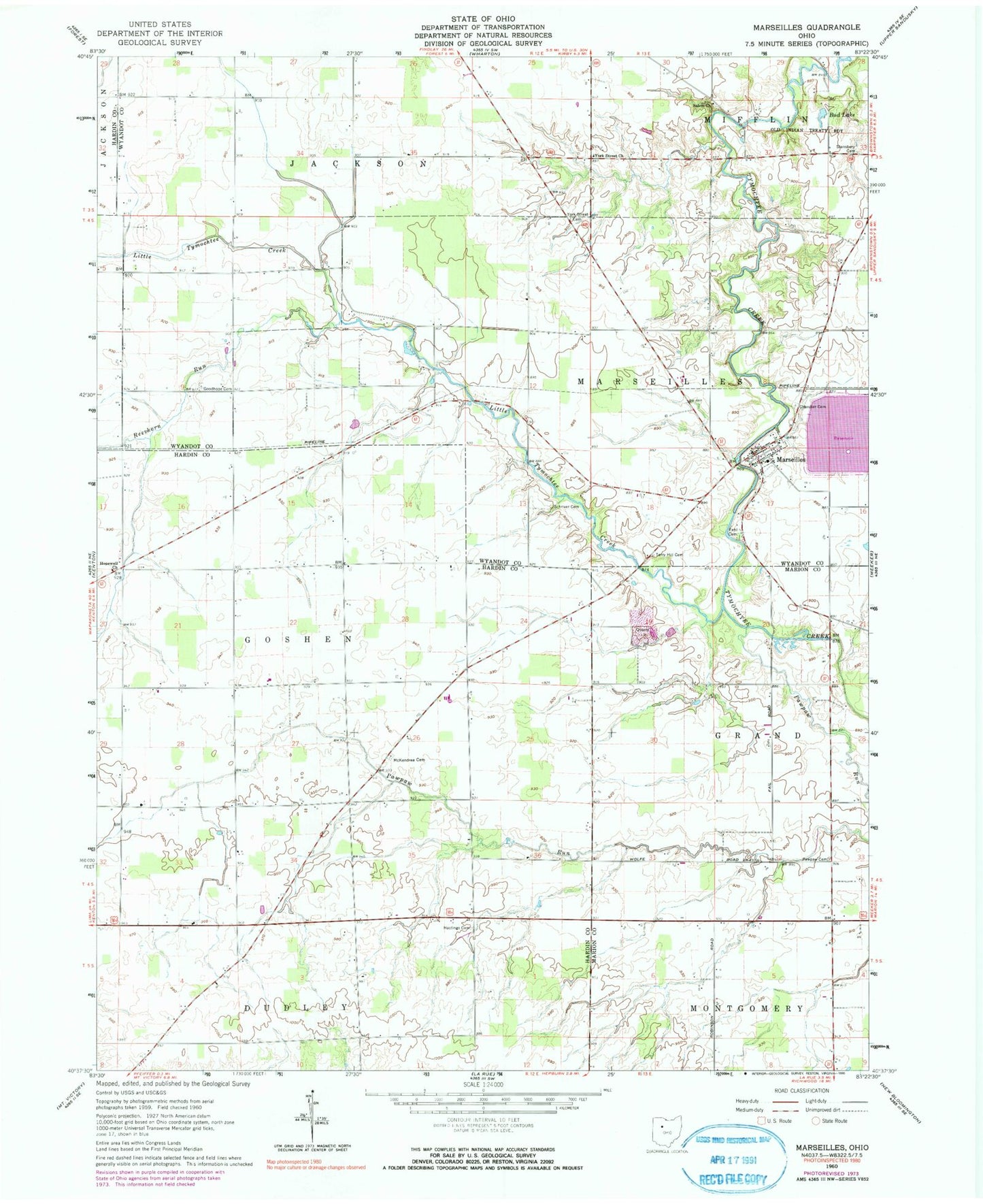
Classic USGS Marseilles Ohio 7.5'x7.5' Topo Map
Couldn't load pickup availability
Historical USGS topographic quad map of Marseilles in the state of Ohio. Map scale may vary for some years, but is generally around 1:24,000. Print size is approximately 24" x 27"
This quadrangle is in the following counties: Hardin, Marion, Wyandot.
The map contains contour lines, roads, rivers, towns, and lakes. Printed on high-quality waterproof paper with UV fade-resistant inks, and shipped rolled.
Contains the following named places: Bradley Cemetery, Bryant School, Bud Lake, Chandler Cemetery, Coo School, Corey Dairy, Fehl Cemetery, Georgetown School, Goodhope Cemetery, Hastings Cemetery, Heckathorn School, Heilman Airport, Hopewell Church, Killdeer Upground Reservoir, Killdeer Upground Reservoir Dam, Little Sandusky Post Office, Little Tymochtee Creek, Mapletop School, Marseilles, Marseilles Elementary School, Marseilles Post Office, Marseilles United Methodist Church, Marseilles Volunteer Fire Department, McKendree Cemetery, McWiggin School, Noyes School, Oak Grove School, Paw Paw Freewill Baptist Church, Pawpaw Cemetery, Pawpaw Run, Pawpaw School, Pfeiffer School, Pisgah School, Reevhorn Run, Ridgeway School, Salem Cemetery, Salem Church, Salem School, Schriver Cemetery, Shanks Cemetery, Stansbery Cemetery, Terry Hill Cemetery, Thomas Cemetery, Township of Goshen, Township of Marseilles, Tri-County Quarry, Tymochtee School, Van Dongen Dairy, Village of Marseilles, Ward School, York Street Cemetery, York Street Church, York Street School