
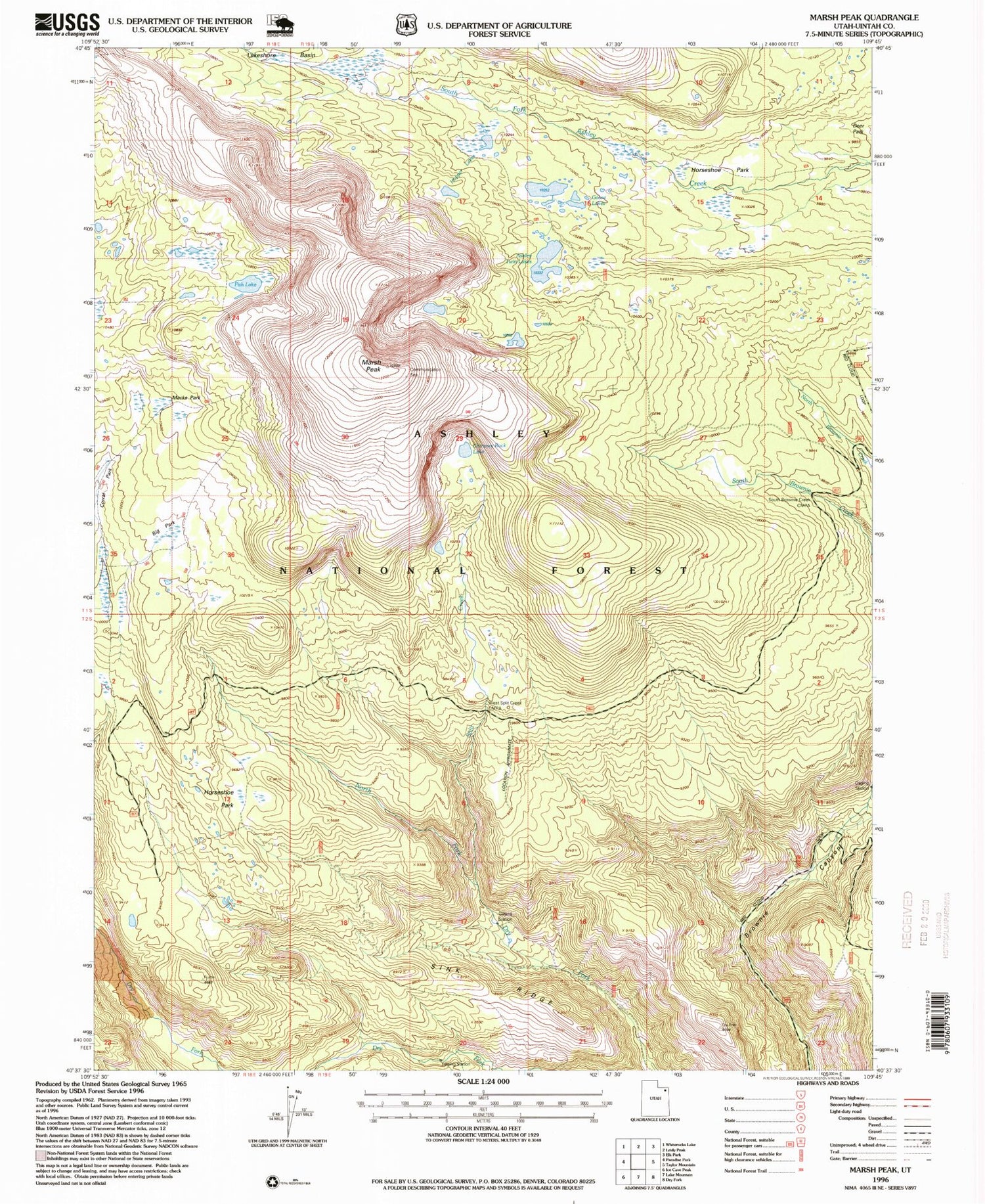
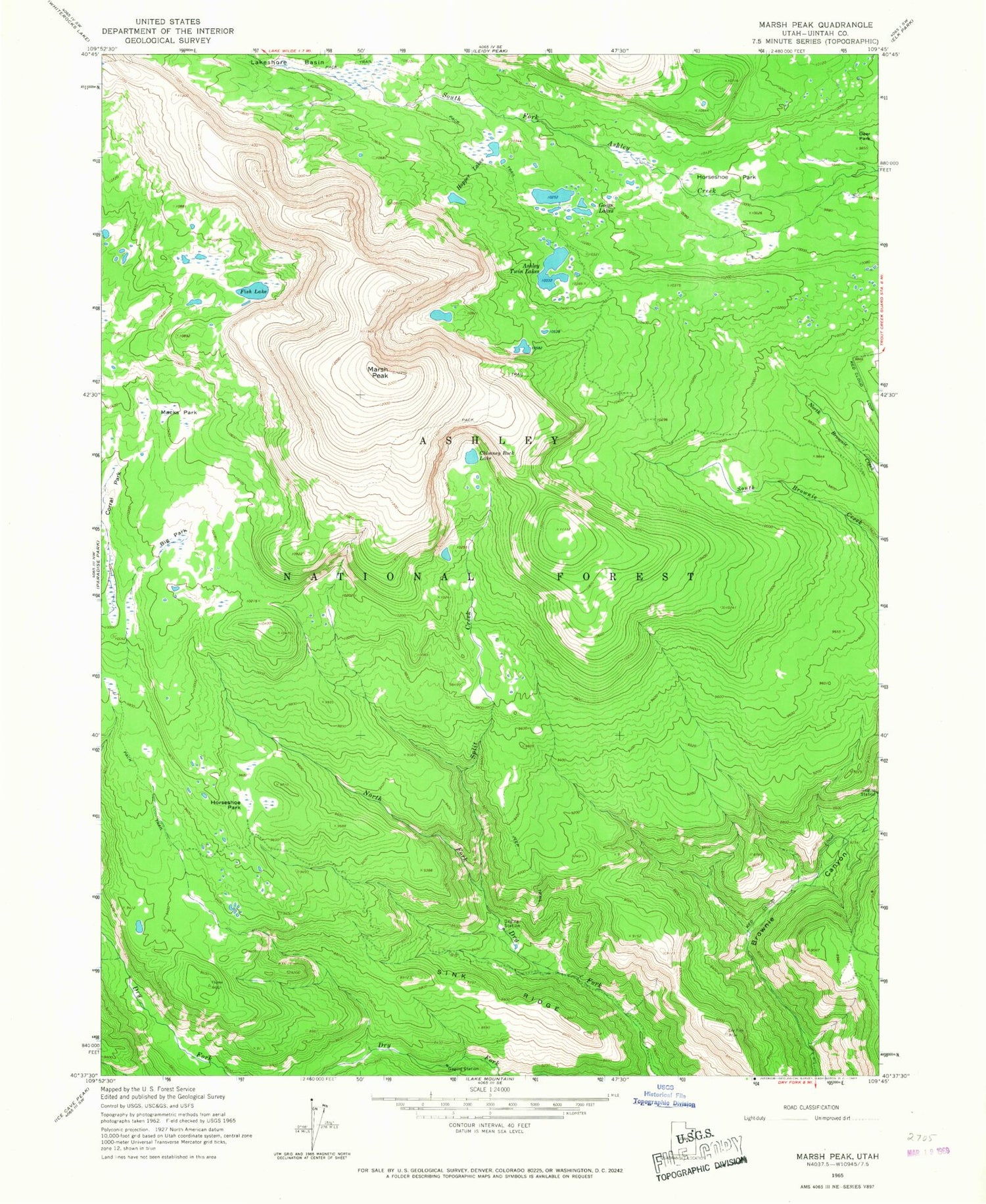
MyTopo
Classic USGS Marsh Peak Utah 7.5'x7.5' Topo Map
Regular price
$16.95
Regular price
Sale price
$16.95
Unit price
per
Couldn't load pickup availability
Historical USGS topographic quad map of Marsh Peak in the state of Utah. Typical map scale is 1:24,000, but may vary for certain years, if available. Print size: 24" x 27"
This quadrangle is in the following counties: Uintah.
The map contains contour lines, roads, rivers, towns, and lakes. Printed on high-quality waterproof paper with UV fade-resistant inks, and shipped rolled.
Contains the following named places: Big Park, Chimney Rock Lake, Corral Park, Fish Lake, Goose Lakes, Hopper Lakes, Horseshoe Park, Horseshoe Park, Macks Park, Marsh Peak, Sink Ridge, Split Creek, Ashley Twin Lakes, Ashley Twin Lakes Dam, Lower Goose Lake, Lower Goose Lake Dam, Upper Goose Lake, Upper Goose Lake Dam, Green Spring


