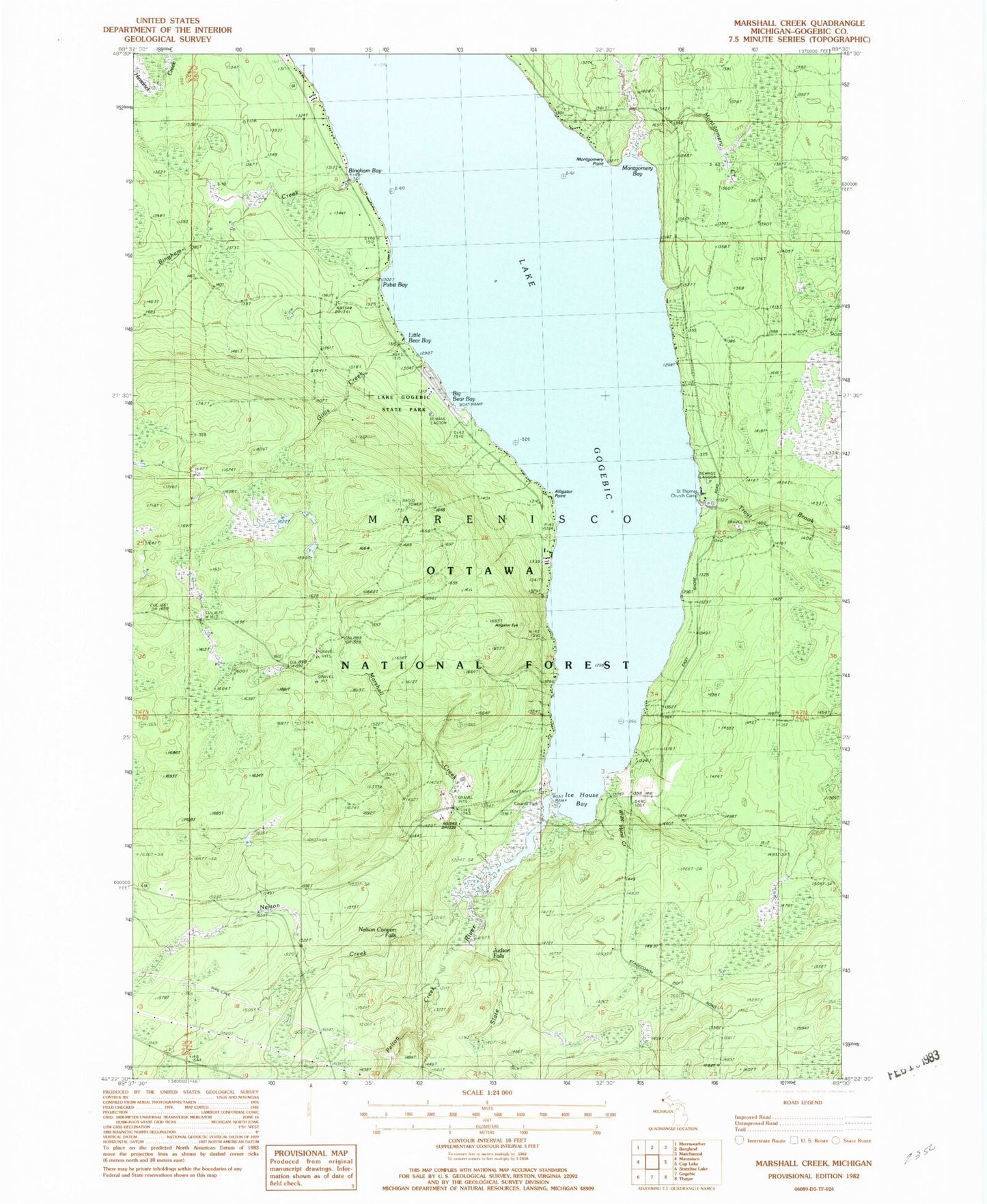
MyTopo
Classic USGS Marshall Creek Michigan 7.5'x7.5' Topo Map
Couldn't load pickup availability
Historical USGS topographic quad map of Marshall Creek in the state of Michigan. Map scale may vary for some years, but is generally around 1:24,000. Print size is approximately 24" x 27"
This quadrangle is in the following counties: Gogebic.
The map contains contour lines, roads, rivers, towns, and lakes. Printed on high-quality waterproof paper with UV fade-resistant inks, and shipped rolled.
Contains the following named places: Alligator Eye, Alligator Eye Trail, Alligator Point, Big Bear Bay, Bingham Bay, Bingham Creek, Gillis Creek, Gogebic County Park, Gogebic Lake State Park, Ice House Bay, Judson Falls, Lake Gogebic Volunteer Fire Department Station 2 - East Shore, Lake Gogebic Volunteer Fire Department Station 2 West Shore, Little Bear Bay, Marshall Creek, Marshall Falls, Montgomery Bay, Montgomery Creek, Montgomery Point, Nelson Canyon Falls, Nelson Creek, Pabst Bay, Pelton River, Saint Thomas Church Camp, Slate River, Township of Marenisco, Trout Brook, White City, White Horse Creek, ZIP Code: 49947