MyTopo
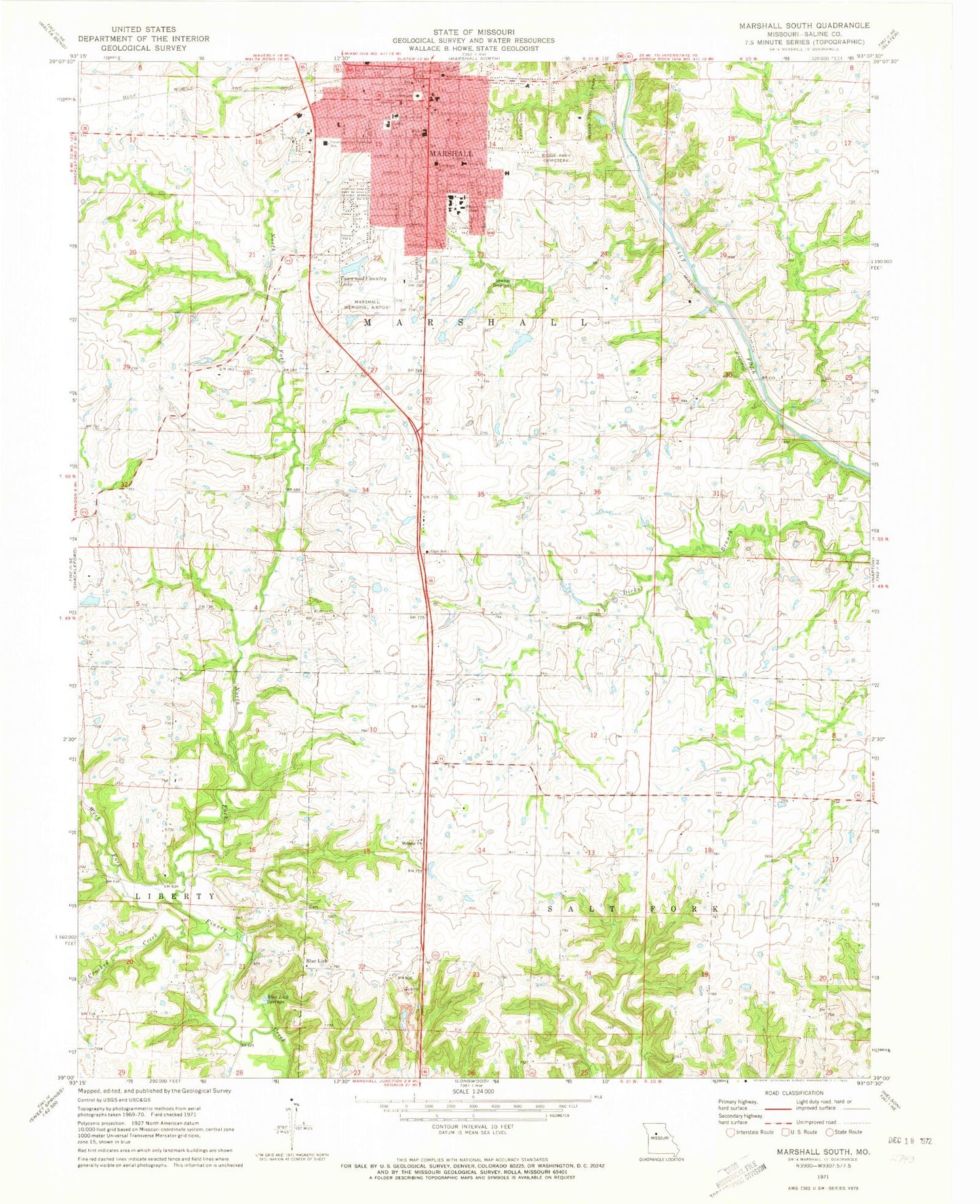
Classic USGS Marshall South Missouri 7.5'x7.5' Topo Map
Couldn't load pickup availability
Historical USGS topographic quad map of Marshall South in the state of Missouri. Map scale may vary for some years, but is generally around 1:24,000. Print size is approximately 24" x 27"
This quadrangle is in the following counties: Saline.
The map contains contour lines, roads, rivers, towns, and lakes. Printed on high-quality waterproof paper with UV fade-resistant inks, and shipped rolled.
Contains the following named places: Benton Elementary School, Blue Lick, Blue Lick School, Blue Lick Springs, Bucksnort School, Bueker Middle School, Calvary Baptist School, City of Marshall, Crooked Creek, Downs School, Eastwood Elementary School, Elgin School, Fairview Cemetery, Fitzgibbon Hospital, Indian Foothills Park, KNOS-FM (Marshall), Marshall, Marshall Fire Department, Marshall High School, Marshall Memorial Municipal Airport, Marshall Police Department, Marshall Post Office, MFA Research Farm Lake, MFA Research Farm Lake Dam, Midway Church, Miles Lake Dam, Missouri Valley College, Mount Airy School, Mount Olive Church, North Fork Finney Creek, Northwest Elementary School, Number 512 Dam, Peterson Lake, Peterson Lake Dam, Plaza Mall, Rasse Lake, Rasse Lake Dam, Ridge Park Cemetery, Saint Peter's Catholic School, Saline County Career Center, Saline County High School, Saline County Sheriff's Office, Shelby School, Southeast Elementary School, Sunset Gardens Cemetery, Thornlea School, Thorp School, Town and Country Lake, Town and Country Lake Dam, Town and Country Mall, Township of Marshall, Township of Salt Fork, Vogel Lake, Vogel Lake Dam, West Fork Finney Creek, ZIP Code: 65340