MyTopo
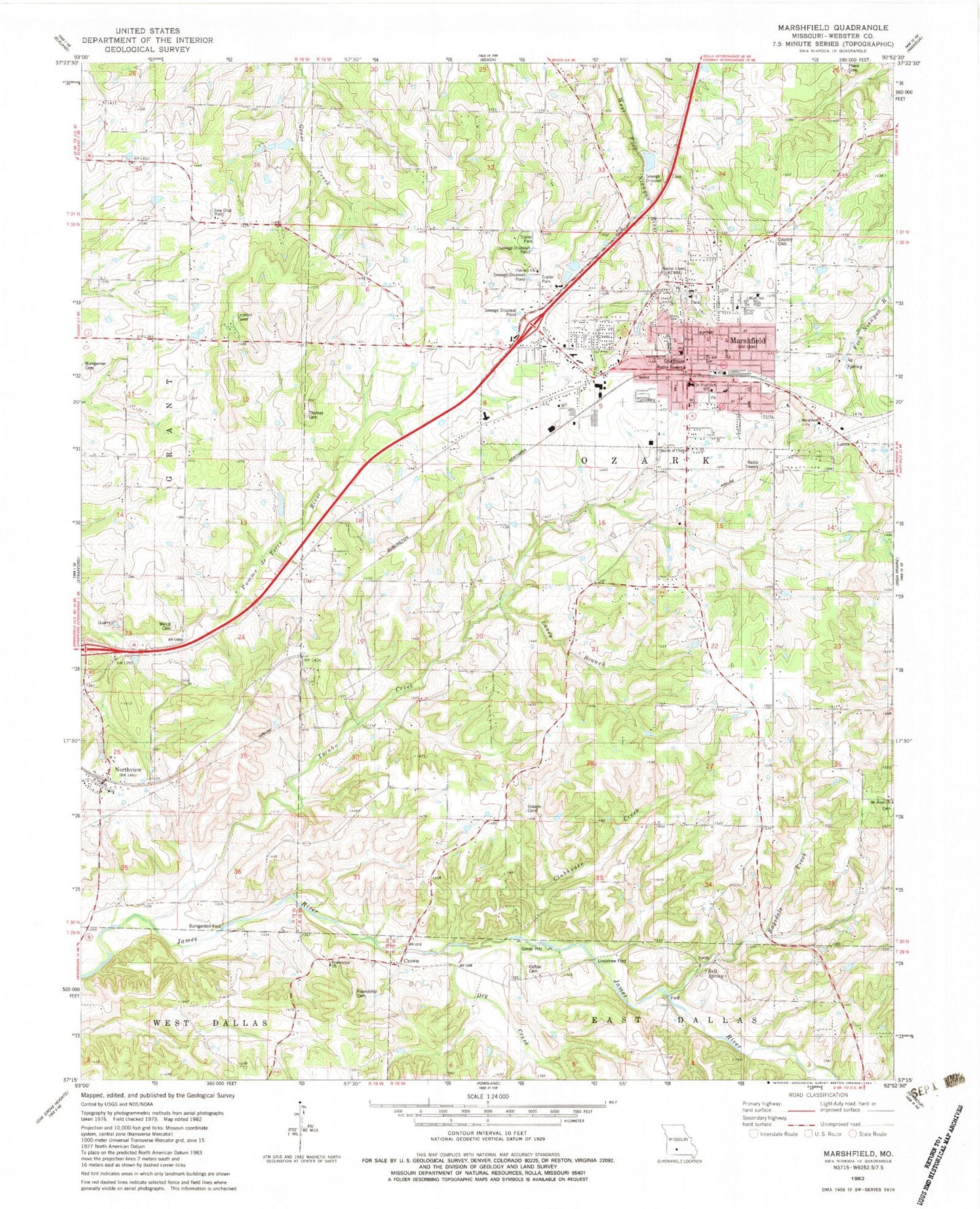
Classic USGS Marshfield Missouri 7.5'x7.5' Topo Map
Couldn't load pickup availability
Historical USGS topographic quad map of Marshfield in the state of Missouri. Map scale may vary for some years, but is generally around 1:24,000. Print size is approximately 24" x 27"
This quadrangle is in the following counties: Webster.
The map contains contour lines, roads, rivers, towns, and lakes. Printed on high-quality waterproof paper with UV fade-resistant inks, and shipped rolled.
Contains the following named places: Anderson School, Bell Spring, Biggs Lower Lake Dam, Bumgarden Ford, Calvary Church, Church of Christ, City of Marshfield, Clifton Cemetery, Clubhouse Creek, Crown, Crown School, Dailey School, Dry Creek, Edwards Chapel, Friendship Cemetery, Friendship Church, Greenwood School, KMRF-AM (Marshfield), Lacey Branch, Lindstrew Ford, Marshfield, Marshfield Cemetery, Marshfield Fire Department Station 1, Marshfield Fire Department Station 3, Marshfield Fire Protection District, Marshfield Police Department, Marshfield Post Office, Marshfield Shopping Center, Marshfield Village Shopping Center, Mount Sinai Cemetery, Mount Sinai Church, Northview, Number 796 Dam, Oak Hill School, Osborn Cemetery, Ragsdale Creek, Saint James School, Shockey School, Thomas Cemetery, Township of Marshfield, Township of Marshfield East, Township of Marshfield West, Township of Northview, Township of Ozark, Township of West Ozark, Turnbo Creek, Webster County, Webster County Sheriff's Office, Welch Cemetery, Welles Church, ZIP Code: 65706