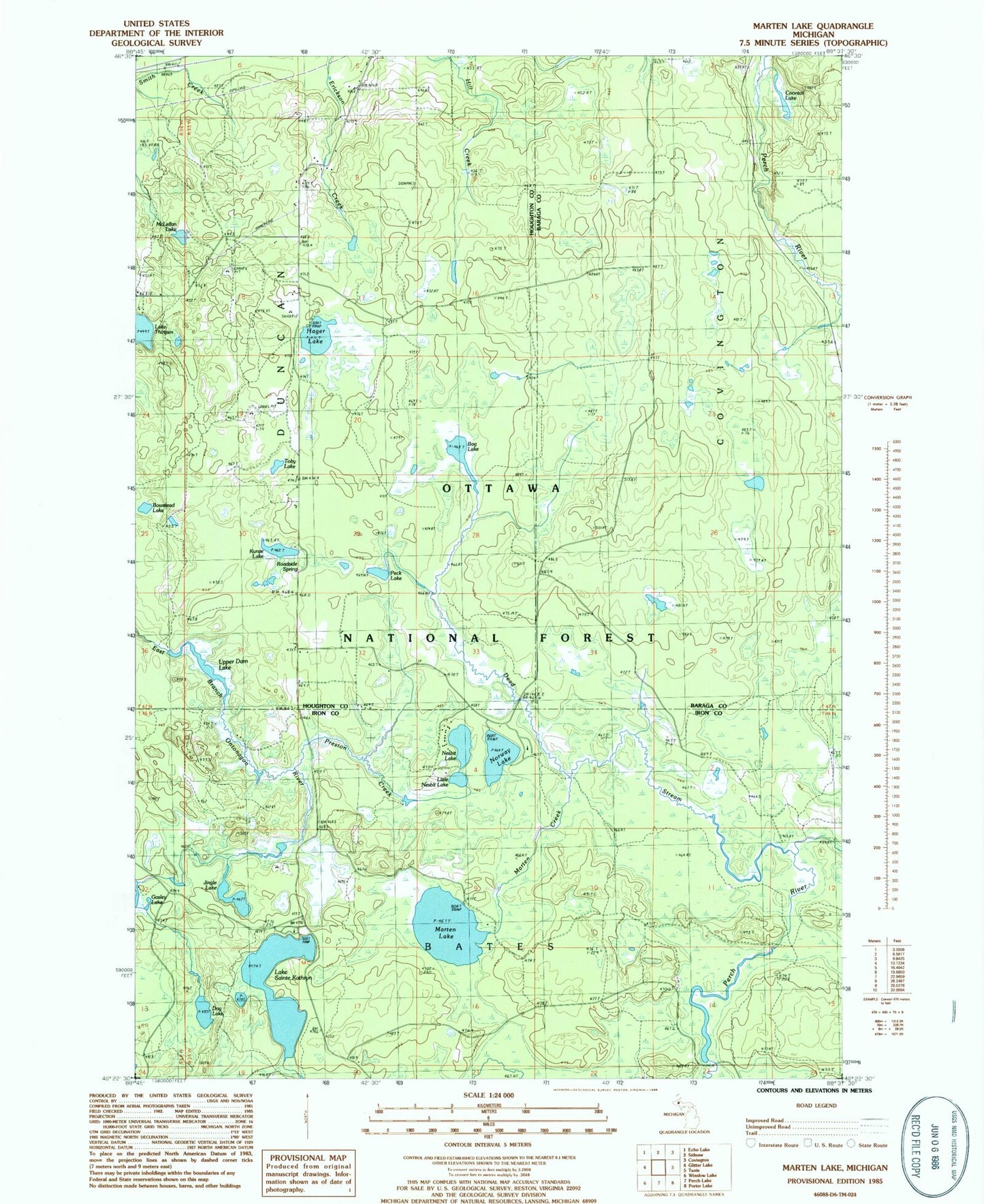
MyTopo
Classic USGS Marten Lake Michigan 7.5'x7.5' Topo Map
Couldn't load pickup availability
Historical USGS topographic quad map of Marten Lake in the state of Michigan. Map scale may vary for some years, but is generally around 1:24,000. Print size is approximately 24" x 27"
This quadrangle is in the following counties: Baraga, Houghton, Iron.
The map contains contour lines, roads, rivers, towns, and lakes. Printed on high-quality waterproof paper with UV fade-resistant inks, and shipped rolled.
Contains the following named places: Bog Lake, Bowstead Lake, Coontail Lake, Dog Lake, Hager Lake, Jingle Lake, Kunze Lake, Lake Sainte Kathryn, Lake Sainte Kathryn Campground, Little Nesbit Lake, Marten Creek, Marten Lake, McLellan Lake, Nesbit Lake, Nesbit Lake Organization Camp, Norway Lake, Norway Lake Campground and Picnic Area, Peck Lake, Preston Creek, Roadside Spring, Sidnaw Lookout Tower, Toby Lake, Upper Dam Lake