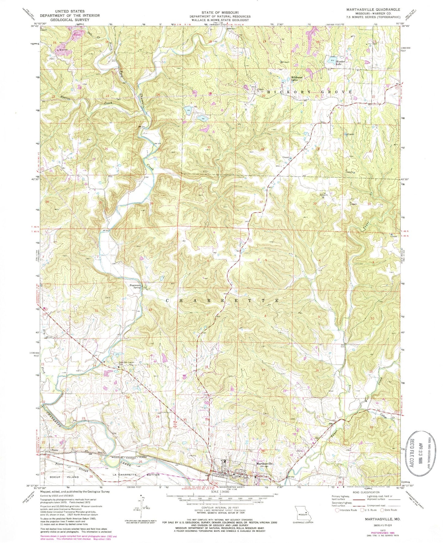
MyTopo
Classic USGS Marthasville Missouri 7.5'x7.5' Topo Map
Couldn't load pickup availability
Historical USGS topographic quad map of Marthasville in the state of Missouri. Typical map scale is 1:24,000, but may vary for certain years, if available. Print size: 24" x 27"
This quadrangle is in the following counties: Warren.
The map contains contour lines, roads, rivers, towns, and lakes. Printed on high-quality waterproof paper with UV fade-resistant inks, and shipped rolled.
Contains the following named places: American Legion Park, Engemann Spring, Hearse Creek, La Charrette Bottom, Marthasville, North Fork Charrette Creek, Owl Creek, Peers, Wildwood Lakes, American Legion Hall, Cave Creek, Grand Canyon, Marthasville Elementary School, Tuque Ridge, Dry Fork, Charrette (historical), Dryer School (historical), Cedar Grove School (historical), Brinkman School (historical), Tuque School (historical), Forest Grove School (historical), Cedar Valley School (historical), College Creek, Wolf Creek, Wonder Lake, Koepke Lake North Dam, Vatterot Dam, Koepke Lake South Dam, Lake of the Woods Dam, Forest Haven Lake Dam, D Bunge Lake Dam, H Bunge Lake Dam, Township of Charrette, City of Marthasville, Marthasville Volunteer Fire Department Station 1, Wright City Fire Protection District Station 2, Marthasville Post Office