MyTopo
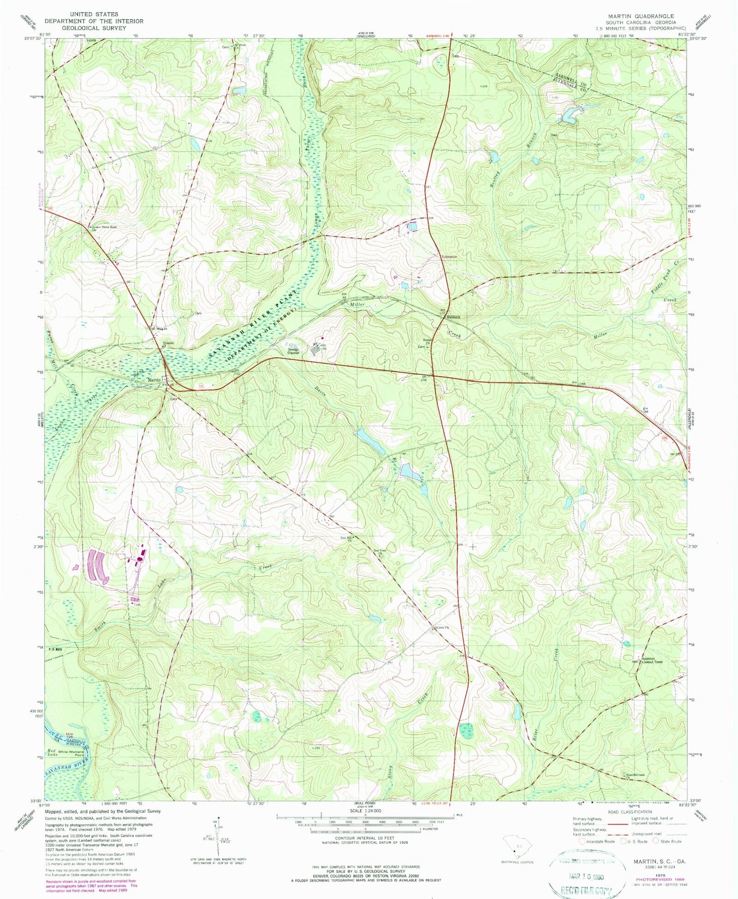
Classic USGS Martin South Carolina 7.5'x7.5' Topo Map
Couldn't load pickup availability
Historical USGS topographic quad map of Martin in the states of South Carolina, Georgia. Map scale may vary for some years, but is generally around 1:24,000. Print size is approximately 24" x 27"
This quadrangle is in the following counties: Allendale, Barnwell, Screven.
The map contains contour lines, roads, rivers, towns, and lakes. Printed on high-quality waterproof paper with UV fade-resistant inks, and shipped rolled.
Contains the following named places: Allendale Division, Allendale Fire Department Station 400, Appleton Lookout Tower, Baldock, Baldock School, Beautiful Gate Church, Bentley Branch, Bentley Branch Church, Bentley Church, Bentleys Church, Beulah Church, Browns Mill, Catawba Pond Number One D-2574 Dam, Cato Mill School, Culbertsons Pond Dam D-2577, Davis Branch, Doe Pond Church, Fiddle Pond Creek, Furse Mill Creek, Gill Crossroads, Gillette Church, Jack Wood School, Jackwood Pond School, Lower Three Runs Church, Martin, Martin Post Office, Martin School, Miller Creek, Mount Hope Church, Mount Sinai Church, Smith Lake Creek, Tabernacle Church, Thankful Church, White Womans Point, Zion Hill Church