MyTopo
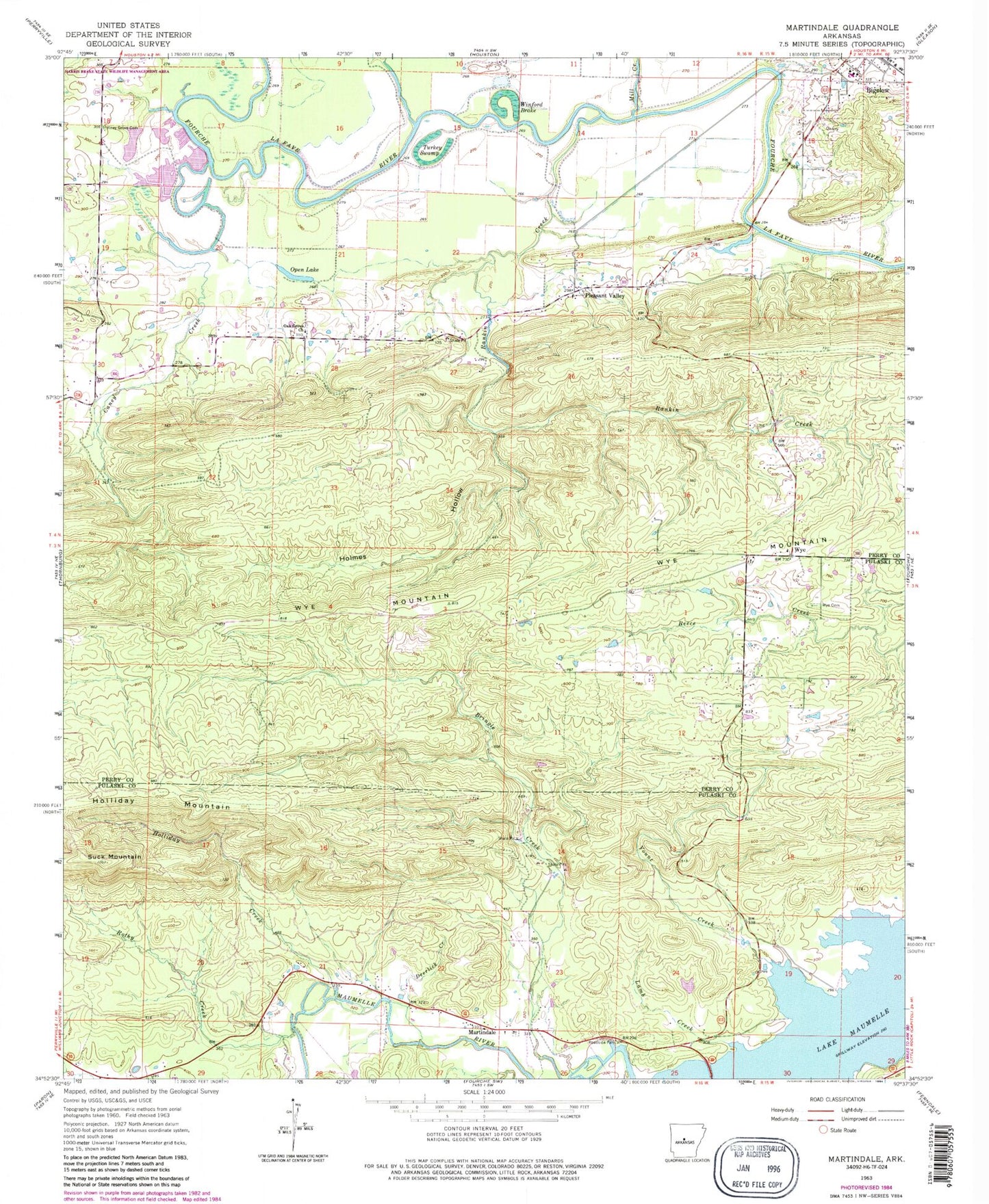
Classic USGS Martindale Arkansas 7.5'x7.5' Topo Map
Couldn't load pickup availability
Historical USGS topographic quad map of Martindale in the state of Arkansas. Map scale may vary for some years, but is generally around 1:24,000. Print size is approximately 24" x 27"
This quadrangle is in the following counties: Perry, Pulaski.
The map contains contour lines, roads, rivers, towns, and lakes. Printed on high-quality waterproof paper with UV fade-resistant inks, and shipped rolled.
Contains the following named places: Bellevue, Bigelow High School, Caney Creek, Crossroads, Deerlick Creek, East End High School, Francis Lake, Francis Lake Dam, Graytown, Highland School, Holliday Creek, Holliday Mountain, Holmes Hollow, Lamb Creek, Long Hollow, Martindale, May Shoals, Mill Creek, Moyer Mountain, Oak Grove, Oak Grove Church, Oak Grove School, Open Lake, Orchard, Pearson Field, Pleasant Valley, Pleasant Valley School, Rankin, Rankin Creek, Rothy Creek, Sleepy Hollow Park, Suck Mountain, Town of Bigelow, Township of Kenney, Township of Maumelle, Township of Rankin, Turkey Swamp, Underwood Store, Van Dalsen Lake, Van Dalsen Lake Dam, Viney Grove Cemetery, Winford Brake, Wolf Hollow, Wye, Wye Cemetery, Wye Mountain, Wye United Methodist Church, Yount Creek, ZIP Code: 72016