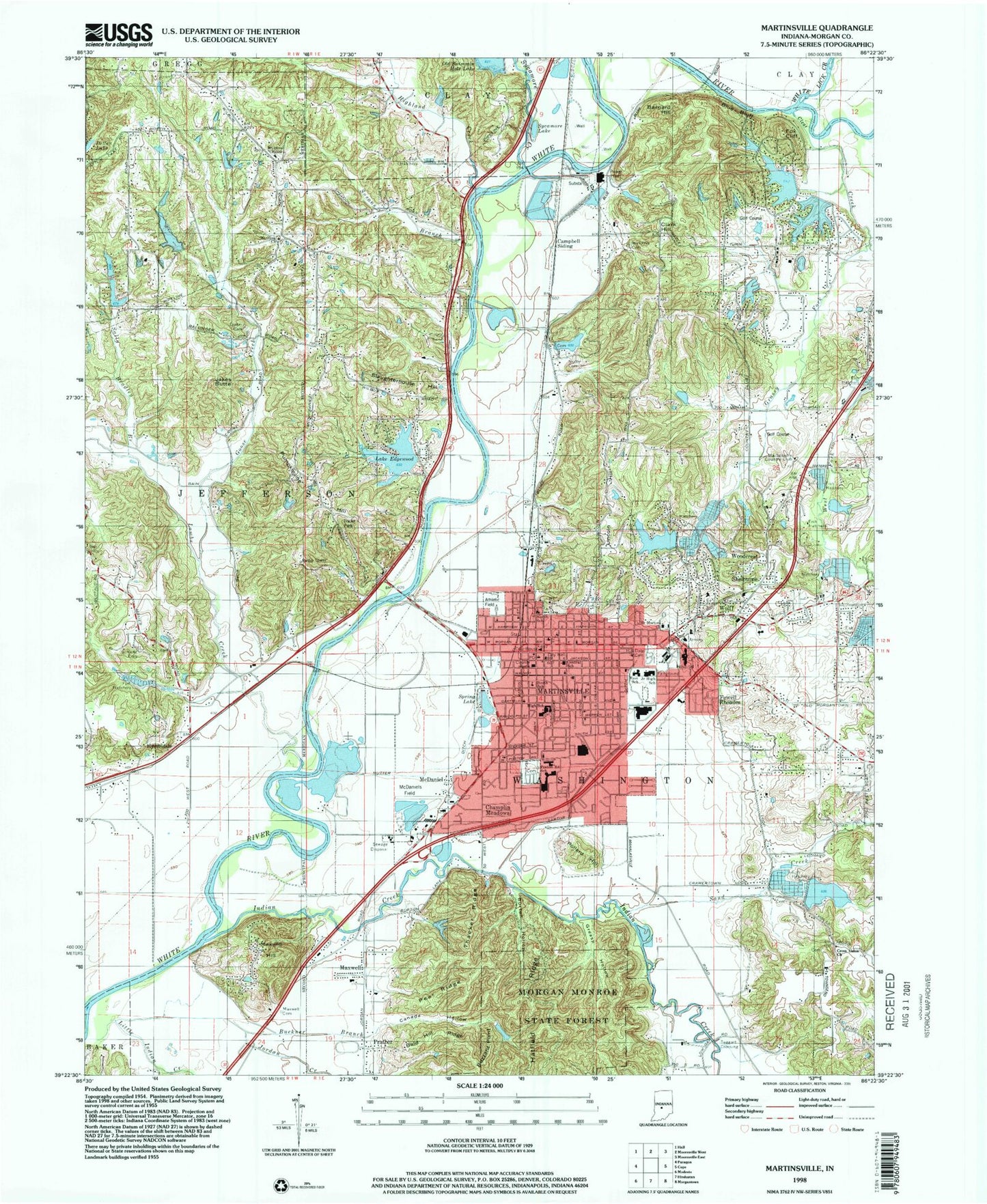
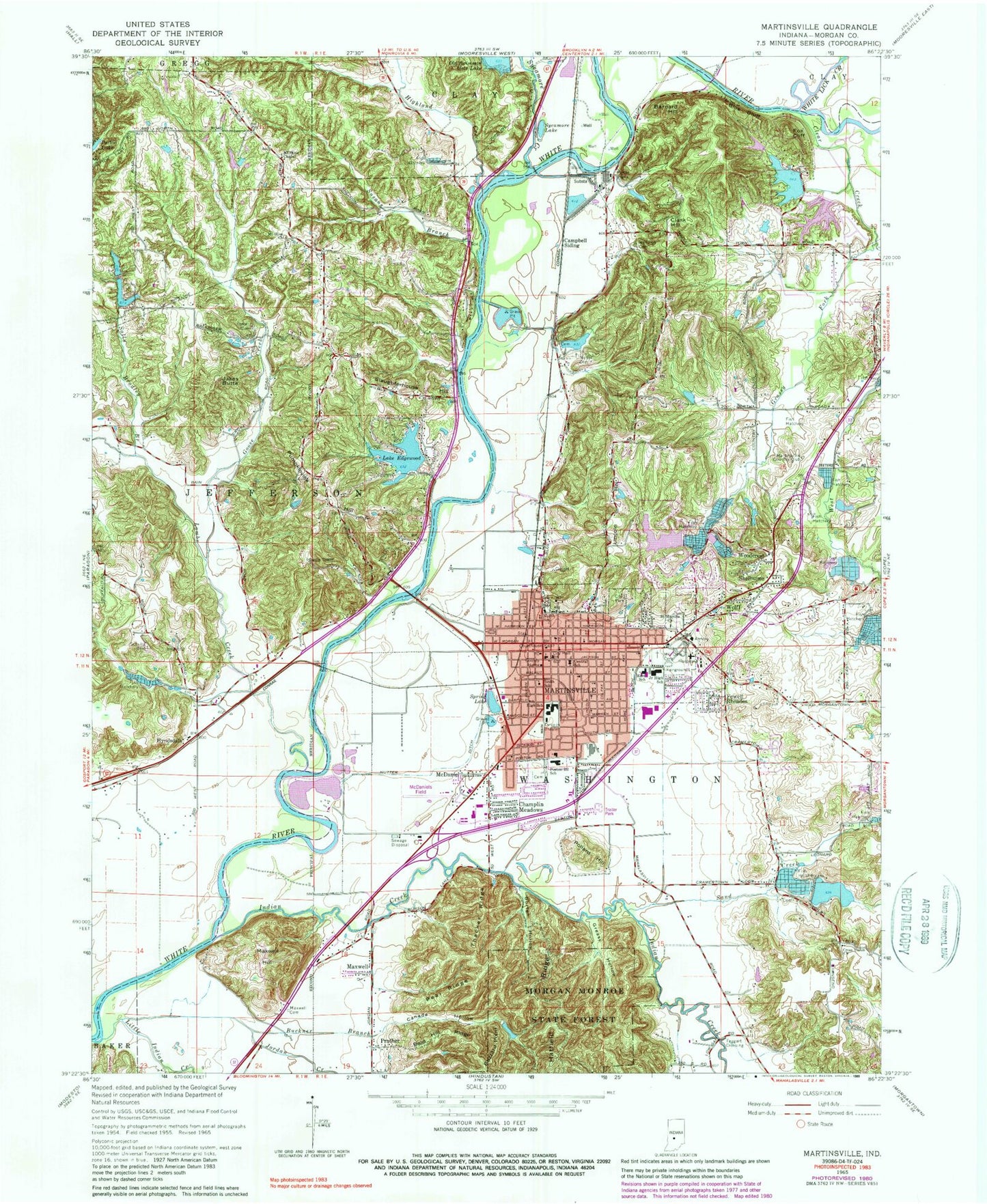
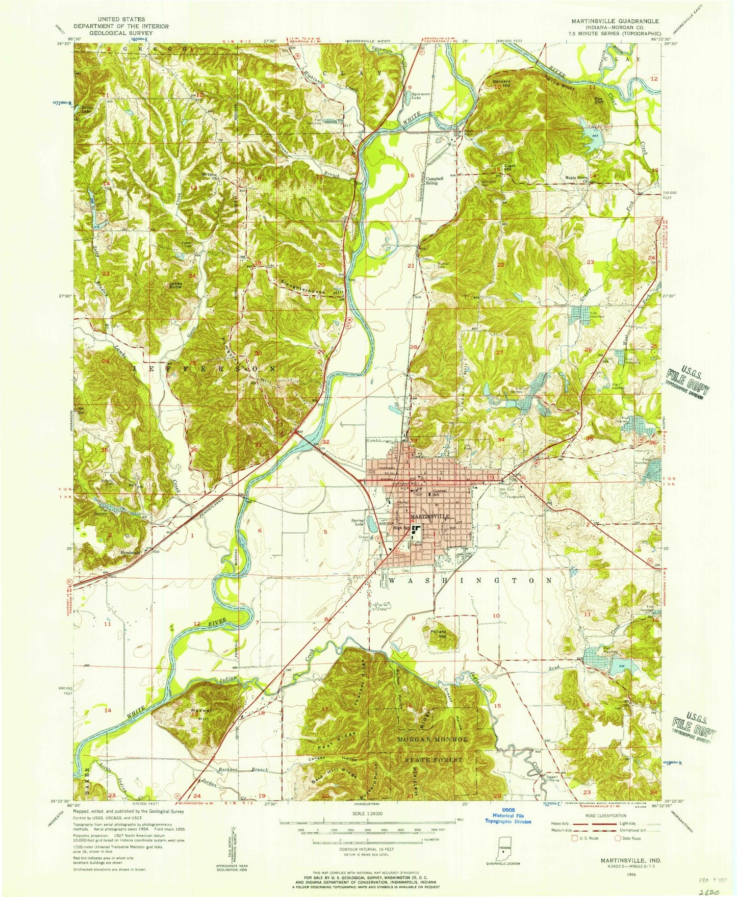
MyTopo
Classic USGS Martinsville Indiana 7.5'x7.5' Topo Map
Couldn't load pickup availability
Historical USGS topographic quad map of Martinsville in the state of Indiana. Map scale may vary for some years, but is generally around 1:24,000. Print size is approximately 24" x 27"
This quadrangle is in the following counties: Morgan.
The map contains contour lines, roads, rivers, towns, and lakes. Printed on high-quality waterproof paper with UV fade-resistant inks, and shipped rolled.
Contains the following named places: Bald Hill Ridge, Barnard Hill, Blue Bluff, Bradford Wood Lake Dam, Buckner Branch, Burton Hollow, Buzzard Point, Campbell Siding, Canada Hollow, Central Elementary School, Champlin Meadows, City of Martinsville, Clark Hill, Clear Creek, Clear Creek Fisheries, Cross Union Church, Dalton Lake, Dalton Lake Dam, Durham Drive Lake, Durham Drive Lake Dam, East School, Elk, Fewell Rhoades, Fish Hatchery Lake, Fish Hatchery Lake Dam, Foster Cemetery, Fox Cliff, Foxcliff Lake, Foxcliff Lake Dam, Frakers Mobile Home Court, Goose Creek, Grassy Fork, Greasy Hollow, Gregg Township Volunteer Fire Department Station 122, Hatfield Ridge, Hick's Mobile Home Park, Highland Creek, Hilldale Cemetery, Hyndsdale, Indian Creek, Indiana University Health Morgan Hospital, Jakes Butte, Jordan Creek, Lahr Lake Dam, Lake Edgewood, Lake Edgewood Dam, Lambs Creek, Laveianan Court, Lincoln Hill, Little Indian Creek, Martinsville, Martinsville Country Club, Martinsville Fire Department, Martinsville Fire Station 14, Martinsville High School, Martinsville Police Department, Martinsville Post Office, Maxwell, Maxwell Cemetery, Maxwell Hill, Mc Daniel's Field, McDaniel, Morgan County, Morgan County Emergency Management, Morgan Monroe State Forest, Mount Olive Chapel, Mount Olive Church, North Elementary School, Nutter Cemetery, Nutter Ditch, Pear Ridge, Pollard Hill, Poston Road Elementary School, Prather, Pumpkinvine Hill, Rural / Metro Ambulance - Martinsville, Saint Martins Church, Sally Bradley Branch, Sand Creek, Sartor Ditch, Shelburne, Shultz Cemetery, Slaughterhouse Hill, Smith Lake, Smith Lake Dam, South School, Spring Lake, Spring Valley Mobile Home Park, Susans Branch, Sycamore Creek, Sycamore Lake, Taggart Crossing, Thacker Ridge, Township of Jefferson, Township of Washington, Vandenbark Lake, Vandenbark Lake Dam, Washington Township Fire Department, Washington Township Fire Department Martinsville, WCBK-FM (Martinsville), West Fork Clear Creek, White Lick Creek, Williams Cemetery, Wolff, Woodcrest, Wooded Hills Mobile Home Park, ZIP Code: 46151