MyTopo
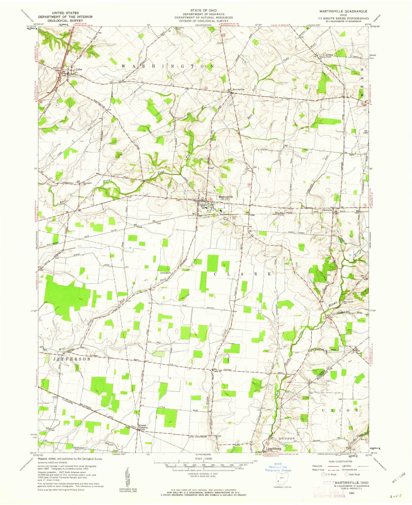
Classic USGS Martinsville Ohio 7.5'x7.5' Topo Map
Couldn't load pickup availability
Historical USGS topographic quad map of Martinsville in the state of Ohio. Map scale may vary for some years, but is generally around 1:24,000. Print size is approximately 24" x 27"
This quadrangle is in the following counties: Clinton, Highland.
The map contains contour lines, roads, rivers, towns, and lakes. Printed on high-quality waterproof paper with UV fade-resistant inks, and shipped rolled.
Contains the following named places: Barnett Airpark, Betterton Farm Cemetery, Big Onion, Clark Township Life Squad, Cowan Creek Cemetery, Cowans Creek Church, Cuba, Cuba Post Office, Farmers, Farmers Station Post Office, Glady Church, Glady School, Independent Order of Odd Fellows Cemetery, Johnson Cemetery, Jonesboro, Klocks Crossing, Lieurance Cemetery, Macedonia Church, Martinsville, Martinsville Cemetery, Martinsville Clark Township Fire / EMS Department, Martinsville Elementary School, Martinsville Post Office, Martinsville Road Bridge, Morrisville, Pfister Farm, Township of Clark, Township of Washington, Turner Cemetery, Village of Martinsville, Wallopsburg, West Chapel Cemetery, WSWO-FM (Wilmington), ZIP Code: 45146