MyTopo
Classic USGS Marvell Arkansas 7.5'x7.5' Topo Map
Couldn't load pickup availability
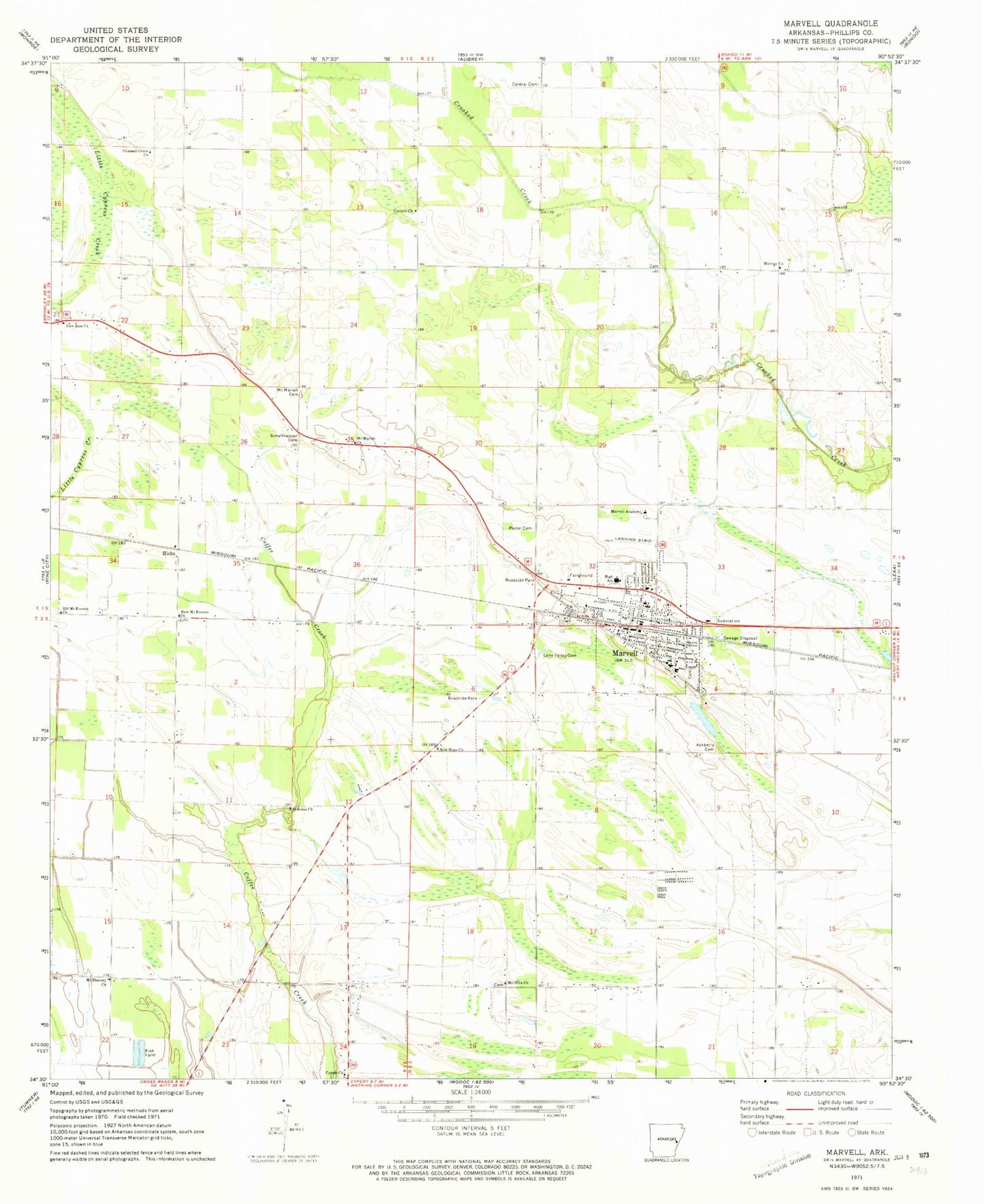
Historical USGS topographic quad map of Marvell in the state of Arkansas. Map scale may vary for some years, but is generally around 1:24,000. Print size is approximately 24" x 27"
This quadrangle is in the following counties: Phillips.
The map contains contour lines, roads, rivers, towns, and lakes. Printed on high-quality waterproof paper with UV fade-resistant inks, and shipped rolled.
Contains the following named places: Ashberry Cemetery, Ashberry Church, Central Church, City of Marvell, Corinth Church, Cypert Church, First Baptist Church, Gibbons Airport, Gill Cemetery, Hickory Ridge Church, Hicks, Hicks Church, Hicks School, Hicksville, King David School, Liberty Church, Lone Valley Cemetery, Marvell, Marvell Academy, Marvell Elaine Elementary School, Marvell Elementary School, Marvell Fire Department, Marvell High School, Marvell Middle School, Marvell Police Department, Marvell Post Office, Marvell Rural Volunteer Fire Department, Midway Church, Mount Mariah Cemetery, Mount Mariah Church, Mount Olive Cemetery, Mount Olive Church, Mount Olive School, Mount Shavery Cemetery, Mount Shavery Church, Neuka Spur, New Hope Church, New Zion Church, Old Mount Everett Church, Pastel Cemetery, Pleasant Grove Church, Saint Johns Church, Schaffhauser Cemetery, Township of Hickory Ridge, ZIP Code: 72366