MyTopo
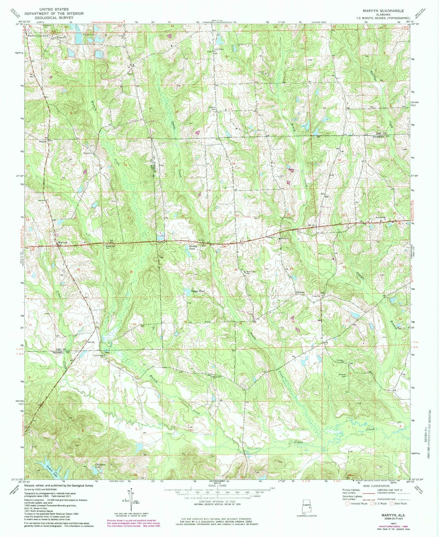
Classic USGS Marvyn Alabama 7.5'x7.5' Topo Map
Couldn't load pickup availability
Historical USGS topographic quad map of Marvyn in the state of Alabama. Map scale may vary for some years, but is generally around 1:24,000. Print size is approximately 24" x 27"
This quadrangle is in the following counties: Lee, Russell.
The map contains contour lines, roads, rivers, towns, and lakes. Printed on high-quality waterproof paper with UV fade-resistant inks, and shipped rolled.
Contains the following named places: Bruce Pond Number Four, Bruce Pond Number One, Bruce Pond Number Three, Bruce Pond Number Two, Brush Creek, Canaan Cemetery, Canaan Church, Capps Pond, Choppers Lake, Corbett Crossroad, Creek Stand Church, Dixie Junior High School, Dixie Volunteer Fire Department, Doctor James Bruce Dam, Doctor James Bruce Number 2 Dam, Doctor James Bruce Number 3 Dam, Doctor James Bruce Number 4 Dam, Dudley Pond, Dupree, Dupree Cemetery, Elizabeth Church, Flying C's Plantation Airport, Jenkins Cemetery, Kellys Pond, Lake Cherry, Long Branch, Marvyn, Marvyn Lake, Mount Airy School, Rising Star Church, Rising Star School, Saint Alice Church, Shiloh Church, Snake Creek, Thomas Cherry Dam, Towns Creek, Uhland, Uhland Church, Union Cemetery, Union Grove Church, Union Primitive Baptist Church, Watoola, Watoola Cemetery, Watoola Methodist Church, Watula Creek, Whatley Cross Road, Wills Valley Church, Wills Valley School, Zion Church