MyTopo
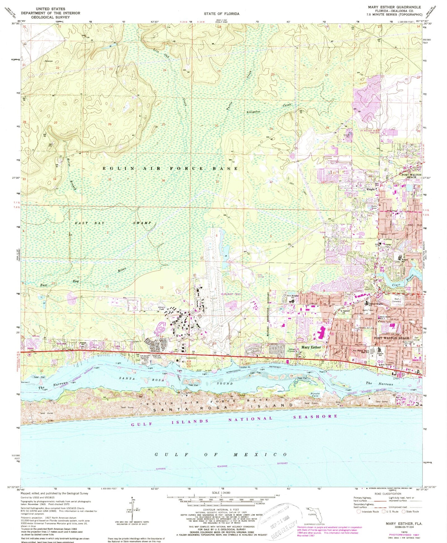
Classic USGS Mary Esther Florida 7.5'x7.5' Topo Map
Couldn't load pickup availability
Historical USGS topographic quad map of Mary Esther in the state of Florida. Map scale may vary for some years, but is generally around 1:24,000. Print size is approximately 24" x 27"
This quadrangle is in the following counties: Okaloosa.
The map contains contour lines, roads, rivers, towns, and lakes. Printed on high-quality waterproof paper with UV fade-resistant inks, and shipped rolled.
Contains the following named places: Alligator Creek, Beal Cemetery, City of Mary Esther, East Bay Swamp, Edwins Fine and Performing Arts School, Eglin Air Force Base Fire Station Hurlburt Field, Florosa Fire Department Station 5, Florosa School, Fort Walton Beach High School, Fort Walton Beach Medical Center, Fort Walton Beach Medical Center Heliport, Gulf Coast Treatment Center, Harris, Holy Trinity Church, Horse Branch, Hurlburt Field, Hurlburt Field Census Designated Place, Kohler Bayou, Lasater Point, Live Oak Creek, Mary Esther, Mary Esther Elementary School, Mary Esther Fire Department, Mary Esther Post Office, Max Bruner Junior Middle School, New Heights School, Oakland Church, Oakland Heights School, Ocean City - Wright Fire District Station 3, Okaloosa County Emergency Medical Services Station 8, Pirate Cove, Silver Sands School, The Narrows, Turtle Creek, WFTW-AM (Fort Walton Beach), WKSM-FM (Fort Walton Beach), WNUE, WNUE-AM (Fort Walton Beach), Wright, Wright Census Designated Place, Wright Elementary School, ZIP Codes: 32544, 32547, 32548, 32569