MyTopo
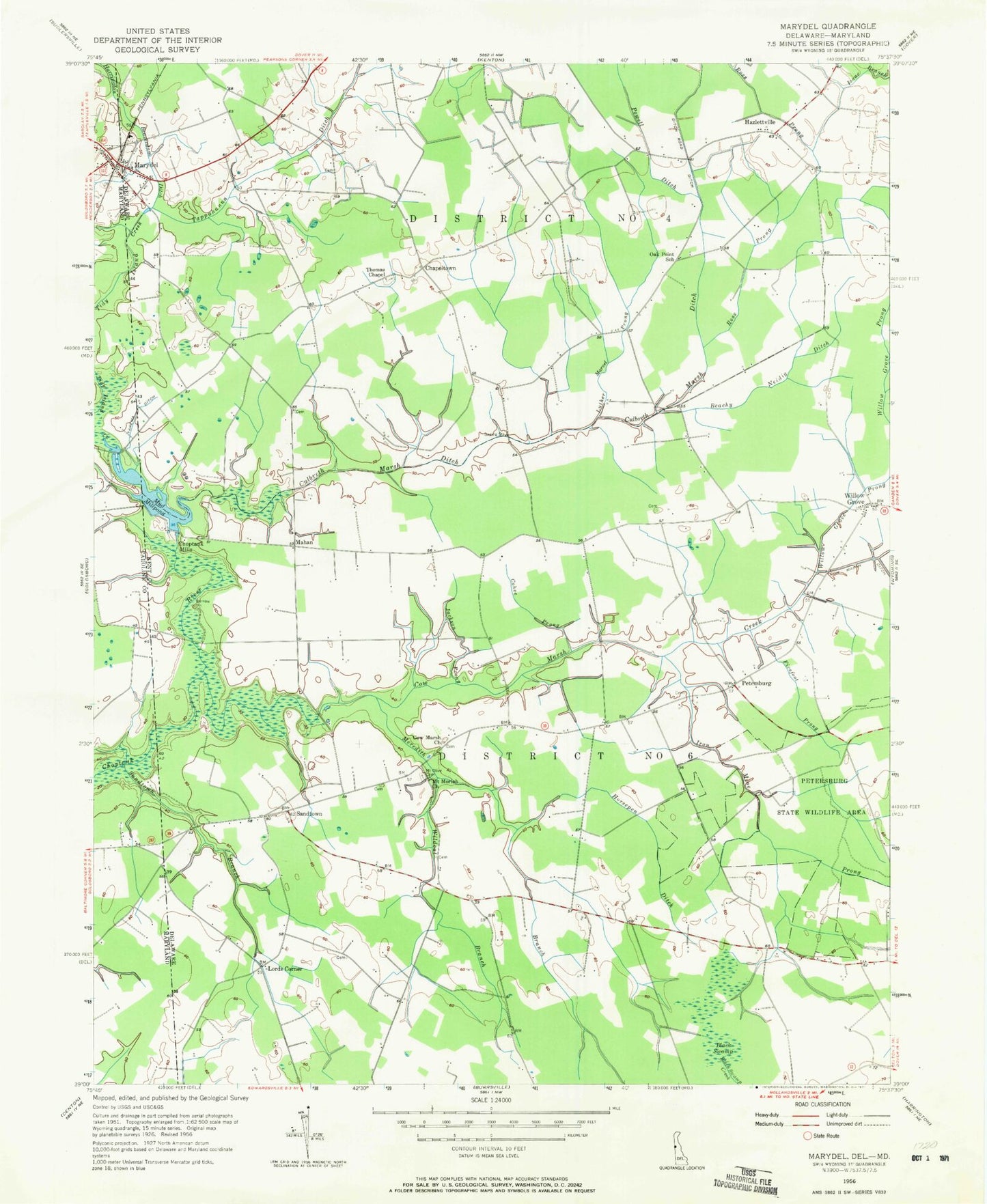
Classic USGS Marydel Maryland 7.5'x7.5' Topo Map
Couldn't load pickup availability
Historical USGS topographic quad map of Marydel in the states of Maryland, Delaware. Map scale may vary for some years, but is generally around 1:24,000. Print size is approximately 24" x 27"
This quadrangle is in the following counties: Caroline, Kent.
The map contains contour lines, roads, rivers, towns, and lakes. Printed on high-quality waterproof paper with UV fade-resistant inks, and shipped rolled.
Contains the following named places: Beachy Neidig Ditch, Black Swamp, Calvary United Methodist Church, Chapeltown, Choptank Mills, Cohee Prong, Cow Marsh Baptist Meeting House, Cow Marsh Church, Cow Marsh Creek, Culbreth Marsh Ditch, Ditch Road Ditch, Dover Bible Chapel, Fivefoot Prong, Harrington Beaverdam Ditch, Hazlettville, Horsepen Ditch, Hrupsa Airport, Immaculate Conception Catholic Church, Iron Mine Prong, Jackson Prong, Lords Corner, Luther Marvel Prong, Mahan, Marydel, Marydel Post Office, Marydel Volunteer Fire Company, Meredith Branch, Mount Olive Cemetery, Mud Millpond, Norman G Wilder Wildlife Area, Oak Point Acres, Oak Point School, Petersburg, Powell Ditch, Probst Mobile Home Park, Ross Prong, Sandtown, Sandtown Branch, Smith Crossroads, Tappahanna Ditch, Thomas Chapel, Tidy Island Creek, Town of Marydel, Wildcat Branch, Willow Grove, Willow Grove Prong, Yarema Ditch, ZIP Codes: 19934, 19964