MyTopo
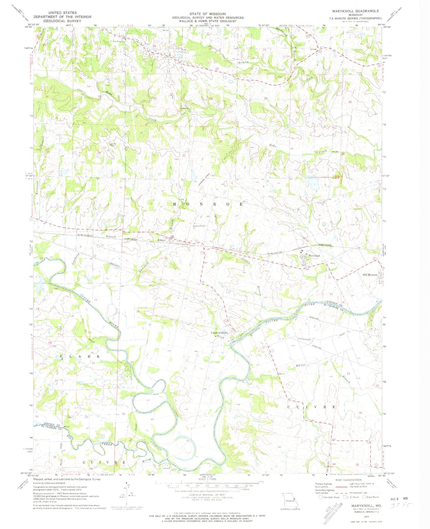
Classic USGS Maryknoll Missouri 7.5'x7.5' Topo Map
Couldn't load pickup availability
Historical USGS topographic quad map of Maryknoll in the state of Missouri. Map scale may vary for some years, but is generally around 1:24,000. Print size is approximately 24" x 27"
This quadrangle is in the following counties: Lincoln, St. Charles.
The map contains contour lines, roads, rivers, towns, and lakes. Printed on high-quality waterproof paper with UV fade-resistant inks, and shipped rolled.
Contains the following named places: Admire Cemetery, Amity School, Bals School, Big Creek, Birkhead Branch, Blackhawk Airport, Brushy Fork, Campbell Branch, Chain of Rocks, Chantilla Post Office, Chantilly, Chantilly School, Creech School, Ethlyn, Fountain N' Lakes, Groshong Branch, Highland Prairie Cemetery, Highland Prairie Church, Highview, Highview Post Office, Immaculate Conception Parish, Immaculate Conception School, Jordan Branch, Keelstone Branch, Keelstone School, Lindsey School, Maryknoll, McCoy Creek, Muich Lake, Muich Lake Dam, Nelson School, Old Monroe Fire Protection District Station 2, Old Monroe School, Owen, Owen Station School, Palmer Farms Lake, Palmer Farms Lake Dam, Riddle Cemetery, Rybolt Cemetery, Saint Pauls Church, Schlueter - Heddinger Lake, Schlueter - Heddinger Lake Dam, Star Prairie School, Touchette Lake, Touchette Lake Dam, Township of Monroe, True Gospel Church, Village of Chain of Rocks, Village of Fountain N' Lakes, Wendt Lake, Wendt Lake Dam, West Liberty School, Whites Bar, Whites Branch, Wilson School, Winfield - Foley Fire Protection District Station 3, Winfield High School, ZIP Codes: 63362, 63369