MyTopo
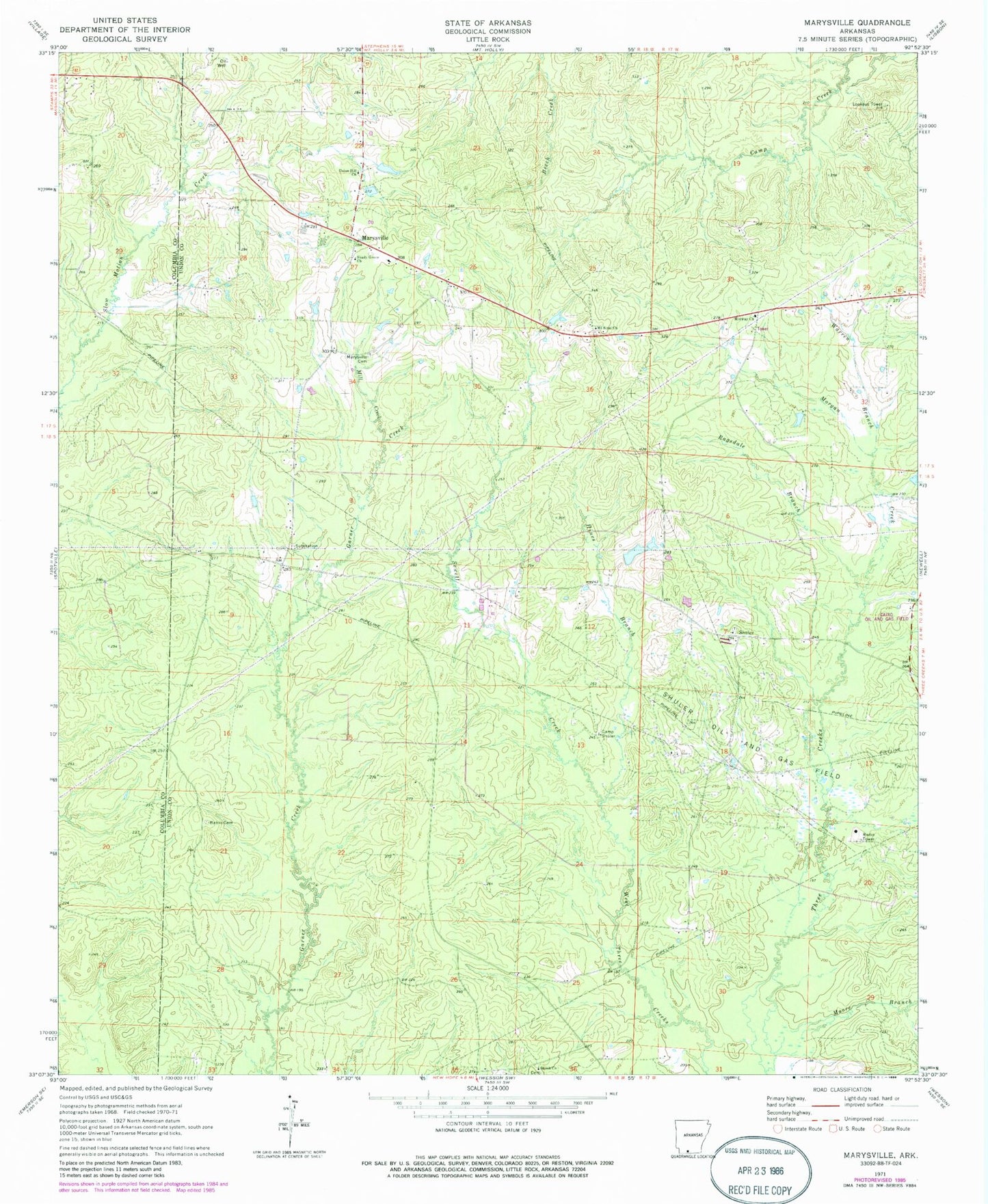
Classic USGS Marysville Arkansas 7.5'x7.5' Topo Map
Couldn't load pickup availability
Historical USGS topographic quad map of Marysville in the state of Arkansas. Map scale may vary for some years, but is generally around 1:24,000. Print size is approximately 24" x 27"
This quadrangle is in the following counties: Columbia, Union.
The map contains contour lines, roads, rivers, towns, and lakes. Printed on high-quality waterproof paper with UV fade-resistant inks, and shipped rolled.
Contains the following named places: Babbs Cemetery, Camp Shuler, Emerson Chapel, Fredonia Cemetery, Fredonia Methodist Church, Harris Lake, Harris Lake Dam, Hines Branch, Holly Grove School, Marysville, Marysville Cemetery, Marysville United Methodist Church, McCalls Gin, Midway Baptist Church, Mill Creek, Moore Branch, Morgan Creek, Mount Sinai Church, Mount Sinai Church Cemetery, Ragsdale Branch, Sewell Creek, Shady Grove Church, Shiloh Church, Shuler, Township of Garner, Union Hill Church, Warren Branch, Wilks Oil and Gas Field