MyTopo
Classic USGS Maryville East Missouri 7.5'x7.5' Topo Map
Couldn't load pickup availability
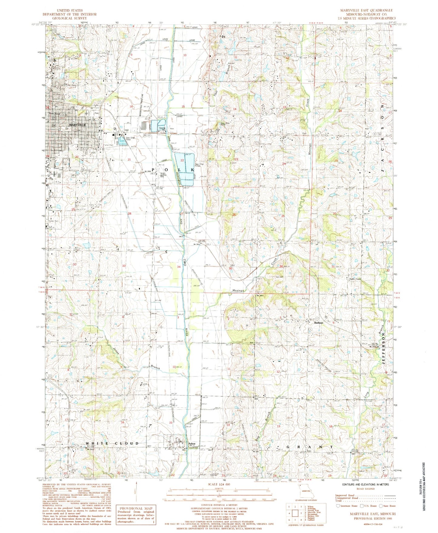
Historical USGS topographic quad map of Maryville East in the state of Missouri. Map scale may vary for some years, but is generally around 1:24,000. Print size is approximately 24" x 27"
This quadrangle is in the following counties: Nodaway.
The map contains contour lines, roads, rivers, towns, and lakes. Printed on high-quality waterproof paper with UV fade-resistant inks, and shipped rolled.
Contains the following named places: 102 River Tributaries Watershed Number 13 Dam, 102 River Tributaries Watershed Number 13 Reservoir, 102 River Tributaries Watershed Number 18 Dam, 102 River Tributaries Watershed Number 21 Dam, 102 River Tributaries Watershed Structure 23 Dam, 102 River Tributaries Watershed Structure Number 16 Dam, 102 River Tributaries Watershed Structure Number 22 Dam, 102 River Tributaries Watershed Structure Number 4 Dam, 102 Watershed Number 18 Lake, Arkoe, Bedison, Casteel School, City of Maryville, Council Corner School, Douglas School, Elm Grove School, Eugene Field Elementary School, Hayden Lake, Hayden Lake Dam, Highland School, Hiley Lake, Jones Branch, Jones Branch School, Lochridge Farms Lake, Lochridge Farms Lake Dam, Martha Washington School, Maryville, Maryville Police Department, Maryville Post Office, Maryville Public Safety Fire Division, Maryville Waterworks, Maryville Waterworks Dam, Mires Lake, Mitchell Lake, Mount Ayr School, Mozingo Creek, Number 23 Lake, Oak Hill Cemetery, Oak Hill Church, Rankin Airport, Rose Hill School, Saint Gregory Barbarigo School, Schimming Lake, Swinford School, Tallen Airport, Thill Branch, Town of Arkoe, Township of Polk