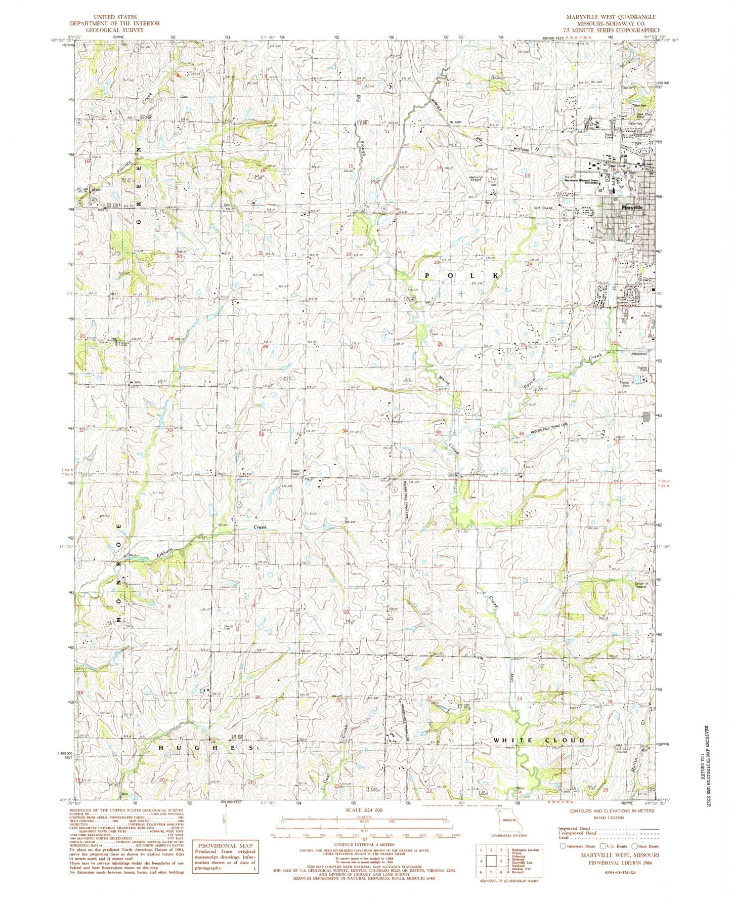
MyTopo
Classic USGS Maryville West Missouri 7.5'x7.5' Topo Map
Couldn't load pickup availability
Historical USGS topographic quad map of Maryville West in the state of Missouri. Map scale may vary for some years, but is generally around 1:24,000. Print size is approximately 24" x 27"
This quadrangle is in the following counties: Nodaway.
The map contains contour lines, roads, rivers, towns, and lakes. Printed on high-quality waterproof paper with UV fade-resistant inks, and shipped rolled.
Contains the following named places: Area Cooperative for Education Support, Bell Grove, Bell Grove School, Big Slough, Cain Cemetery, East Star School, Gill School, Highland School, Horace Mann Laboratory School, Houston Lake, Houston Lake Dam, Knabb School, KNIM-AM (Maryville), KNIM-FM (Maryville), KXCV-FM (Maryville), Lasher School, Maryville High School, Maryville Middle School, Morgan Cemetery, Nodaway County, Nodaway County Farm, Northwest Missouri Regional Airport, Northwest Missouri State University, Northwest Technical School, Peace and Harmony School, Peach Creek, Pleasant Hill School, Rockford School, Scudder School, Shelton Lake, Shelton Lake Dam, SSM Health Saint Francis Hospital - Maryville, Swallow School, White Cloud Cemetery, ZIP Code: 64468