
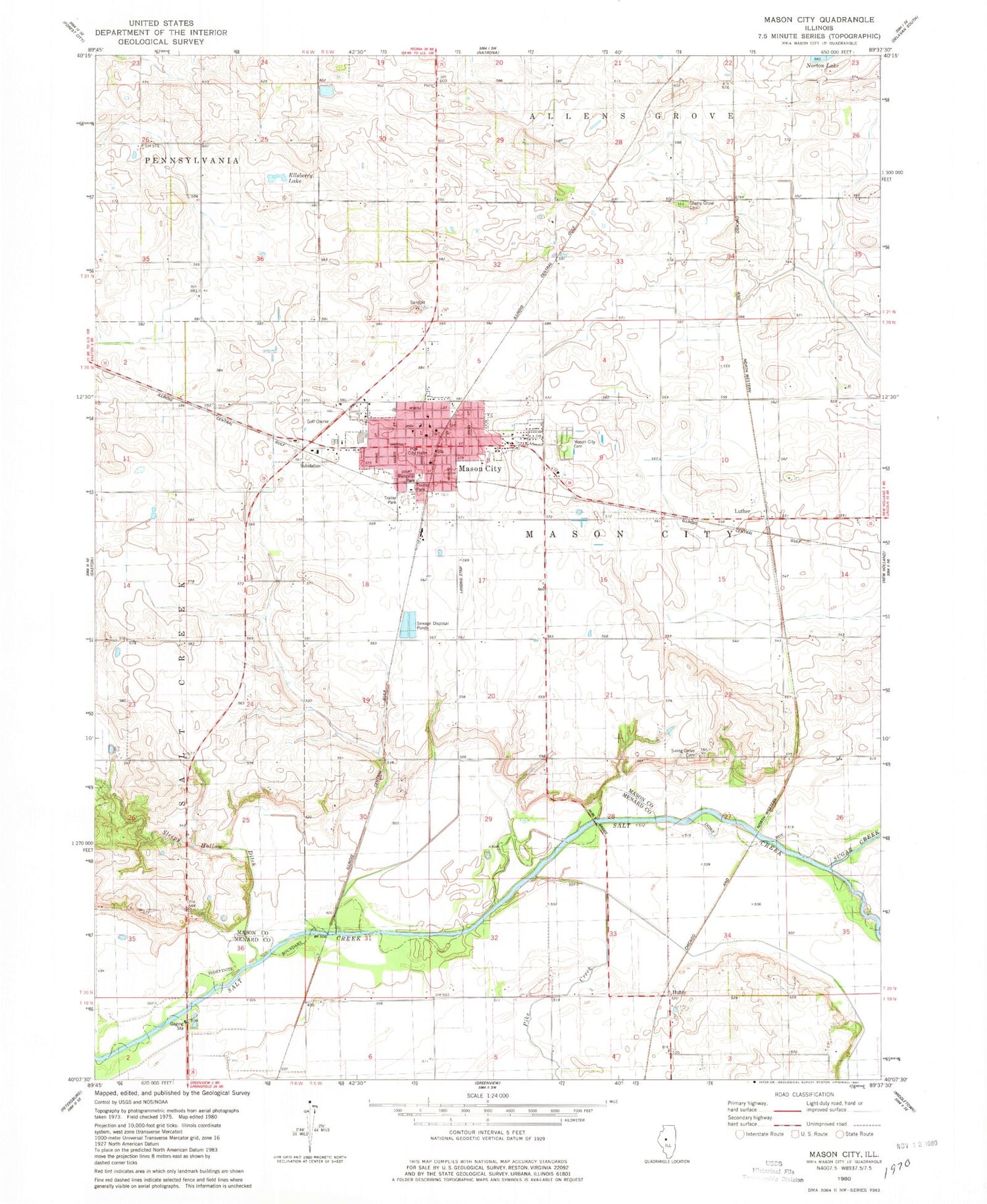
MyTopo
Classic USGS Mason City Illinois 7.5'x7.5' Topo Map
Couldn't load pickup availability
Historical USGS topographic quad map of Mason City in the state of Illinois. Map scale may vary for some years, but is generally around 1:24,000. Print size is approximately 24" x 27"
This quadrangle is in the following counties: Mason, Menard.
The map contains contour lines, roads, rivers, towns, and lakes. Printed on high-quality waterproof paper with UV fade-resistant inks, and shipped rolled.
Contains the following named places: Cherry Grove Cemetery, Cherry Grove School, Christ Lutheran Church, City of Mason City, Ellsberry Lake, First Baptist Church of Mason City, First Christian Church, Hubly, Hubly Bridge, Illini Central High School, Luther, Mason City, Mason City Cemetery, Mason City City Hall, Mason City Fire Protection District, Mason City Post Office, Mason City United Methodist Church, Mason County Ambulance Service, Mason Police Department, Memorial Park, North Prairie School, Pike Creek, Pleasant View School, Pollock School, Saint Columba Catholic Church, Salt Creek School, Sleepy Hollow Ditch, Sleepy Hollow School, Sugar Creek, Swing Grove Cemetery, Swing Grove School, Tourist Park, Township of Mason City, Wooley School, ZIP Code: 62664


