MyTopo
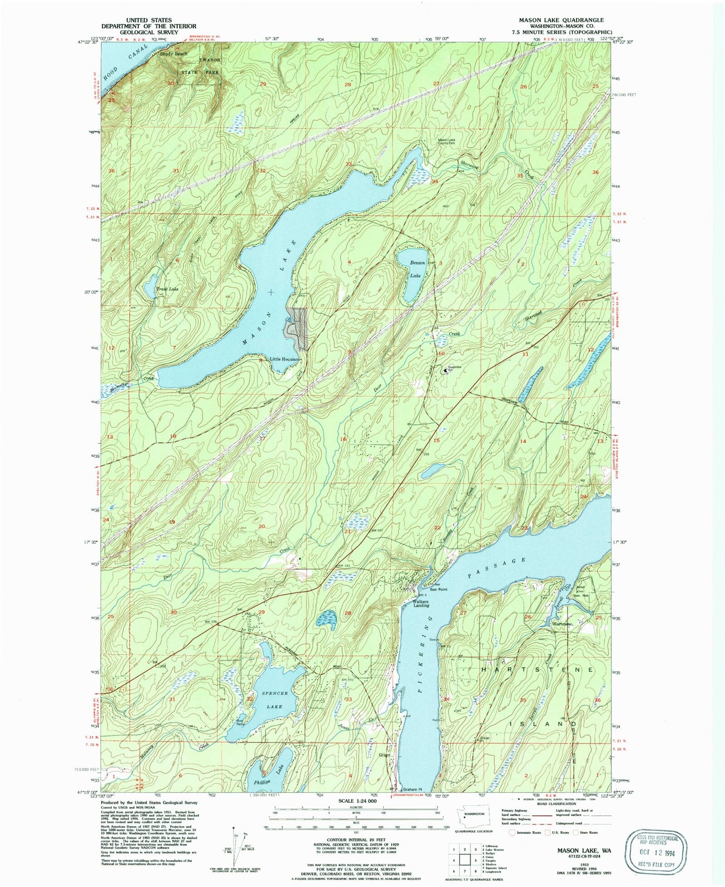
Classic USGS Mason Lake Washington 7.5'x7.5' Topo Map
Couldn't load pickup availability
Historical USGS topographic quad map of Mason Lake in the state of Washington. Map scale may vary for some years, but is generally around 1:24,000. Print size is approximately 24" x 27"
This quadrangle is in the following counties: Mason.
The map contains contour lines, roads, rivers, towns, and lakes. Printed on high-quality waterproof paper with UV fade-resistant inks, and shipped rolled.
Contains the following named places: Allyn, Benson Lake, Buck Lake Dam, Courner Dam, Graham Point, Grant, Grapeview School, Hartstene, Hiawata Creek, Hoke Creek, Jarrell Cove, Jarrell Cove State Park, Jarrell Creek, Jarrell's Cove Marina, Jones Creek, Little Hoquiam, Mason County Fire District 3 Station 2, Mason County Fire District 5 Station 3 Headquarters Mason - Benson, Mason County Fire District 5 Station 7 Pickering, Mason County Fire District 5 Station 9 - North Harstine Island, Mason Lake, Mason Lake Lookout, Phillips Lake, Pickering Passage, Schumacher Creek, Shady Beach, South Shore Division, Spencer Lake, Sun Point, Trask Lake, Twanoh State Park, Union-Grapeview Division, Walkers Landing, ZIP Code: 98546