MyTopo
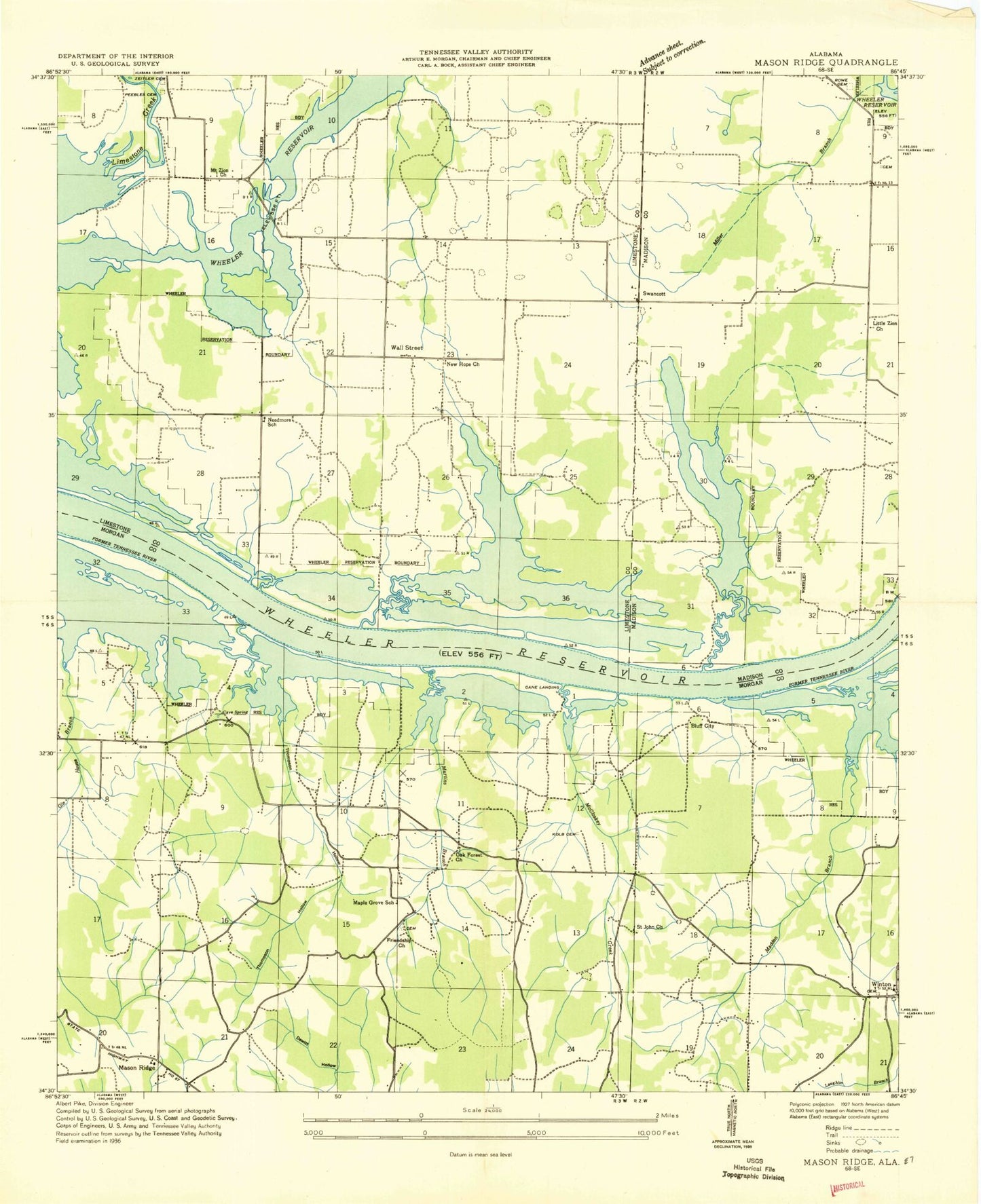
Classic USGS Mason Ridge Alabama 7.5'x7.5' Topo Map
Couldn't load pickup availability
Historical USGS topographic quad map of Mason Ridge in the state of Alabama. Map scale may vary for some years, but is generally around 1:24,000. Print size is approximately 24" x 27"
This quadrangle is in the following counties: Limestone, Madison, Morgan.
The map contains contour lines, roads, rivers, towns, and lakes. Printed on high-quality waterproof paper with UV fade-resistant inks, and shipped rolled.
Contains the following named places: Ashford Cemetery, Barclay - Teney Cemetery, Blackwell - Collier Cemetery, Blackwell Run, Blackwell Swamp, Blue Spring, Bluff City, Bluff City Landing, Brakes Branch, Brooksville, Brooksville Church, Buckeye Pond, Burlesons Ferry, Cain Landing, Cave Spring, Cave Spring Branch, Cave Springs, Cave Springs Landing, Center Springs Cemetery, Center Springs Methodist Church, City of Huntsville, Collier Cemetery, Crabbs Ferry, Dewitt Hollow, Echols Crossroads, Forest Hill Church, Friendship Baptist Church, Gillsport, Gillsport Bar, Ginhouse Branch, Goose Pond, Hunley Cemetery, Kolb Cemetery, Laughlin Spring, Leemon Slough, Lily Pond, Limestone Slough, Little Zion Primitive Baptist Church, Madden Branch, Maple Grove School, Martin Branch, Mason Ridge, Matney Branch, McCroskey Spring, McKees Ferry, Meyer Cemetery, Miller Branch, Mitchell Pond, Mount Zion Church, Needmore Church, Needmore School, New Hope, New Hope Cemetery, New Hope Church, Oak Forest Church, Pathway Church, Peebles Cemetery, Pickett Pond, Pool Hollow, Priceville Volunteer Fire Department Station 2, Rockhouse Buckeye Blackwell Dewatering Area, Rockhouse Landing, Rocky Point, Rowe Cemetery, Saint Andrews Baptist Church, Saint John Church, Saint John School, Sand Mountain High Ridge, Sharp Spring, Shirley Hill Church, Stringfield Ferry, Swancott, Swancott Church, Thatch Cemetery, Thompson Hollow, Triana Division, Troup Cemetery, Turkey Mountain, Wall Street, Watkins Bluff, Watkins Landing, Winton, Winton School, Wright Cemetery, Wright Spring, Zeitler Cemetery, ZIP Code: 35649